

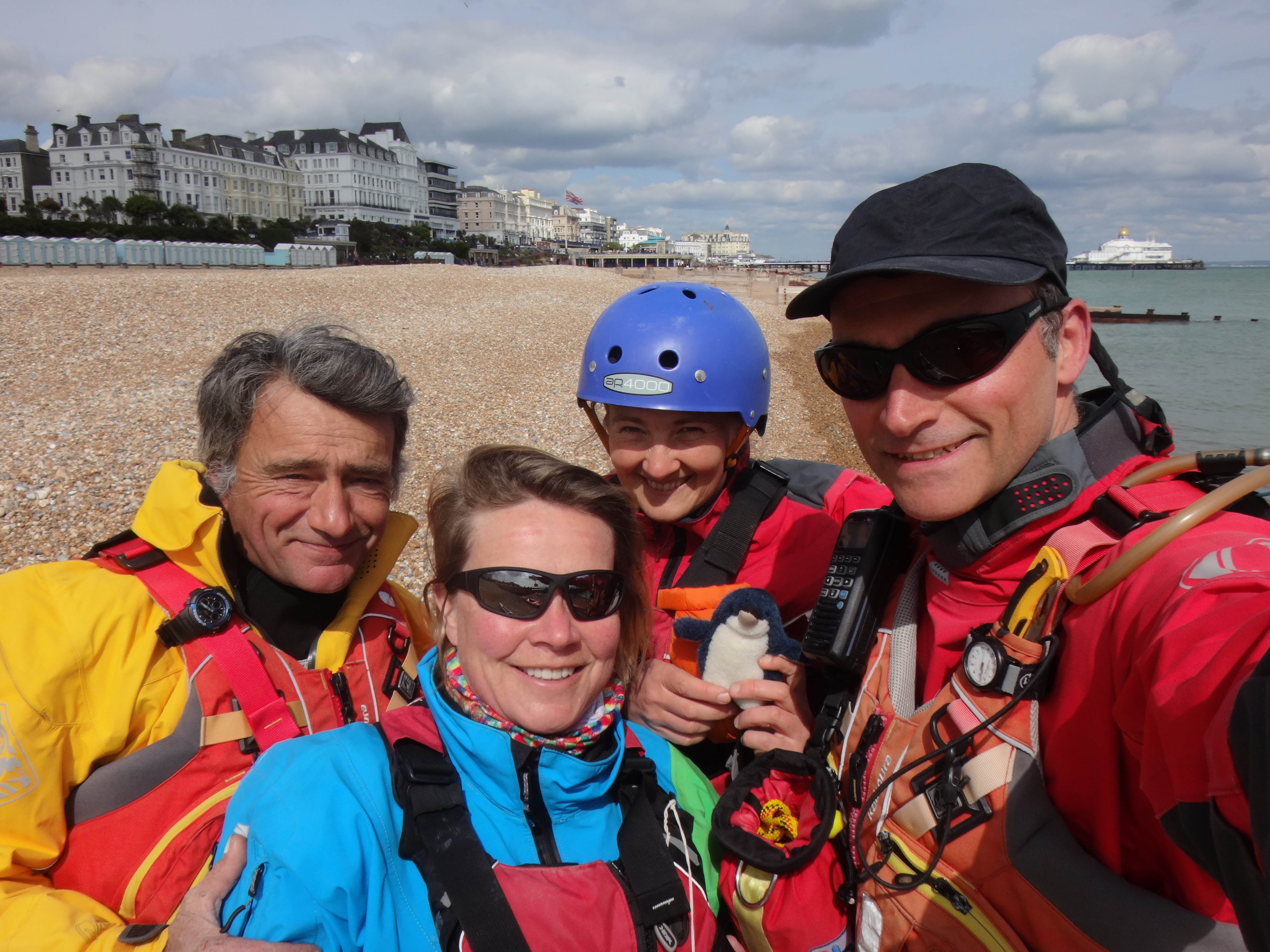
Easter Saturday 15 April 2017 – Alex, Liza, Philippe and Fiona met just east of the Wish Tower in Eastbourne to go around Beachy Head to Cuckmere Haven, then Newhaven and then up through River Ouse to Barcombe Mills– as part of the London to Lands’ End paddling project!
Alex & Liza had already dropped cars off at Barcombe mills which is where we intended to land on Sunday. We had been watching the winds in the run up to Saturday, with the Met Office issuing strong wind warnings for the area but a forecast 24hr window of winds F3-4 gave us our opportunity. However, the possibility of a force 5 or more remained! We could expect a swell of 2-4ft from SW forecast for the 2 days. High tide at Eastbourne and Newhaven was ~3pm.
After photos of us with L2LE mascot Skeg we set off bang on schedule at 2pm.
(Alex handled very sensitively super keen interest of a tourist who wanted come with us just as we were launching!) We were aiming to get to Beachy Head, just as the flow from the east started. Protected from the wind by the cliffs, the sea was calm up to Beachy Head. At Beachy Head there are prominent ledges marked with “overfalls” on charts. This can result in the sea being a bit choppy, especially when there is wind against a fast tide flowing through a constrained space. So the trip timings were planned around when it was most suitable to go past Beachy Head.
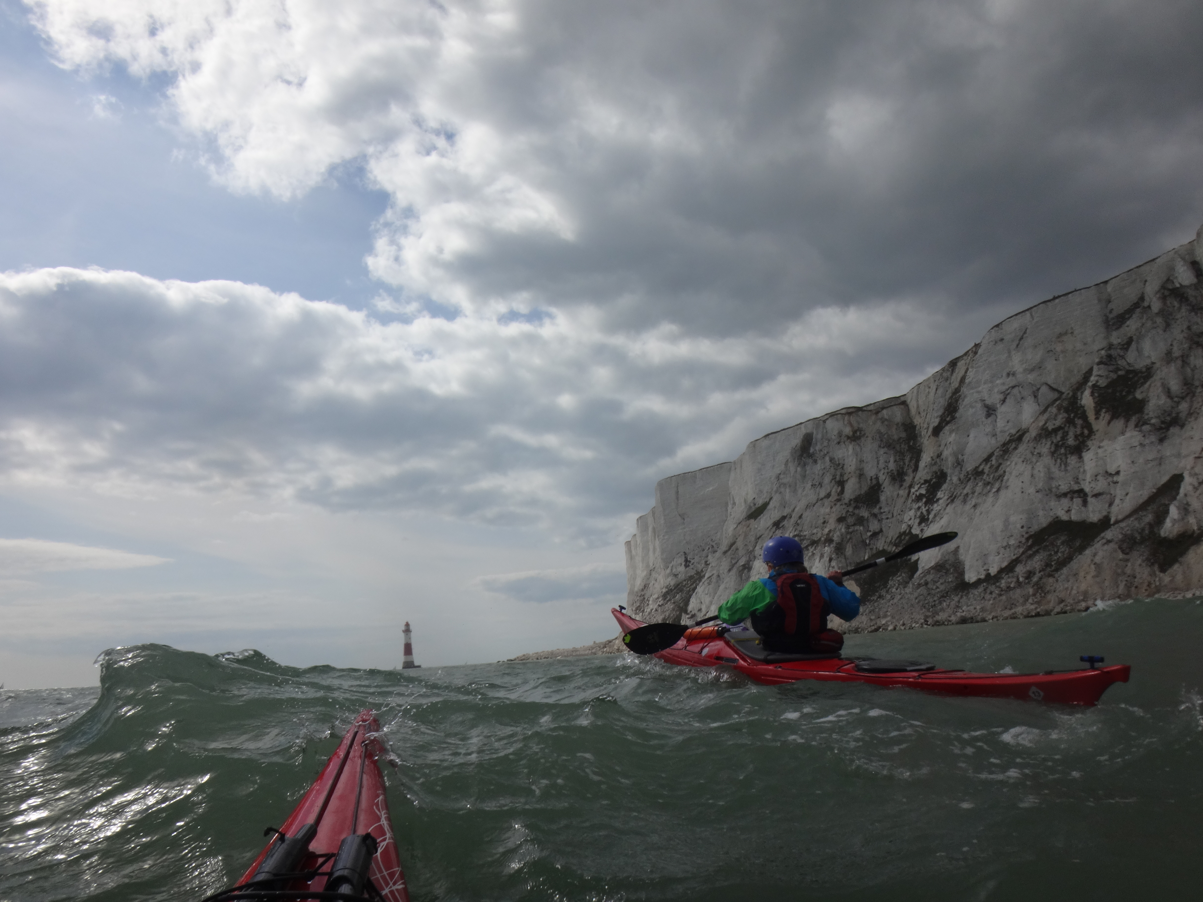
When we got to Beachy Head we had spectacular white soaring cliffs above us, and some lumpy water ahead of us, with breaking waves further out to sea. First was Head Ledge, which had the “lumpiest” water and we paddled together as a close group. We then got used to the choppy water with Liza and I paddling steadily. Our group photographers captured the stunning views and then would catch up us.
This gave Liza and I the opportunity to circumnavigate anti-clockwise the lighthouse at the bottom of Beachy Head. It was noticeably more unnerving having swell and wind behind us going round the lighthouse than when going into the wind.
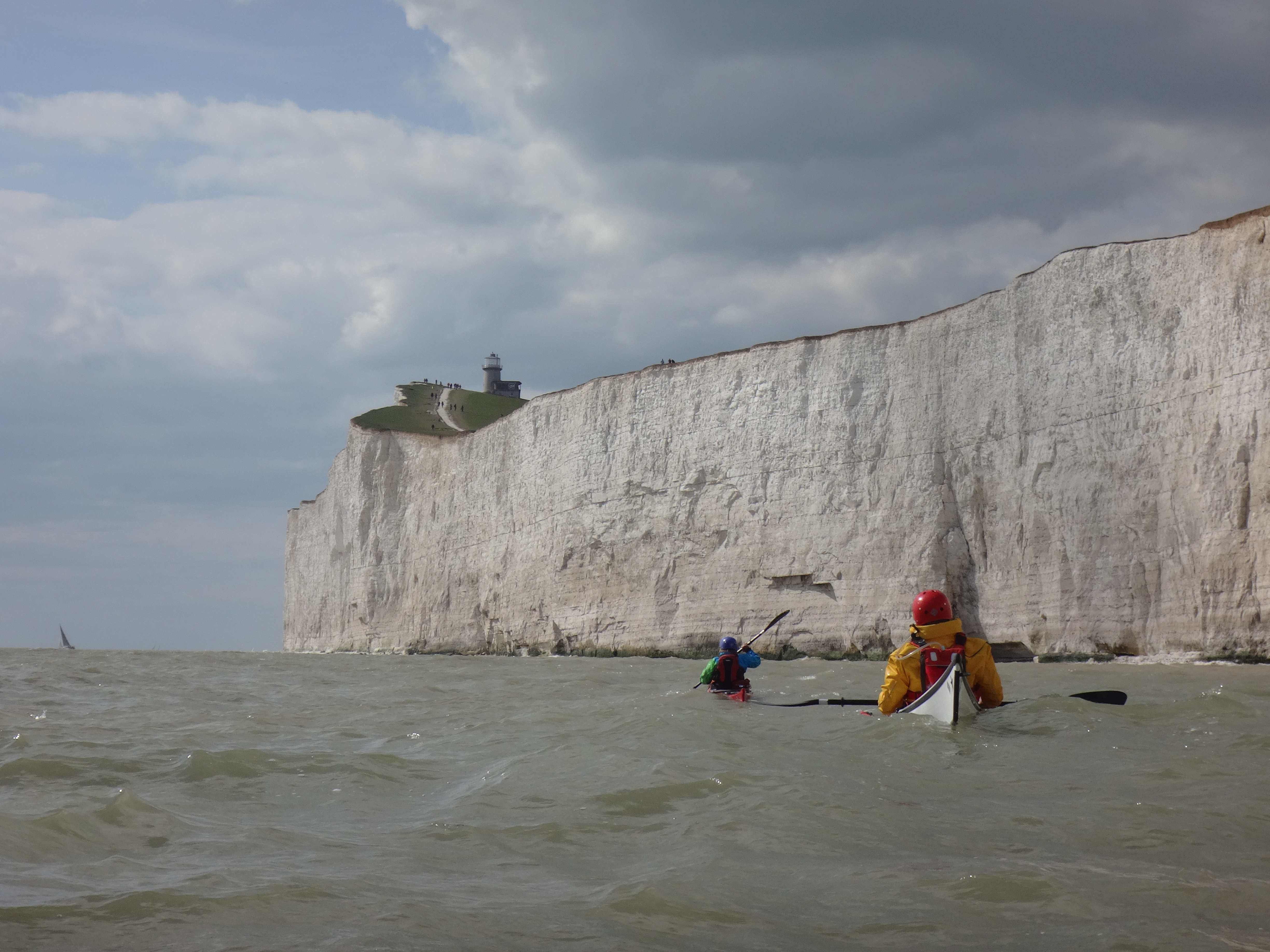
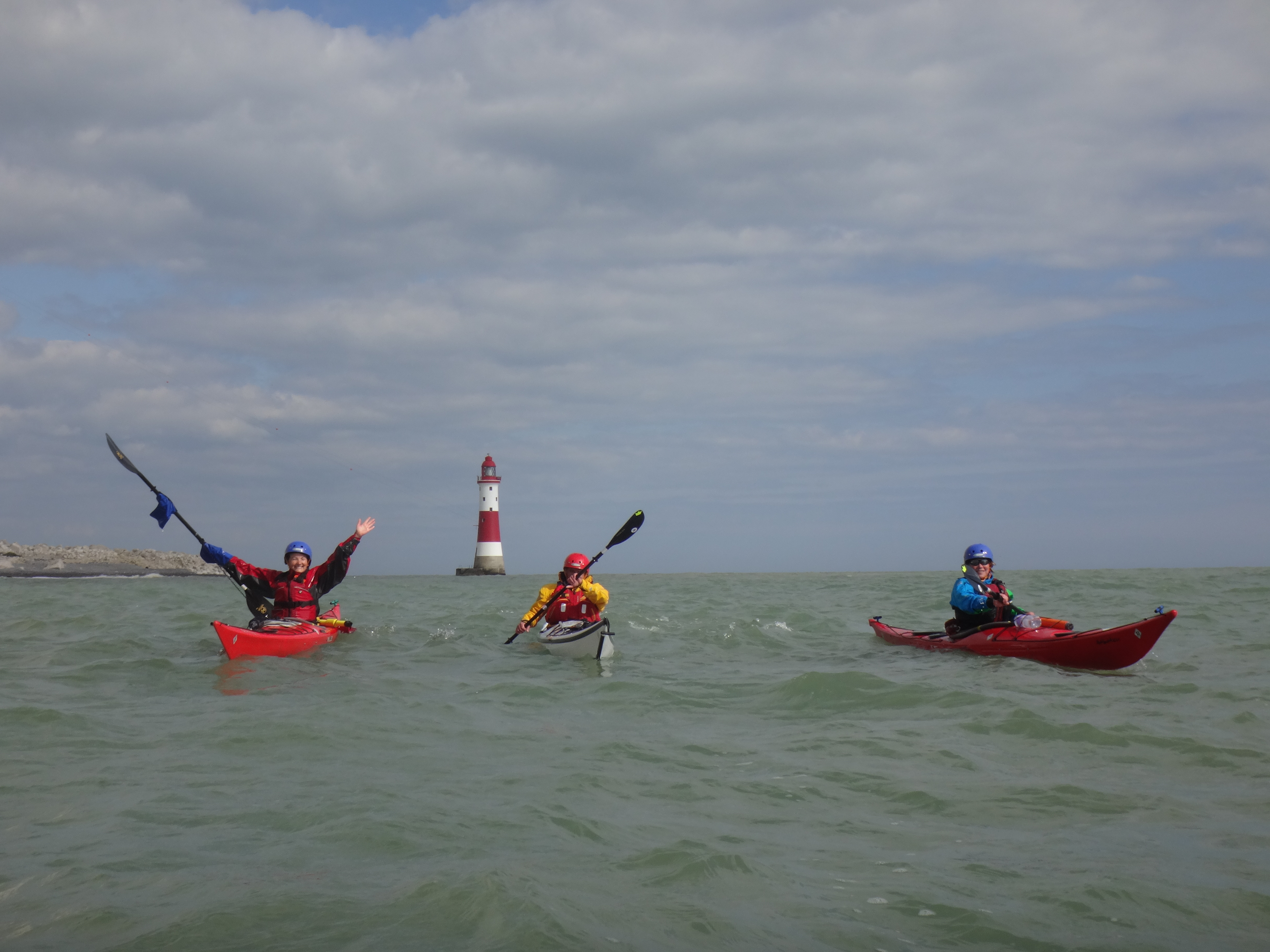
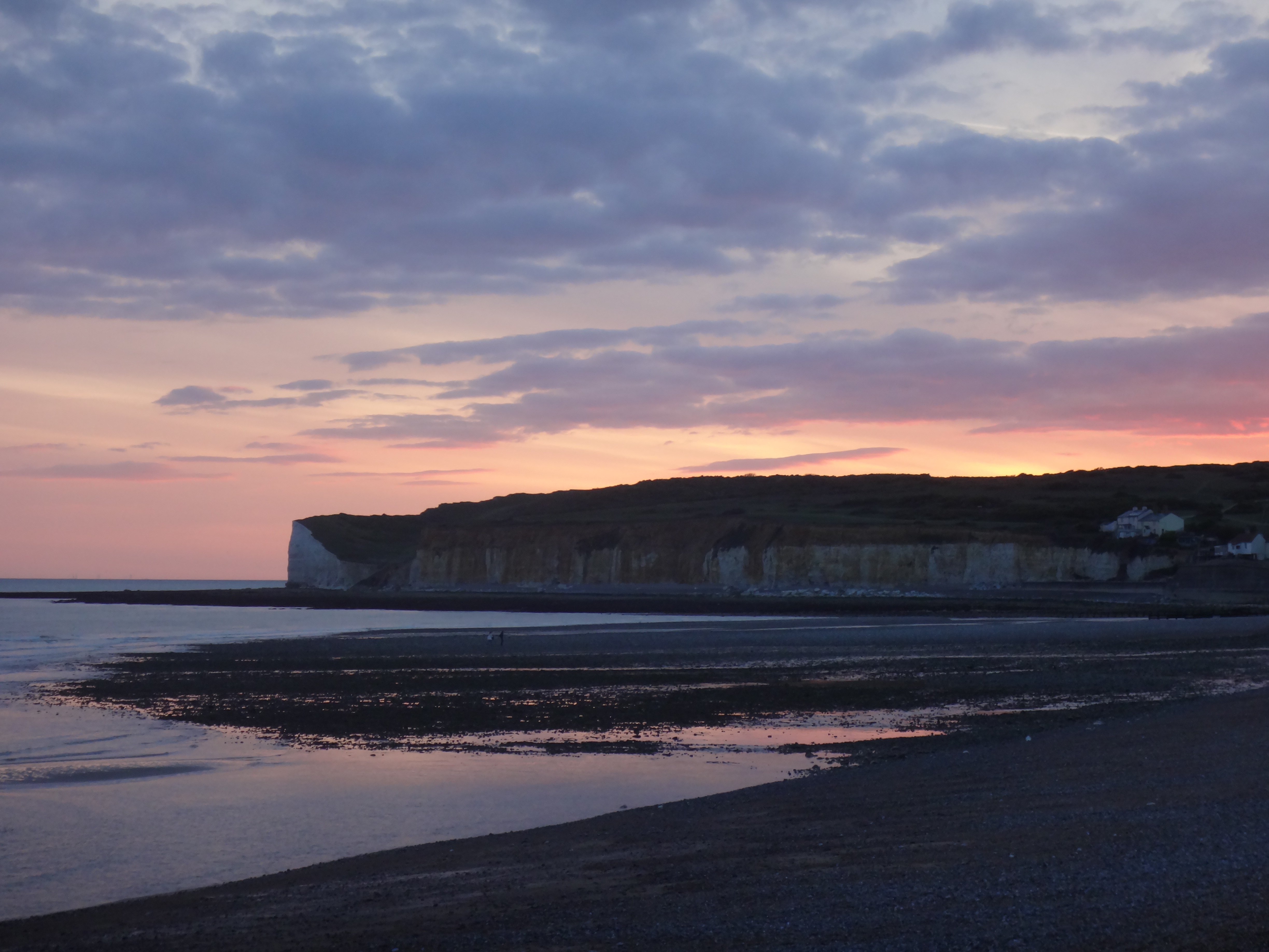
We then carried on to Cuckmere Haven paddling underneath the brilliant white of the Seven Sisters cliffs, with sea birds and walkers spotted above us! On the way to Cuckmere we heard over the radio the inshore forecast from the coast guard, which included a possible F6 “later” on Sunday.
At Cuckmere we landed ~ 5.15pm on the beach where there were many tourists, majority from the Far East. (We are not quite sure how this spot got onto their tourist itinerary!) We had paddled 7 nautical miles. We had a discussion about whether we would have a snack and then push on for Newhaven that night because of the stronger winds forecast, or stick with the original plan to camp at Cuckmere and then continue to Newhaven on Sunday. With a more detailed forecast, which didn’t anticipate the wind picking up until the following afternoon, we decided to camp as we were tired and Cuckmere was probably a much nicer camping spot. However, we planned to leave earlier on the Sunday morning, to make better use of the tides and reach the shelter of the Newhaven harbour wall and the River Ouse,before the stronger winds arrived.
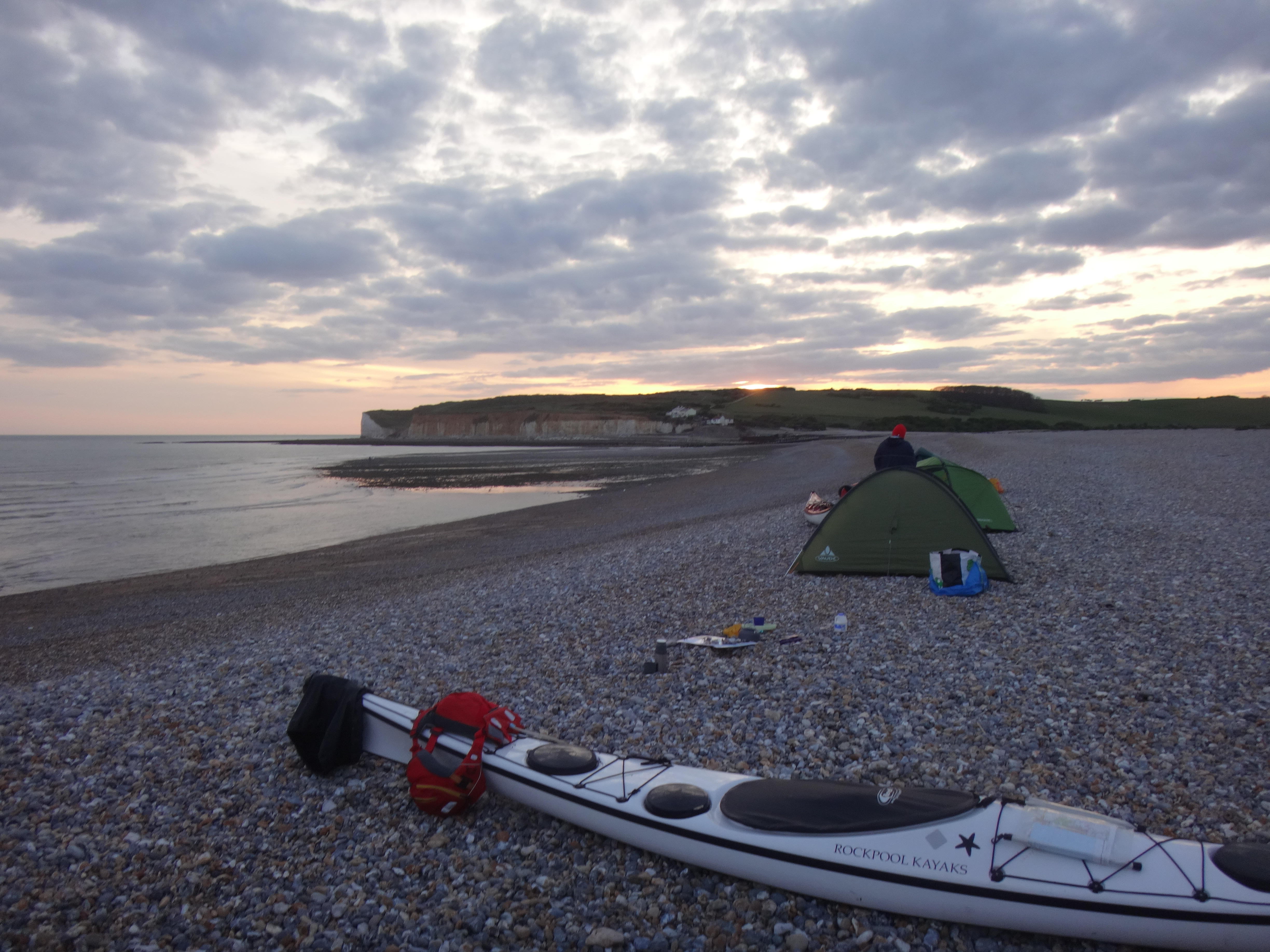
Saturday evening was magical. The tourists left leaving us alone on the beach. A small amount of driftwood was found to make a fire which was lovely and warming.
Before bed, we walked to the top of the first of the Seven Sisters, where we could see the twinkling lights of Brighton in the distance, below a star filled sky. We camped at the top of the shingle with lovely views from tents out to sea. However the down-side of this was that 3 out of 4 of us didn’t sleep as much as we might have done because the roar of a wave sweeping across a long pebble beach is very noisy! 2 out of the 4 of us were cold in the night – a reminder that it is still April!
Sunday morning initially the wind was calm but we could feel the wind slowly building. We left 9.50am our lovely camping spot fortified with breakfast and hot drinks. Paddling against a head wind from the west we made steady progress. We passed under South Hill, where there might have been some choppy water over the ledge there. After Seaford cliffs our speed dropped a bit as we came into the bay,the tide having turned against us. We had a go at guessing distances from Seaford cliffs to Newhaven. We were able to see the light at the end of Newhaven’s westerly pier and so assumed that Newhaven wasn’t far away but in fact it was still ~3NM (~6km) away! The wind was F3 perhaps and building as we paddled to Newhaven. Alex and I had some practice at towing initially in a “V” arrangement which is very sociable if you both have 15m towlines, and then in an in-line tow. As we saw the ferry to Dieppe reversing out of Newhaven harbour we came out of the towing arrangement in case there was some wake. The harbour office had warned the ferry that the wind was now F5 with gusts of F6 on the end of the Western harbour wall, so we had made the right call to start the day paddling earlier. We landed on the beach to the east of Newhaven’s Eastern harbour wall at ~11.30am. It was lovely to be in the sun & out of the wind. We had more hot drinks and snacks, or for some lunch #1. Alex’s speedy cooker warmed up some milk for our teas & coffees – luxury!
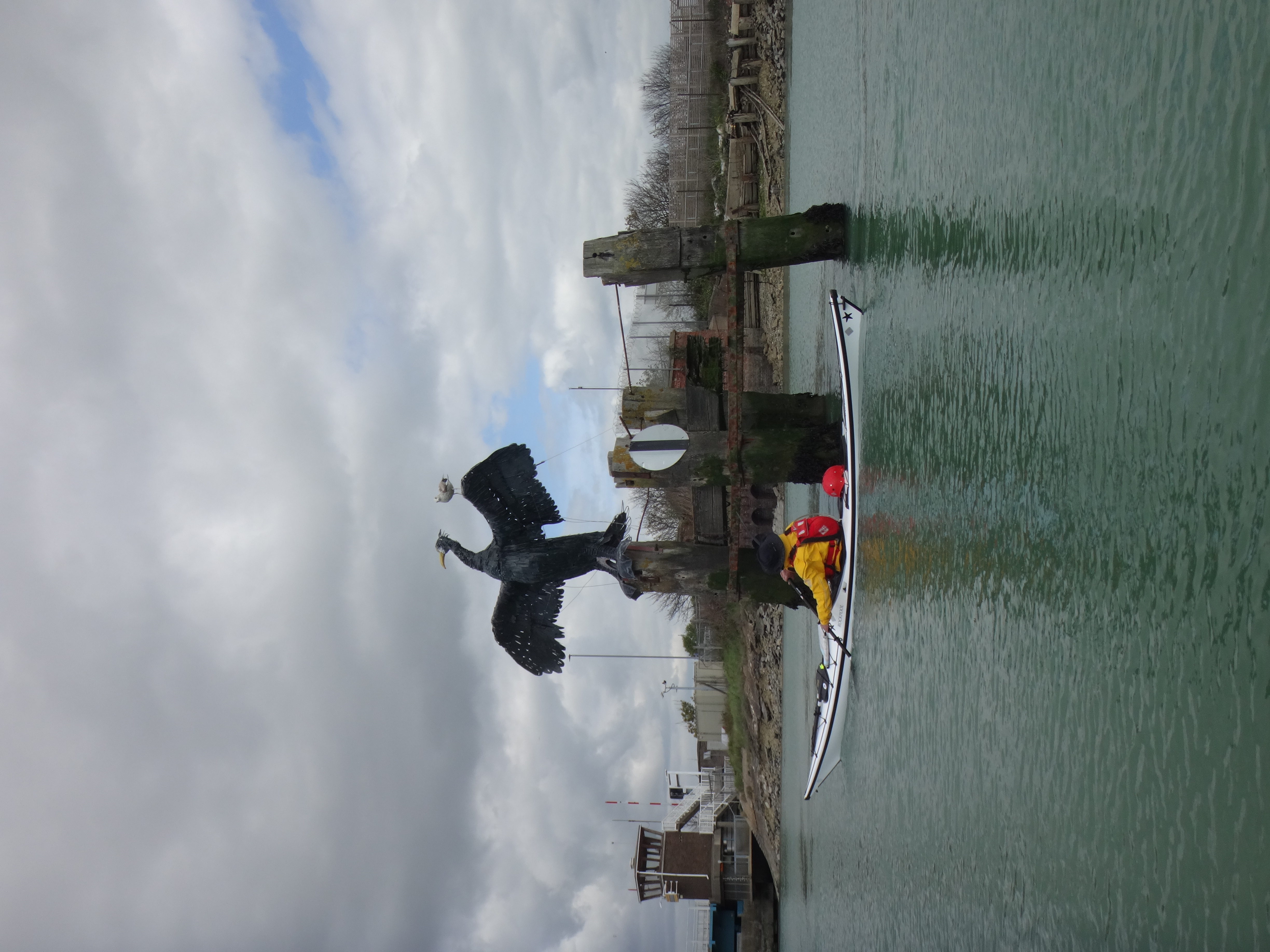
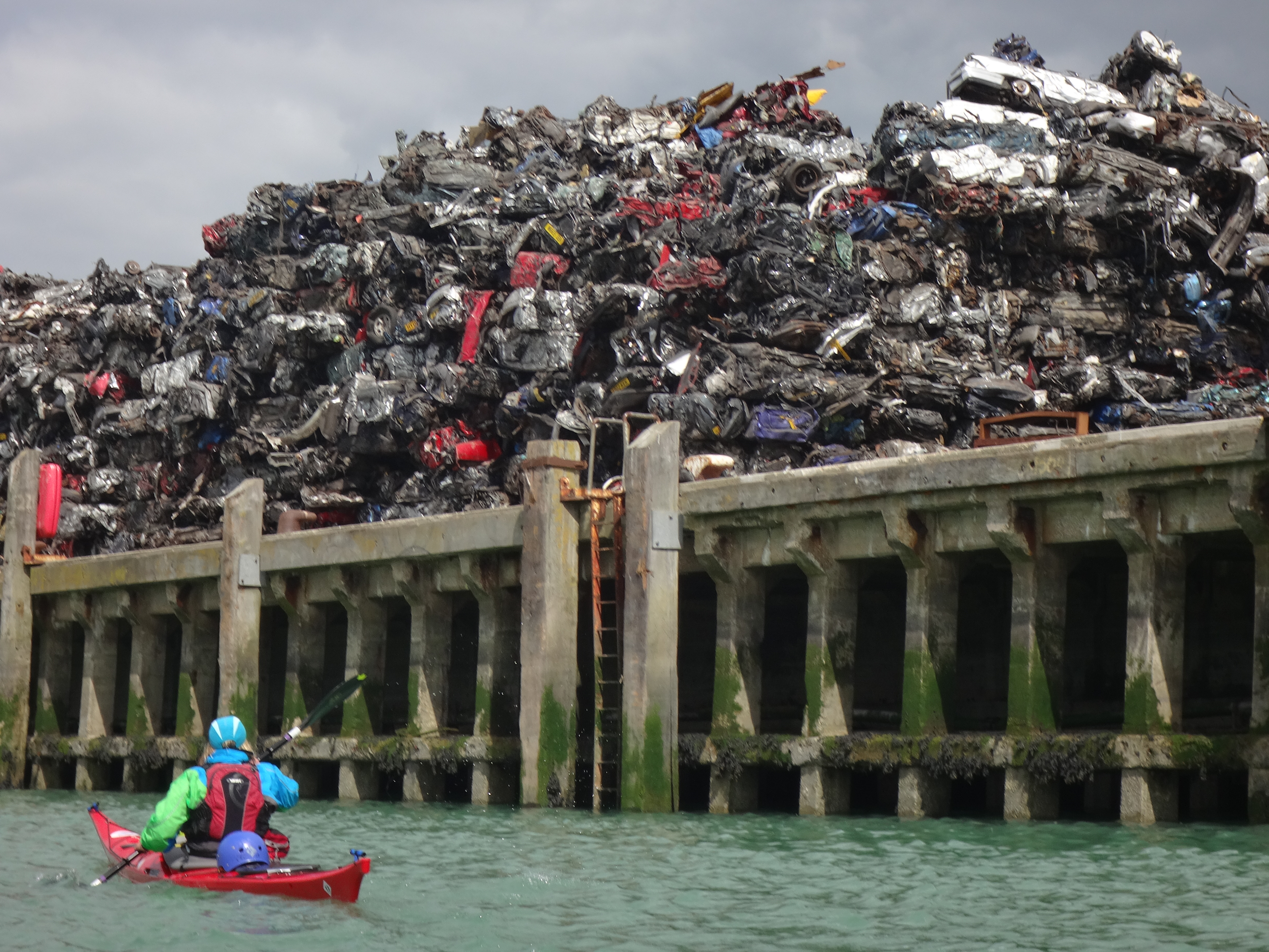
The inbound tide up the River Ouse started at 12.30pm. At ~1pm we paddled through the concrete lattice structure which makes up Newhaven’s Eastern harbour wall, after Alex got the OK from Newhaven harbour control that there were no commercial traffic in the harbour. The harbour is a working harbour where there is the most amazing pile of scrap metal made up of compressed cars.
After the scrap metal pile on the east came a very new looking incinerator, and then there were fields. At 1.30pm we got to Piddinghoe where we had lunch #1 or #2 for others. I was grateful to 2 friends for dropping off a bottle of fresh water because I was almost out of clean water. (I’d unwisely used some to rinse pans the night before!)
We then got back on the river at ~2pm. We knew we had an inbound tide at Lewis until ~4pm but were not sure how long we would have the tide after Lewes. So we needed to paddle swiftly, otherwise we might be fighting an out-flowing tide later on. We could very much feel the wind from the West in the wider, exposed parts of the river, and so we needed to use our skegs. Now the inbound tide was now much stronger. Alex mentioned that we were doing 5knots and we’d just past a speed limit sign of 5.5knots! The jet ski and motor boat (I assume) hadn’t seen the speed limit, whilst the lone kayaker going (downstream) against the flow was very much inceeding the speed limit!
We reached Lewes very quickly ~3pm after views of chalk rolling hills, fields, walkers on the river bank, cattle and sheep with lambs. Lewis doesn’t provide welcoming public landing spots. In fact the public landing spot just SW of the road bridge has some steps where access is hampered by an overgrown bush. We did have an option of attempting to get out at grassy river bank just north east of the town. What we did instead was to have a rest rafting up to have snacks and water, whilst gloriously continuing to be taken upstream by the tide!
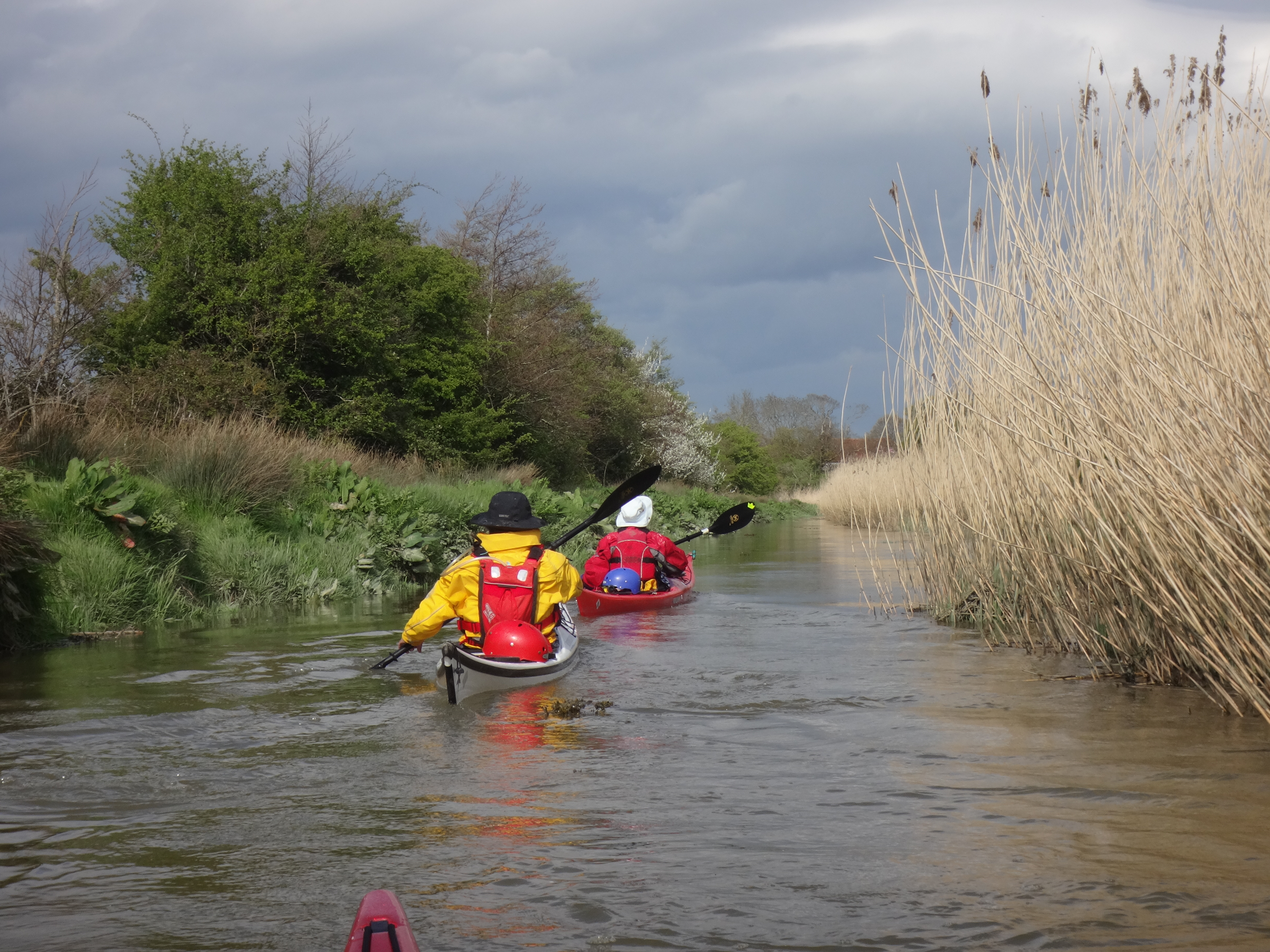
After Lewes we saw fewer people, and we took a left hand “short cut” down a narrower channel. From now on we were out of the wind. This was a perfect channel for kayakers – it is easily wide enough for 1 kayaker and we zoomed along dodging the odd tree branch in the water. When we re-joined the main channel we noticed there was a small weir as the main channel dropped down in height ~0.5ft which perhaps explained why our channel was flowing faster than the main channel. The river proceeded to get narrower, and there were lovely reeds on the banks, and we saw more ducks and swans.
At Barcombe Mills we were not sure were to get out. At the mill area we could see there were kayakers above us –but 3 weirs were separating us from them! It was fun to explore up ever narrower channels possible get-outs – but these were steep, muddy and/or overgrown. We decided to get out under the road bridge which had steps to provide access to the river. This meant a very steep carry up the steps and for the fibre glass boats, carefully pulling them out of the river avoiding the sheet pile wall.
In total we had paddled 22 Nautical miles over the two days averaging ~2.9knots. See tracker below
Many thanks to Alex for planning and leading this lovely trip.
L2LE-10 eastbourne 2 barcombe mills GPS track
Leave a Reply