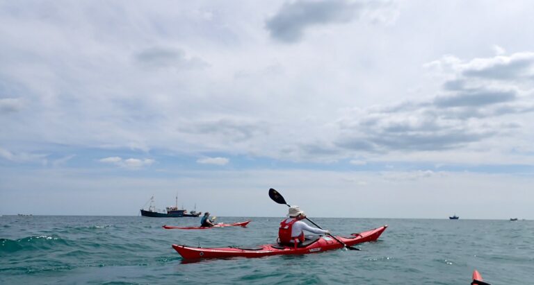
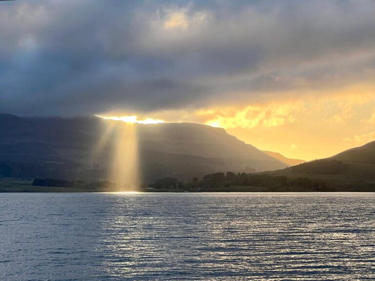
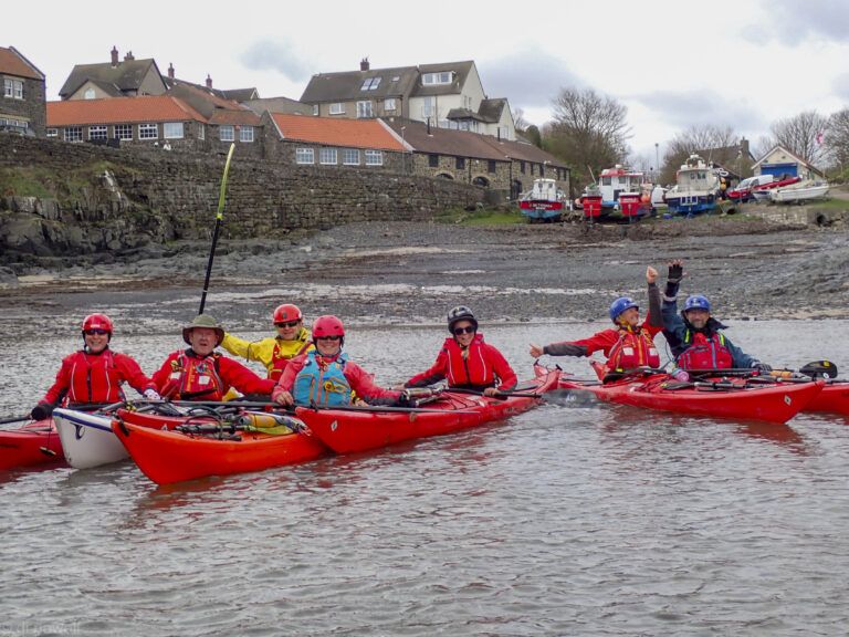
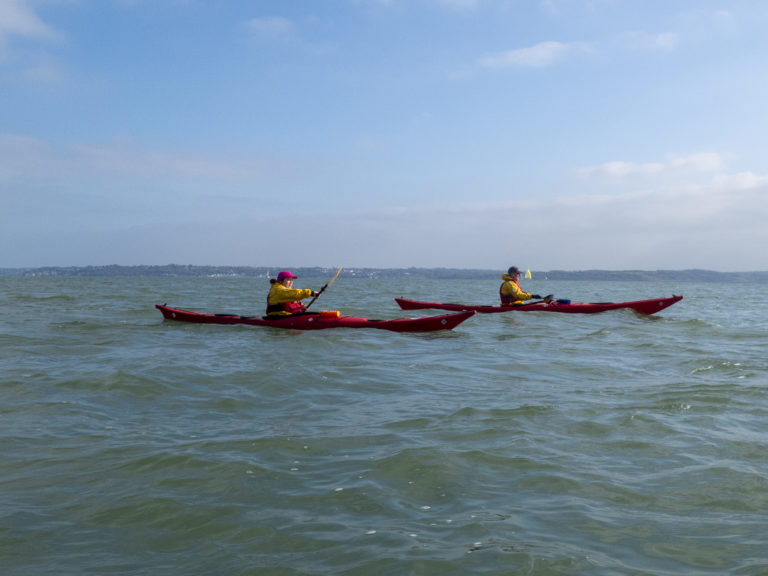
On Sunday 19 July a small group of four CKC-ers, led by Liza, headed to Bracklesham beach on the south coast, for a lovely paddle on the sea. There’s a car park right by the beach, but on a beautiful sunny weekend day in the summer holidays, it fills up quickly and there were no spaces left at all by the time we arrived just after 10.00. We unloaded the kayaks near “The Beach” café (with adjacent public toilets) and drivers Liza and Mary had to go find parking spaces in the streets nearby.
After a briefing from Liza, and with the tide coming in and a light north/north easterly breeze from behind, we carried the boats down the steep shingle bank and launched in light surf, heading out from the beach to catch the flow. We headed southeast, following the coastline towards Selsey Bill, making good progress. The Windmill at Medberry soon came into view, and the cardinal markings off Selsey Bill became more clearly visible ahead.
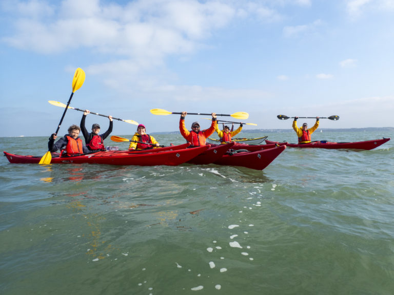
Happy days!
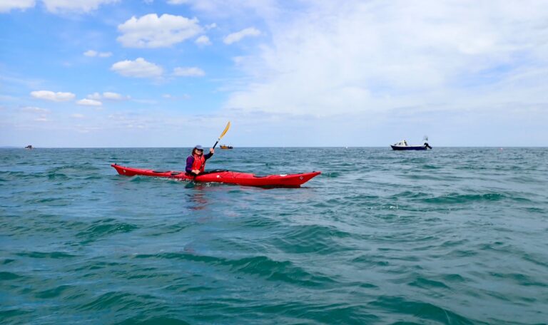
As forewarned by Liza, we headed away from the shore and out towards the further cardinal markings as we got closer to Selsey Bill, to avoid the roughest area of water where it suddenly becomes pretty choppy as the current pushes it over the shallow bar. It was indeed rather bouncy with short steep waves coming from various directions, and the bows of the kayaks plunging ahead. It required some extra concentration as we pushed through the turbulence, but it didn’t last long and we were soon in calmer waters again, albeit with the occasional gusts touching force 4.
Around Selsey Bill
We headed close to Pagham beach for lunch, below a row of beach houses, some pretty plush and a few adapted from old railway carriages that had been moved there during WWII to accommodate soldiers ahead of the D-Day landings.
Lunch
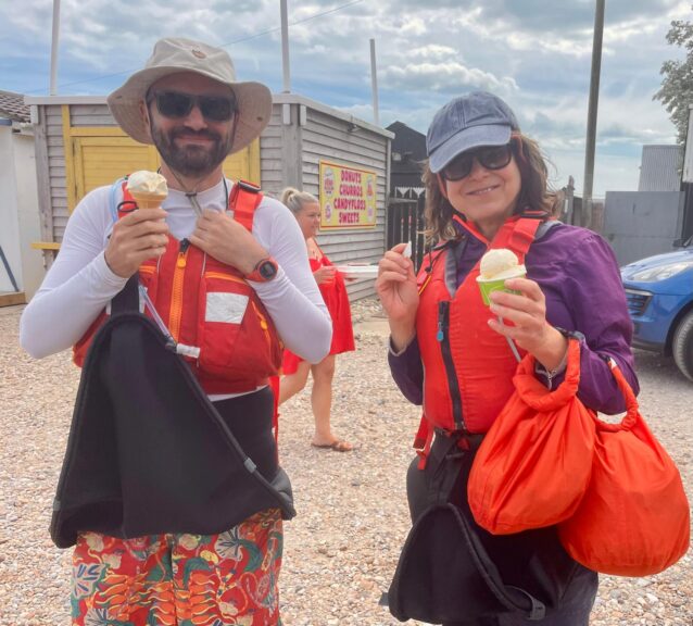
After lunch we were back in the kayaks for a short burst to Selsey to get an ice-cream.
Mandatory ice cream stop
Having scoffed those, we were back in the kayaks and did a seal launch, sliding down the shingle in our boats into the water. With the flow still with us, although we found ourselves pushing against occasional gusts of wind. We didn’t need to move out much to navigate Selsey Bill on the way back. It was only mildly choppy and perfectly manageable.
Back in Bracklesham Bay Liza demonstrated a self-rescue, which Emmanuel then tried a couple of times, nail-bitingly close to fully executing it. Fionna then tried and failed, and was rescued mostly ably by Emmanuel.
The fun passed all too quickly, and we headed in, with the 4pm high tide accommodatingly well up the shingle, making landing surprisingly easy. A great day out, excellently planned and led by Liza, with a nice of mix of leisurely paddle, focused concentration around the Bill, and some rescue practice.
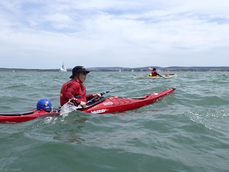
Conditions couldn’t have been better for the trip from Hampshire to the Isle of Wight on a Saturday in June. We all assembled at the campsite on Saturday morning to discuss the plan, before heading to the launch point. Most had come down the night before to the campsite amongst trees and were comfortably settled in. This campsite was a much better experience than the previous year, with wild New Forest ponies walking through the campsite while we did our briefing!
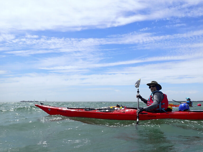
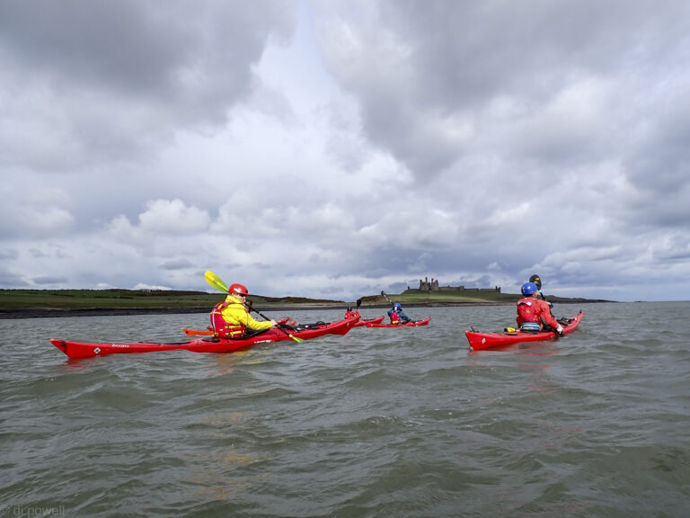
The UK had been experiencing a heatwave and everyone was relieved to get some cooler Solent air for the weekend. It wasn’t long before we launched, heading towards Hurst Castle and Albert Fort.
To the Isle of Wight!
Some waves too
And a lot of yachts
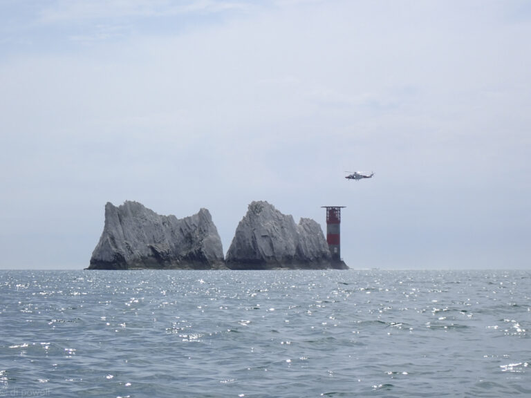
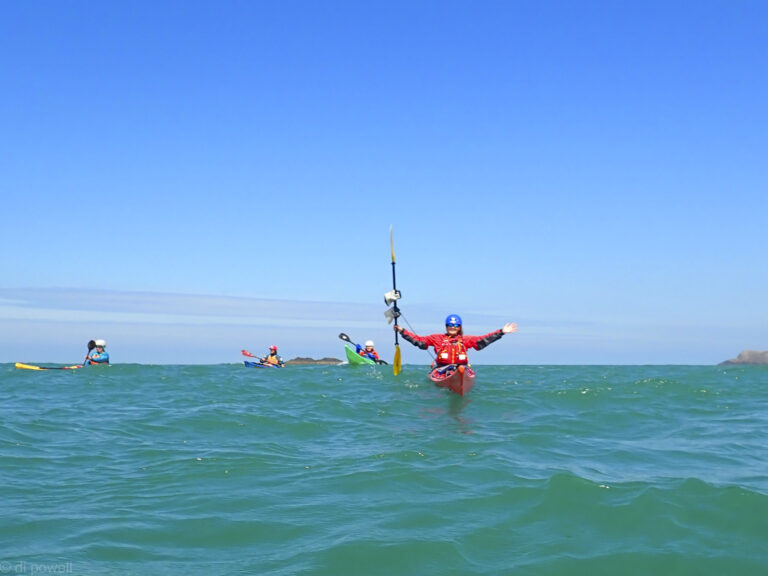
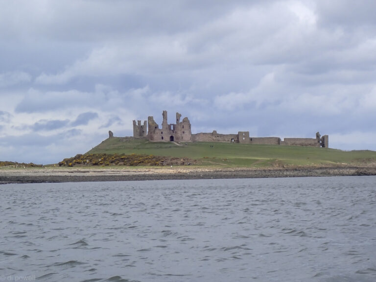
It seemed that every sailor with a boat on the Solent also had the same idea and we had to be alert to the multiple vessels approaching us from different directions until we were well passed Fort Albert. As we approached the Needles an RNLI helicopter overtook us and then hovered for 15 minutes, leaving just as we arrived at the Needles.
RNLI Helicopter
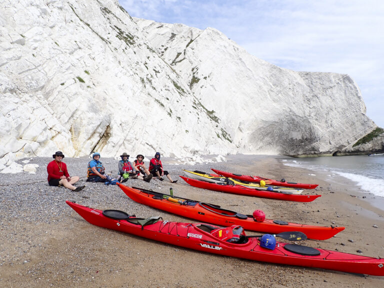
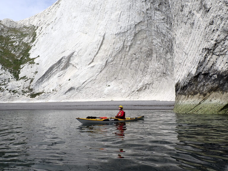
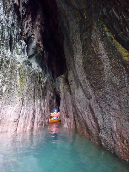
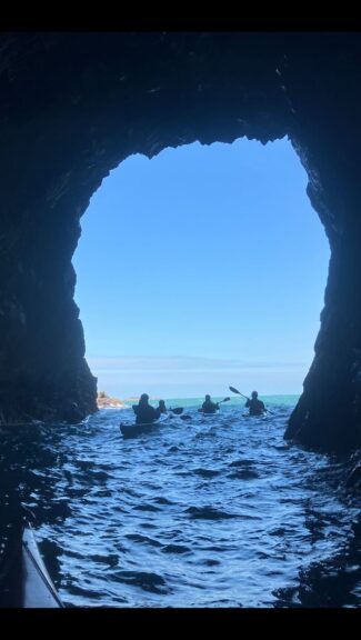
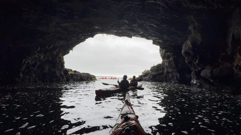
We had no time to speculate what it was doing as we had a tidal gate to meet which meant we landed at Scratchells Bay on the Isle of Wight quickly (accompanied by a seal). After a quick lunch it was back on the water to investigate one of the Isle of Wight caves and impressive cliff face.
Seal for scale
Sun Corner
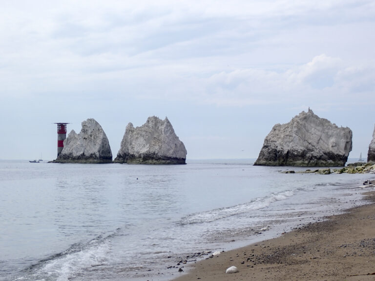
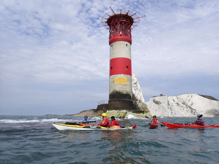
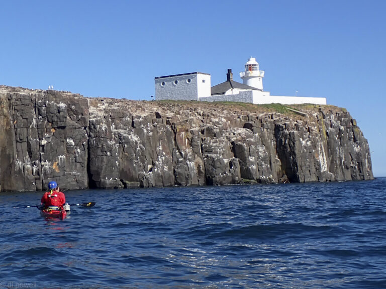
Lighthouse at The Needles
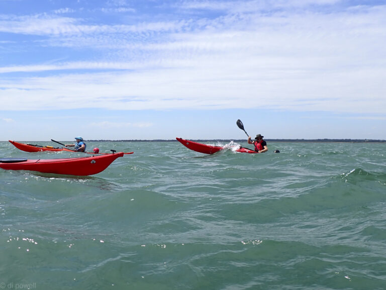
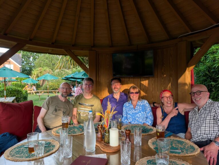
The flow was starting to pick up at the Needles when we rounded the lighthouse, so it was time to head back. There was a lot less traffic on the way back and it seems that Solent sailors don’t stay out after 5pm. A hasty load of the boats, kit and change, then on to the pub at Brockenhurst for dinner, where we had our own private dining pod.
Dinner in the evening sun
Reviewing the day Mike summed up the feeling of the group: the day was dramatic, beautiful and memorable. Here’s to more of these!
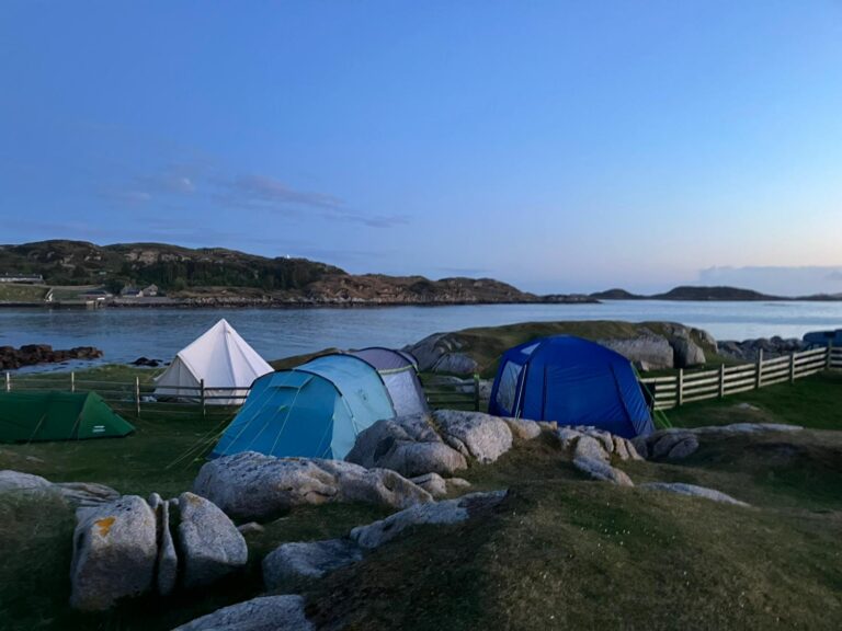
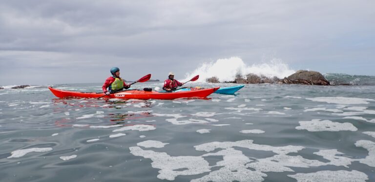
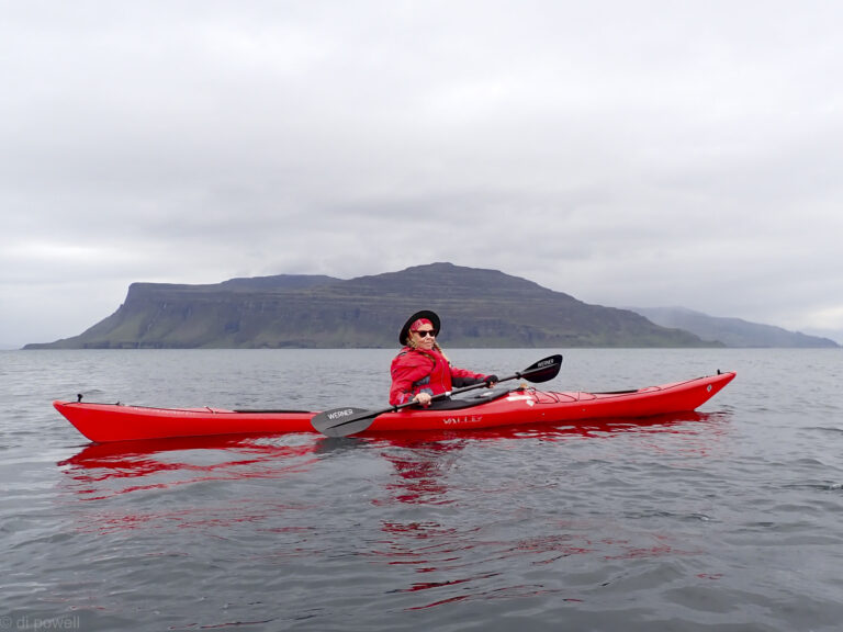
The Isle of Mull is a long way from London and a long way from anywhere. But it wasn’t always that way. Just across the water from the island’s western tip, where CKC pitched camp for a stormy week in May, lies Iona and its abbey, where, if Wikipedia is to be believed, 60 Scottish, Irish, and Norwegian kings lie buried. They and their followers would think nothing about nipping across the Irish Sea or voyaging down the coast past Cornwall to Brittany and beyond. We were beside the original nautical crossroads.
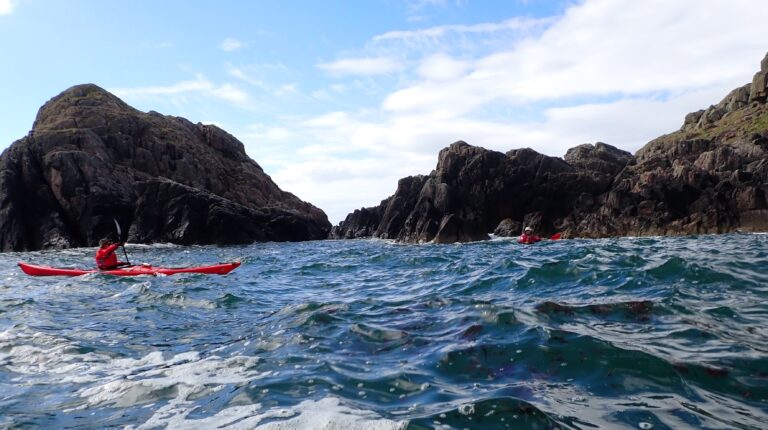
Our trips weren’t quite on the same scale. My day one saw six of us— Fiona, Jude, Gilly, Liza, David, and yours truly— circumnavigating Iona. It was a long day. Liza organised the trip to keep us clear of rock gardens made hazardous by a spring tide running full bore. She also scheduled not one but two lunch breaks on the Atlantic side of Iona so we could ride the flooding tide north.
Dynamic water around Iona
The trip started on the beach at Fidden Farm, our campsite, from where we had a quick hop across the Sound of Iona to the island’s southern tip. There we found ourselves surrounded by white bubbles that stretched in every direction, making the sea resemble an infusion of bath salts.
West side of Iona
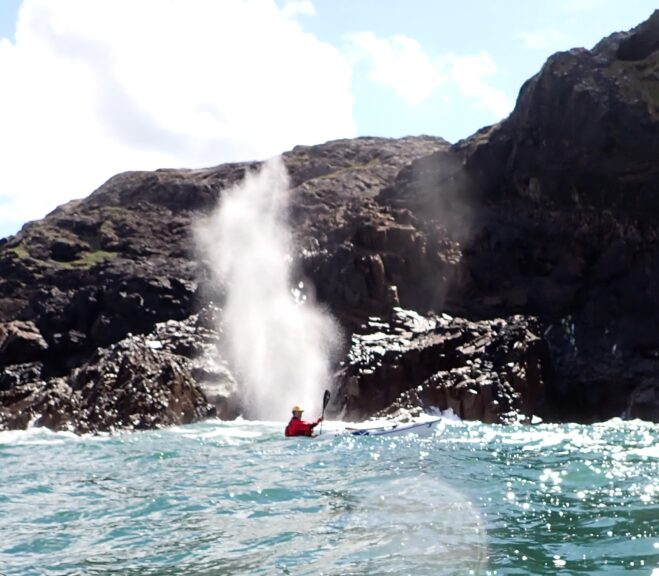
Spouting Cave living up to its name
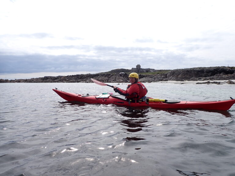
Back on the mainland side of Iona, near the jetty where tour boats were disembarking passengers from the ship anchored offshore, lunch breaks were followed by an ice cream break. With the wind picking up, there was no time to visit the Abbey, the island’s main attraction. Instead, we headed back across the sound to our campsite, passing the Waverley, the world’s last surviving seagoing paddle steamer. Later, we learned it had just been used to ferry passengers back to Oban after the notoriously unreliable Caledonian MacBrayne ferry had broken down.
Iona Abbey
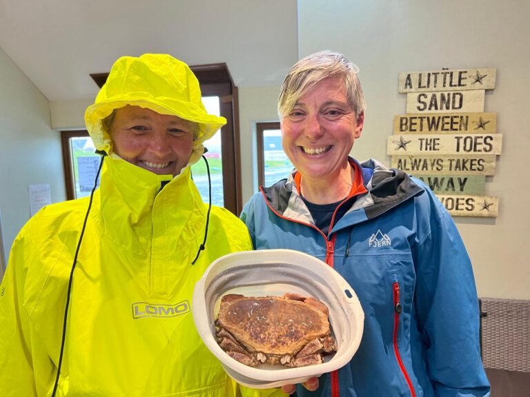
The next day on the water we had greater delights when Fiona bought a crab from a fisherman. She decided a spell in the campsite freezer was the humane way to despatch Claude (clawed— get it?). That was the easy part. She then had to persuade two American visitors there was nothing unusual to be seen in the freezer where they had left their food.
Claude
When Claude was judged sufficiently chilled, into the pot he went. Then it was over to Jude, who proved ruthlessly efficient at dismantling crabs. David and Liza had thoughtfully brought a large pop-up tent for use as a group shelter, and, wrapped in woolly hats, anoraks, and every last stitch of clothing, we all huddled beneath it and tucked into crabmeat.
The spectre at the feast was the weather. We had rain by the bucketful; gales meant the group tent had to be twice taken down; the temperature dropped overnight to just five degrees sending Jude and Fiona for emergency purchases of locally woven blankets; and we all became weather junkies, glued to our weather apps.
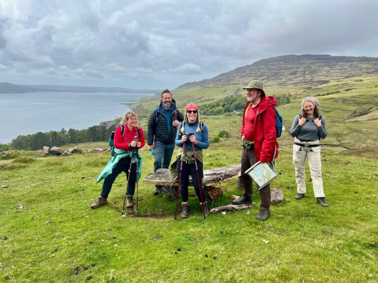
When the wind was too strong for kayaking, we put on hiking boots and headed for Burg, the massive headland across the sea loch. We didn’t even attempt the 1,400ft climb, but it was to be my toughest day. The plan was to follow the coast to a geological shrine: a 50-million-year-old fossilised tree, preserved in lava flows and first recorded over two centuries ago.
Walking around the Berg
The start was deceptively gentle – a forestry track leading through an avenue of contorted beech trees. But track turned into path, path became a rocky scramble, then we were faced with a climb down a shiny steel ladder bolted to the rock face. After that everyone had to pick their own way for the final half-mile along the boulder-strewn shore. That was when Gilly and I decided it was time to sit back and enjoy the sights while the others pressed on.
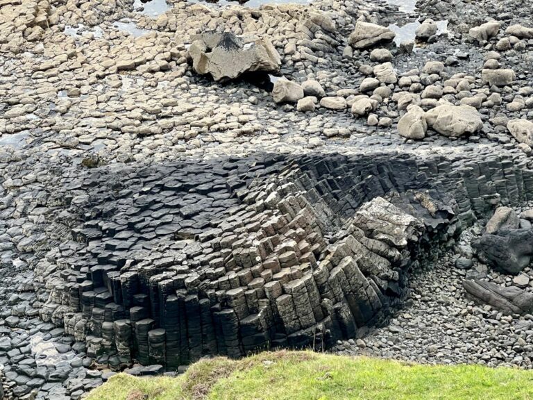
I’m glad we did. The basalt rock formations, which had been caused by violent eruptions, had settled into strange and wonderful shapes leaving a giant wheel that might have been a druids’ altar; sharply cut columns fit to grace a palace; and more columns fanning out like hands in prayer. They weren’t the only spectacles – I was delighted to see a pair of ravens patrolling the cliffs (and envious of Fiona, who claimed an eagle).
Basalt columns around the Berg
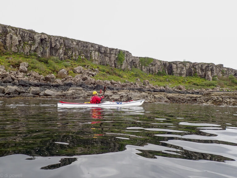
The next day was to be our last on the water, and we had the odd experience of admiring the entirety of our walk from a distance. There was nothing to make it look difficult. But then the same could have been said of that day’s paddling. A sheltered coast with hardly any tidal flow meant we could relax and we had time to admire the huge sea caves made by the waves to boom like giant orchestral instruments.
View of the Berg walking route the next daySouth side of Loch Scridain
But the caves were a bit too tempting, and David was inspecting one interior when a sudden surge reduced his headroom from yards to just a couple of feet. There was no harm done, but the case for wearing a helmet could hardly have been made more forcefully.
Sod’s Law kicked in when it was time to strike tents and pack up – the rain stopped and the sun came out. Back on the mainland, the further south I drove the more layers I had to strip off. Now I’m writing this from a hot and sticky cauldron.
Give me the wild, wet, and windswept north any day.
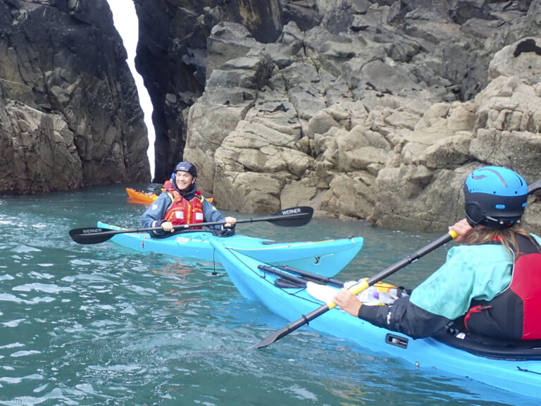
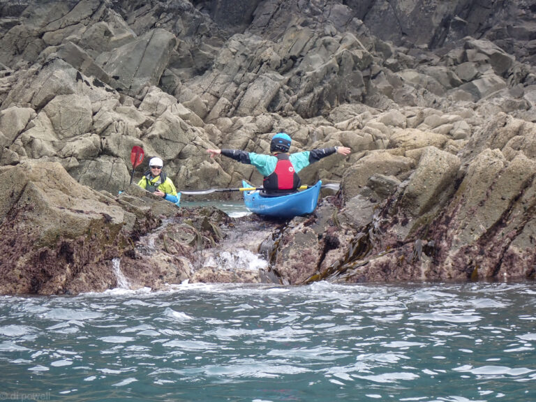
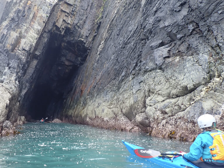
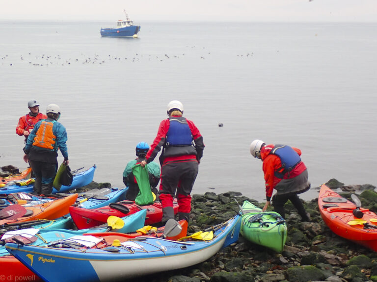
After settling in on Friday evening to our most comfortable accommodation at Preseli Venture, between St David’s and Fishguard, our fun-filled kayaking weekend started off meeting our coaches Martin, Ben and Rich from Sea Kayak Guides (SKG) at their new base at The Paddock, Mathry. There’s a small cafe and nice farm-shop there, and toilets. We agreed that with a south-westerly wind, we’d opt for a fairly gentle paddle day along the sheltered coastline from Porthgain Harbour, where there’s a slipway into the sea for easy launching. We headed west along the coast past Traeth Beach, Garn Lwyd and towards Trwyncastyell, then back via Cerrig Gwylan. Plenty of opportunities for some paddling through gullies, rock-hopping and exploring big and small caves. That evening we enjoyed a well-deserved dinner at the Sloop Inn at Porthgain.
Successfully navigating a gully
Literally rock hopping!
Big cave
(Very) small cave
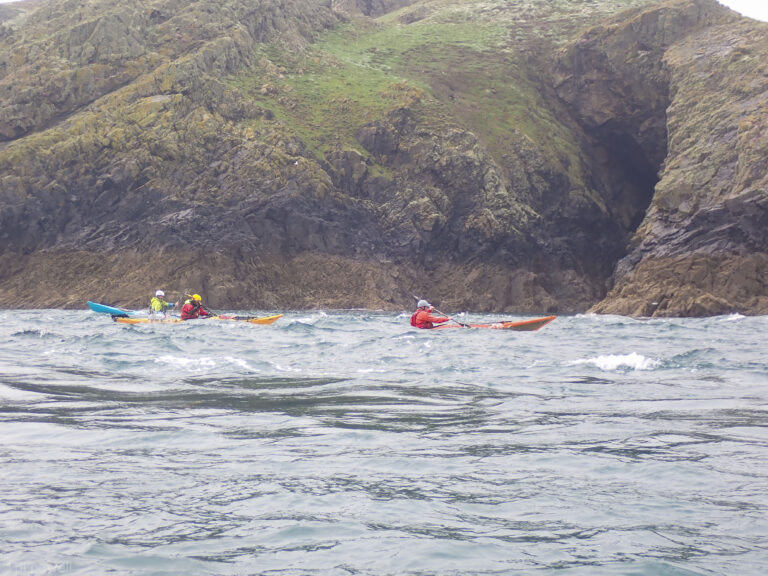
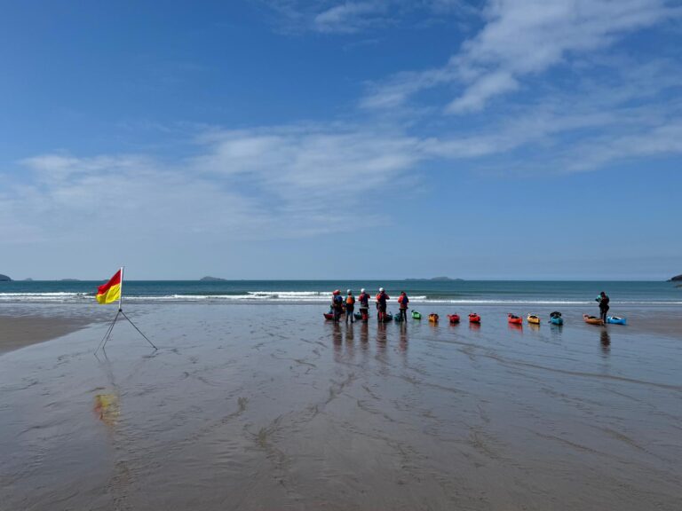
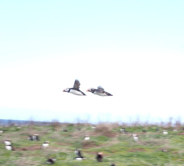
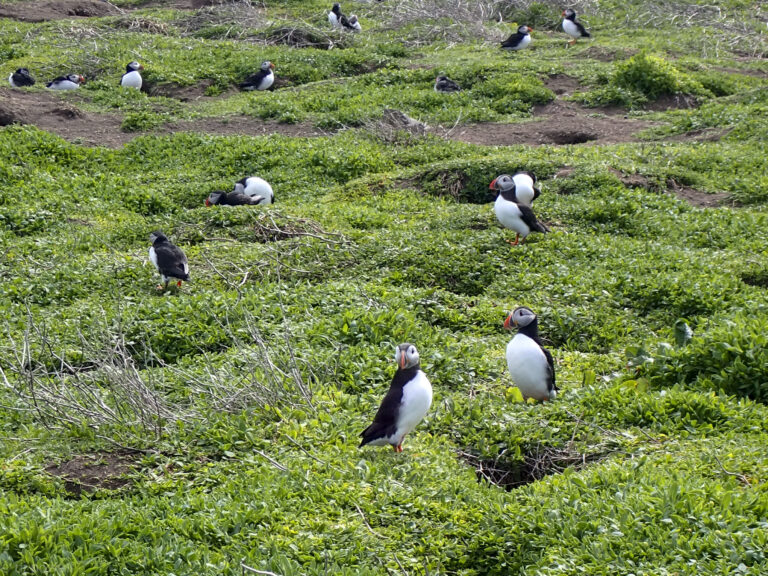
Looking for a bit more challenge on Sunday, we drove about an hour to Martins Haven, Marloes, where there’s a National Trust car park. It’s a bit of a walk to the beach from the car park so have trolleys – it’s possible to take a car down temporarily but space is tight. There are toilets (and an underwater photography gallery), and nearer the car park an NT shop selling lots of puffin paraphernalia and hot drinks. Leaving the harbour, carefully avoiding the Skomer Ferry and a number of scuba divers, we headed west past Wooltack Point and across to Skomer Island, much of which is a Nature Reserve. Stopping in at North Haven beach near the Warden’s house for lunch, and where an inquisitive seal kept an eye on us.
The seals kept an eye on us
Wildlife was abundant and we saw puffins, razorbills, guillemots and more. Continuing anti-clockwise round Skomer, there were some thrills or gritted teeth, depending on experience (!) in the fast flow turbulence on the north side, and the first elegant capsize.
Around Garland Stone
More fun in the fast flow of Little Sound on the south side, practising navigating the eddy lines and wave surfing – and another “swim”. Then finally past Midland Isle and across the often challenging Jack Sound, back to Martins Haven. Tired but happy, we ended the day with a hearty and delicious Indian meal back at the accommodation, accompanied by the most amazing sunset.
Little Sound tide race play
Dinner after a full day’s paddling around Skomer Island (and yes that is a kayak hanging from the roof!)
Sunset!
On Monday we started from Whitesands Bay on a linear route to Porthclais Harbour. It did mean moving most of the cars to Porthclais after dropping off the kayaks, but that didn’t take long. Whitesands Bay has a nice big beach, so easy for launching. There’s an RNLI lifeguard station there, and a good cafe/shop and toilets.
Whitesands Bay
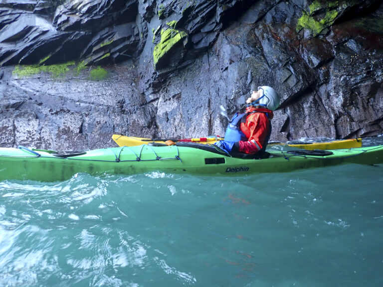
We headed slightly north away from the beach to St David’s Head, to optimise catching the wind and flow, before heading west over to Ramsay Island. We visited Ogof Hen (Old Cave), one of longest going back 200m. It was pretty awesome inside, and the roof of the cave drips freshwater.
Trying to drink water from Olaf Hen
Back out into the light
Ramsey Sound
We had lunch on the pebble beach below the abandoned farmhouse, then moved south down to The Bitches, playing around in the flow, crossing and re-crossing eddy lines – though the flow was more forgiving than in Little Sound.
Ramsey Harbour
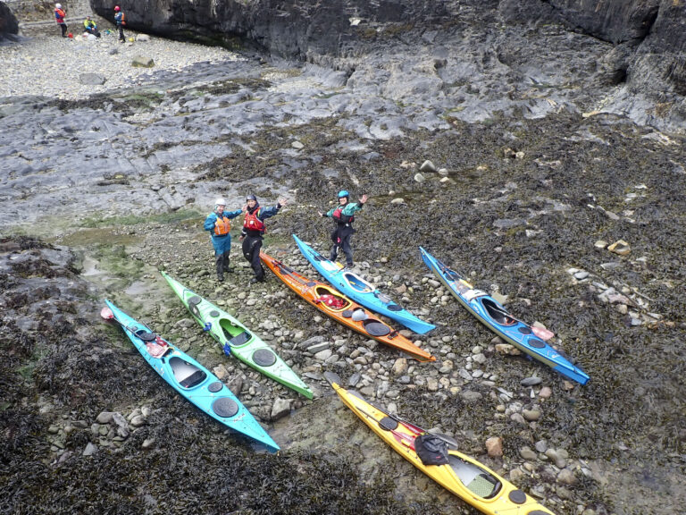
We crossed over Ramsey Sound doing a swift 7 knots (!), and then with the wind swinging east and touching Force 4, we had a bit of a push along the coastline to Porthclais Harbour (toilets and a closed kiosk). A few stayed behind for a bit practising rolls and rescues in the harbour. We returned to the happy news that CKC’s Liza had passed her Sea Kayak Leader assessment. Congratulations Liza! And many thanks to Andrew, Ingo, Jo and Jude for offering to be led over the two days (aka being ‘dunk monkeys’!).
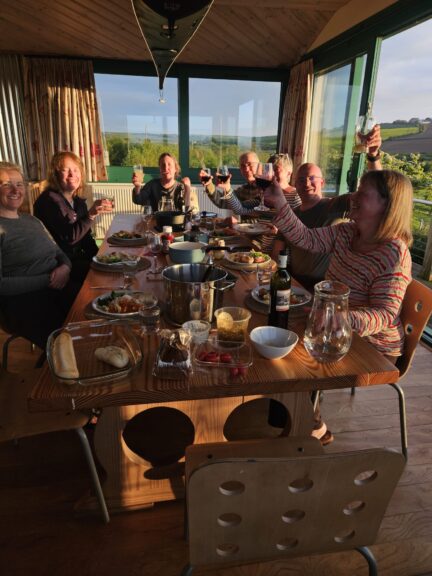
Final night dinner
Thanks to Martin, Ben, Rich and Ollie from Sea Kayak Guides for an excellent weekend of coaching, learning and exploring!
You can see some of the highlights on our YouTube video of this weekend, here (7mins 40s): Pembrokeshire, May 2026.
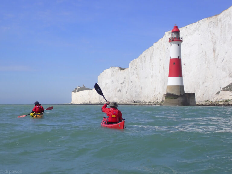
We haven’t been able to paddle to Beachy Head for the last 2 years as the weather and tides never worked for us. But this year we managed to get to see the lighthouse twice in 6 weeks!
Although the wind was a bit gusty while we were getting ready at Eastbourne, it was to get lighter throughout the day. Whereas on the previous trip we were dodging rain clouds, this time getting sunburnt was more of a concern.
Blue skies around Beachy Head
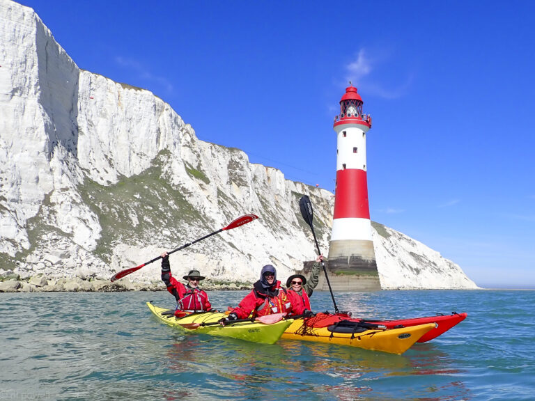
Paddling passed the lighthouse we were able to surf some small waves, pushing us on towards Birling Gap. Birling Gap had suffered a landslide of part of the cliff around the steps leading to the beach. We had hoped that we would have the beach to ourselves, but the steps had re-opened 2 days previously letting the general public back onto the beach. Still, it was quieter than usual. For lunch we kept well away from the cliff, just in case there was another rockfall.
Birling Gap
On the way we had seen one really big seal, but on the way back we saw a large group of 8. After paddling back to the launch point we continued onto have a look at the golden domes on the pier, before landing. An enjoyable day on the sea!
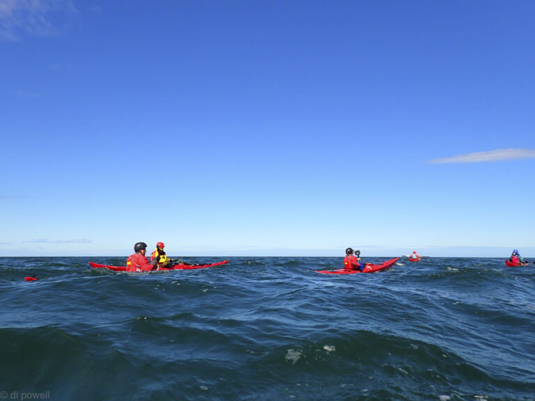
It’s 11:00am and I’m already part way through my first crab roll of the weekend for brunch. Today is a travel day as we’re on the Northumberland coast and it takes about 6 hours to drive up from Kew Bridge. There are 8 of us paddling plus a cake maker and support dog. Over the course of the day everyone arrives at the Airbnb, which overlooks the massive sandy Budle Bay, near Bamburgh, in the distance. Claire is not able to come because she’s hurt her back but has sent up a vegetable chilli for our Friday dinner!
Craster Harbour
On Saturday we’re all excited to launch at Craster Harbour, where we have to pay £5 a boat to launch, although Liza haggles and is able to get us a group rate. Once we are out of the harbour we stay close to land in the wind shadow of the land, passed Dunstanburgh Castle under some ominous looking skies.
Dunstanburgh Castle
Under grey skies around Dunstanburgh Castle
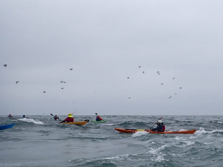
Some of the points forced us to go further out away from the land and here the gusts got stronger. Crossing Beadnell Bay was initially a challenge, although it got easier as we got more shelter from the dunes. Luckily we had set up a shuttle so there was no need to paddle back in the strong gusts.
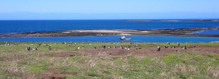
On Saturday we all assembled on the beach near Seahouses to launch for Inner Farne. Inner Farne is a National Trust island with a large puffin population, although we had been told on Friday that there were only 2 puffins on the island. Paddling over to Inner Farne we saw both of them! And then a lot more on the water and on top of the island.
Puffins on Inner Farne
As we had a tidal gate, we only stayed about an hour before paddling to Outer Farne, via Knoxes Reef which provided plenty of waves.
Knoxes Reef
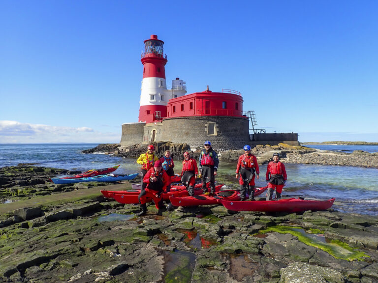
Arriving at Craford’s Gut we had a tough 50m paddle against the flow to get to the Longstone lighthouse, but everyone made it.
Longstone Lighthouse
Then it was back across glassy seas to our launchpoint, via the cliffs of Inner Farne.
A very enjoyable weekend paddling with good company, good cake, interesting paddling and lots of birdlife. We only wish it wasn’t so far away from us!
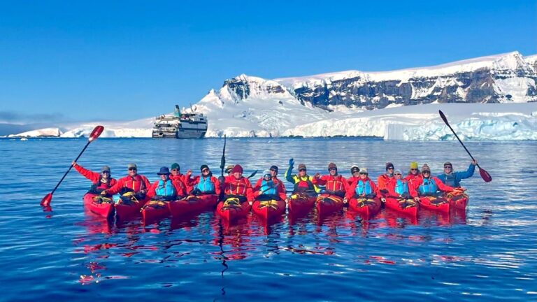
When I signed up to join an expedition cruise to Antarctica I ticked the box labelled ‘kayaking’. I had previously done what I thought was kayaking on the Loire in France and a single trip to look at Sea Otters in Monterey Bay. It turned out that this wasn’t nearly enough experience to qualify. I had about 9 months to pick up the skills. This was a little daunting for an older man based in central London – somewhat out of my comfort zone.
I started my education in the unlikely setting of a swimming pool – under the auspices of the Battersea Canoe Club in Clapham Leisure Centre. A good choice. The instructors were patient and calm and after six sessions I felt confident getting in and out of the boats and what to do if I turned over. But I realised there was quite a difference between the small water polo kayaks and full size sea kayaks – so I joined the Chelsea Kayak Club. My previous experience allowed me to gain my Discover award reasonably quickly (thank you David P.) and then consolidate by taking part in a few evening paddles up and down the river.
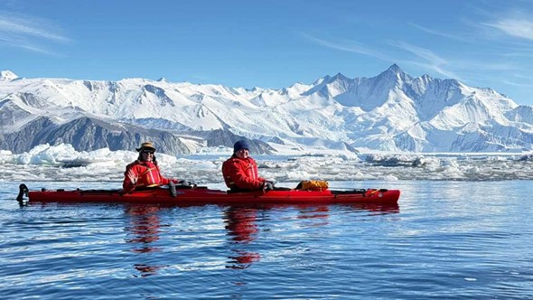
Kayaking in Antarctica is a step up again. The boats were double kayaks with a rudder operated by the rear paddler. They felt a little more stable than the single kayaks and it was good to have a ‘buddy’ in the boat with you. The kit was another matter. To stay warm you needed two thermal layers and a down jacket. You then had to worm your way into a dry suit (tight rubber gaskets around arms and neck), and fit a life jacket over the top. One felt like a Michelin Man. A neck gaiter and beanie hat would keep you protected from winds. Gloves I found were less necessary, the pogies being surprisingly effective at keeping your hands warm.
We were put through our paces at a sub – Antarctic island called Enderby Island. A gentle paddle around cliffs of basalt pillars with the odd cave. No ice, just a few fur seals for company.
We proceeded down to Antarctica proper with paddles at Cape Hallet and McMurdo Sound. Here we encountered ice in its many forms. Grease ice makes the sea soupy – like paddling through treacle. Brash ice – small, floating ice fragments that need careful navigation; bumping into a small block of ice can stop your kayak in its tracks. Nilas ice, where the ice has formed into thin sheets on the surface. Your kayak will just force them to slide over one another. And then Pancake ice, circular dishes of ice that you can hopefully force apart and find a way through.
The paddle at Cape Hallet was extraordinary. Bright sunshine and the grease ice damped down any choppiness, just leaving a long wavelength swell where you would drop into an icy world in the troughs. The brash ice was all sparkly and the snow covered mountain scenery breathtaking.
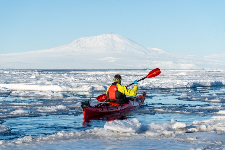
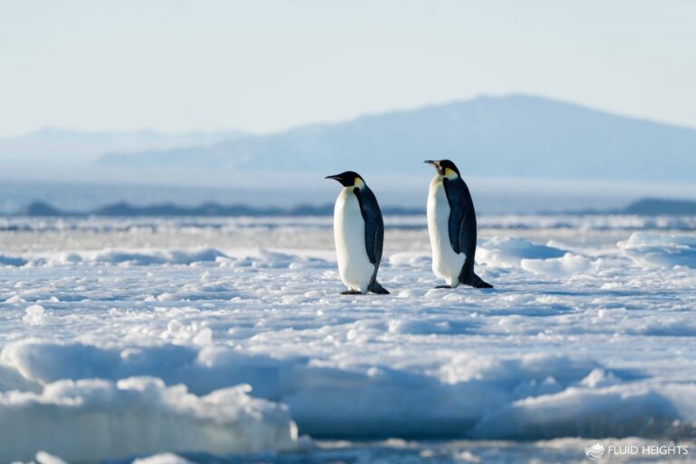
In the more southerly McMurdo the temperature was lower and the ice was much more intimidating. Large flat ice floes with narrow leads in between, all underneath the smoking volcano Mount Erebus. We did have a close encounter with some stately Emperor Penguins on the flat floes.
Our route then took us along the Ross Ice Shelf and beyond, to a part of the continent known as the peninsula. This is an offshoot of the main land mass and largely above the Antarctic Circle.
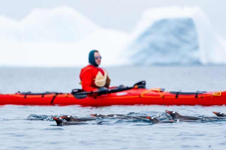
On a foggy morning we paddled around a Ukrainian base on the Argentine Islands. Visits to bases are no longer allowed (post covid) and so we had to forego the home distilled vodka that the Ukrainians normally serve to visitors. Rather oddly our only interaction with the scientists was one of them appearing from a sauna and promptly mooning at our flotilla! At one point we were asked to raft up as an inquisitive, three metre Leopard Seal buzzed around our kayaks. Just after being picked up in our Zodiac we witnessed its true nature in full tooth and claw – the seal caught a young Gentoo Penguin and hurled it back and forth in order to detach the feathers and skin from the body. Bloody and chilling, but fascinating.
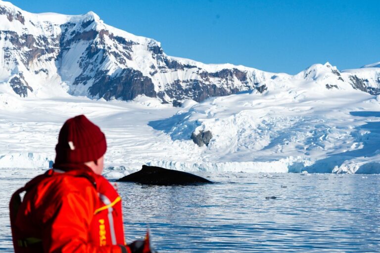
Our final paddle was in the beautiful surroundings of Founier Bay on Anvers Island. The weather was perfect and the bay turned out to be full of Humpback Whales. They were actively feeding, so constantly sounding and returning to the surface with noisy blows – right in front of our kayaks. An afternoon that none of us wanted to stop.
There are many wonderful things to experience in Antarctica – the scenery, the wildlife, the history (we visited both Shackleton’s Nimrod hut and Scott’s Terra Nova hut, still with their very British stores of Huntley and Palmer’s biscuits and Colman’s mustard!) – but the kayaking gave you a whole other perspective, sneaking up on sleeping seals, being visited by interested penguins and experiencing the full majesty of Cetaceans.
A wonderful and memorable trip for which I owe many thanks to the Chelsea Kayak Club. I would wholeheartedly encourage anybody thinking of going to Antarctica to tick that kayaking box!
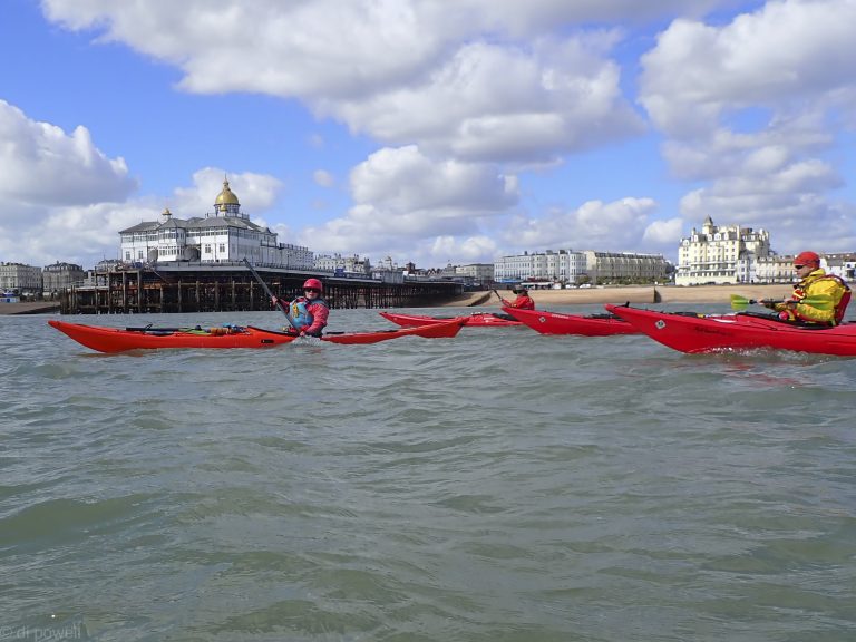
An early start meant that we were on the beach at Eastbourne at 10:30am, having coffee and croissants and sausage baps outside the local café next to our launch point. After a short safety briefing on the beach, we launched from the shingle beach into absolutely no waves.
Fantastic conditions to launch and not what was expected
That was a surprise as the weather forecast had been very bad, even up to the time we arrived. Wind was forecast to be NW F4 with F5 gusts and 0.7m waves every 5s. It really was about F2 with F3 gusts, with very small waves. However, we knew from previous experience that a NW wind meant that the Eastbourne side of Beachy Head was sheltered and we would experience stronger winds around the headland.
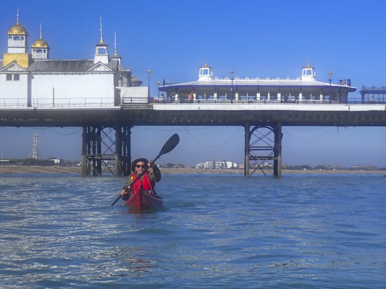
We had both the sun and the flow with us, so we zipped passed the Eastbourne Pier with its golden domes.
Eastbourne Pier
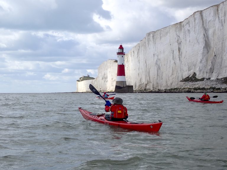
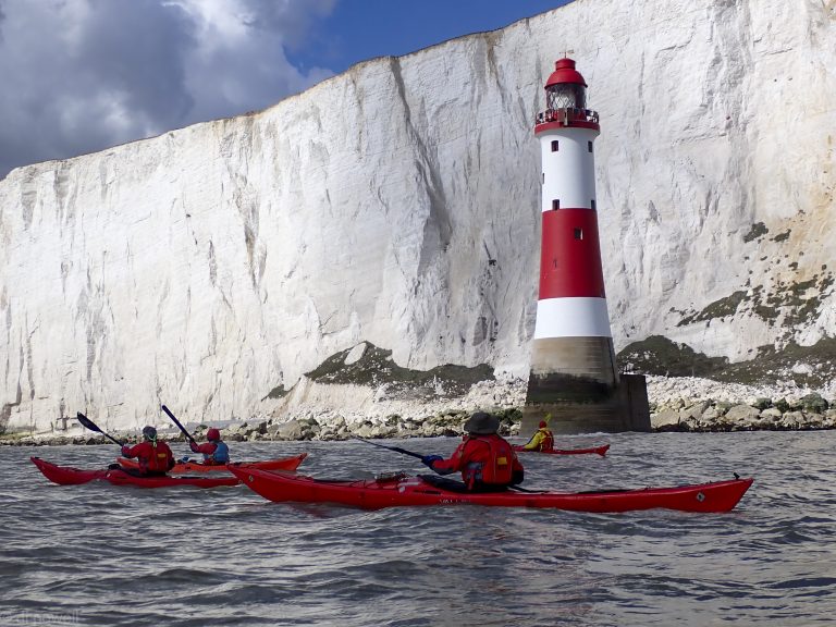
A short stop on one of the beaches exposed at low water to correct some footpegs and we were off around the reef at the headland. Passing the reef, two seals accompanied us with one following us to the lighthouse.
The lighthouse itself is on the sea with huge white cliffs as backing. At Beachy Head the fast moving clouds gave a searchlight effect to the cliff face, as the sun alternate shone through and was blocked by the next cloud.
Beachy Head Lighthouse
The wind also had picked up as anticipated and although we paddled about 3km into the wind, our pace started to drop so that by the time we reached Belle Tout (the second lighthouse) we really weren’t making much progress.
Liza, our leader, decided to cut our losses and we headed for lunch at one of small beaches under the cliffs out of the wind, that were exposed at low water.
Sun and clouds at Falling Sands
After lunch we headed back to the launch point with the increasing flow. The clouds also thickened and we saw in some places that it looked like the clouds came down to the sea.
As we passed Eastbourne pier the clouds in the distance turned very black. As we started to load the boats on the cars, it started to snow!
A lovely day on the sea at Margate. We parked up at Hodges Gap promenade car park at Palm Beach Bay. It’s not the closest to the beach – that one is adjacent but closed by a barrier to vehicles and access is only for jet-skiers with a code. So it adds a little to the walk, but is manageable. There are no toilets here – the nearest we found were at the smart Bowling Club a short walk away – visitors welcome.
Palm Bay Launch
The launch at about 1215 from the beach was straightforward, with just a slight swell to contend with, and keeping clear of the reef to the left. We headed out to catch the flow, keeping a careful eye on a pack of noisy jet-skiers who fortunately moved off pretty quickly and left us in peace.
We headed west with the flow in good conditions, with a light north-easterly breeze and a sunny sky. We paddled past Walpole Bay, Margate Cove, past the Turner Contemporary, searching as we did for the Antony Gormley statue, but he was submerged (the solitary figure becomes visible three hours before low tide). Then past Margate Main Sands, Westbrook Bay, St Mildred’s Bay, Westgate Bay, towards the impressive Reculver Tower and Roman Fort. A deliberate and – may I say – a well-executed roll by David along the way added to the fun.
Hazy afternoon start
We stopped for a packed lunch at Epple Bay, the turning tide revealing an area of sand to land on, which was much preferable to a slipway a bit further along. No facilities in the area though.
Small beach at Epple Bay
Then back the way we came, a lovely smooth run in the sun and the sparkling sea, keeping out from land to catch the flow which picked up as we headed east. It felt we covered the ground faster than on the way out – and we took the time to do some skills practice with Mary coming to the aid of a suddenly poorly David, who was towed by Liza for a few metres before happily recovering Liza demonstrated an impressive self-rescue.
Cliffs near Westgate on Sea
We arrived back at Palm Bay Beach at about 1630 with the tide coming in, shortening a little the walk back to the cars. It was a great day out, and it felt good to brush off the winter cobwebs. Many thanks to Liza for organising it so well.
Perfect weather for a first time sea paddle for five members on the Solent trip in October. Liza had us all doing warm up exercises under the watchful eyes of some donkeys in the nearby field, before getting on the water, then it was simply a matter of following the coastline.
First sea trip!
We had perfect conditions: a little cloud, slight winds and small waves, with the tide with us both ways. Once we also thought we saw some cows on the beach, but on getting closer we saw they were New Forest ponies.
After 45 minutes of paddling in a straight line, it was time for the ‘peg game’, seeing how many pegs you could get from each others kayaks. After 10 minutes, Struan was announced as the winner of the prized Double Decker chocolate bar.
Then onto Lepe Country Park for lunch after crossing the Beaulieu River entrance, which became very busy as we approached it. After a break for lunch and tea, there was some messing about with paddles to warm up again. Later one broke in half and had to be replaced but it wasn’t because of this (honest, Rich!).
Then we retraced our route back to the launch point. With the cloudy dissipating and the sun beating down on us, it made for a hot return. Before landing there was the opportunity to practice some cooling off rolls and an anchored tow rescue (so the rescuer and rescuee would not be taken onto the sandbank near to the landing point).
After an efficient boat and kit loading it was time for a chocolate biscuit and photo on the foreshore, before heading back to the Arches through the New Forest, where we saw a family of Gloucester Old Spot pigs and piglets crossing the road!