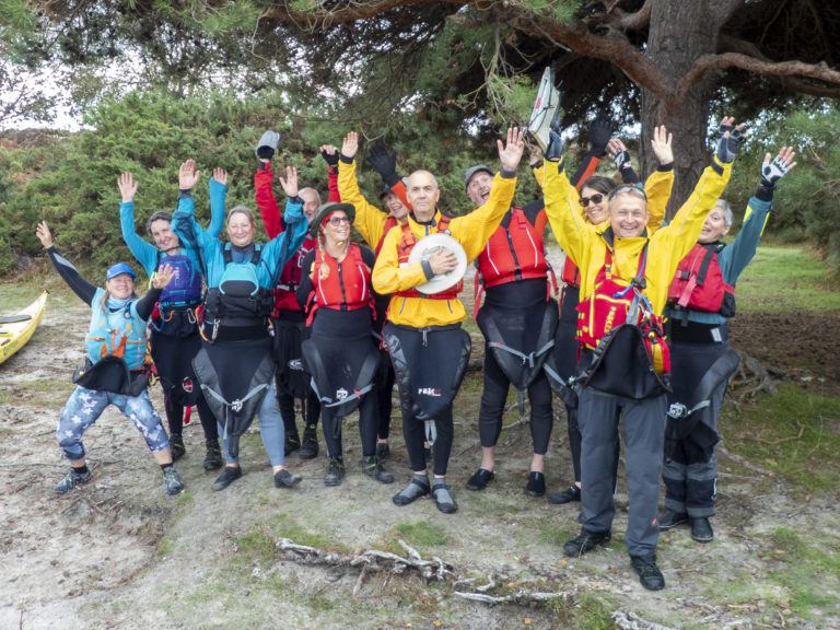
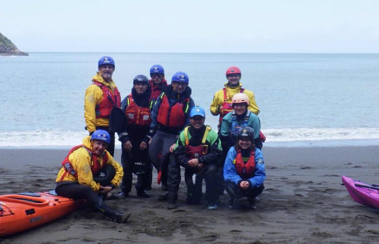
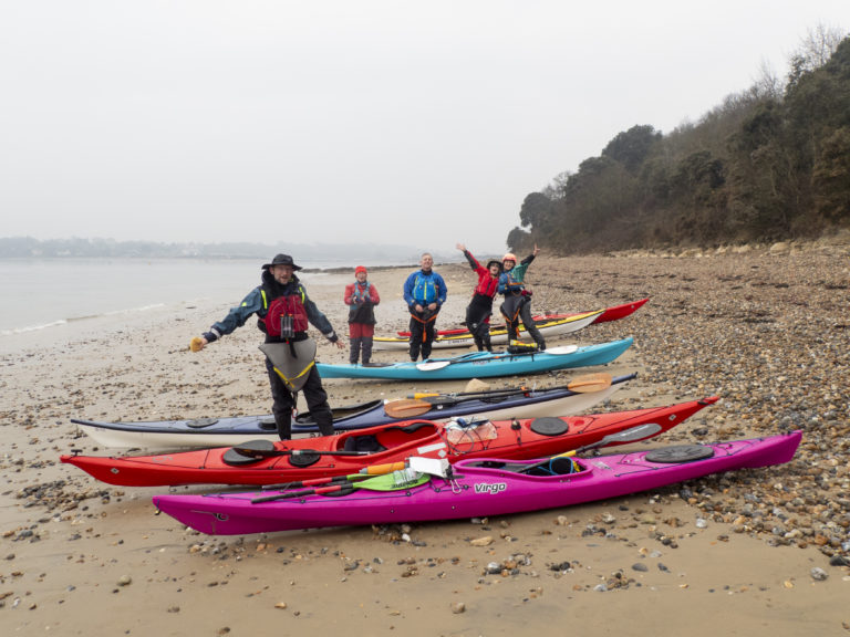
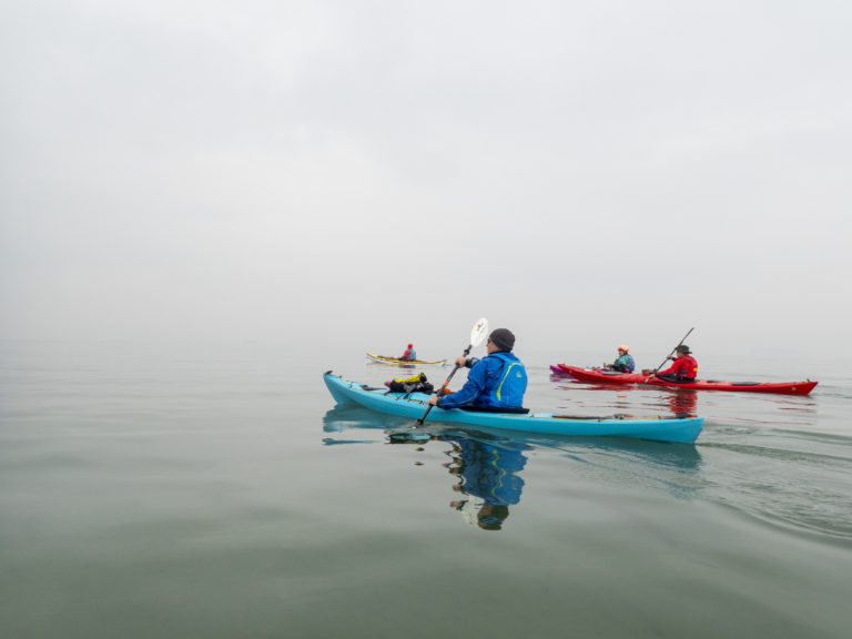
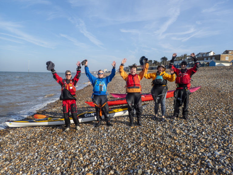
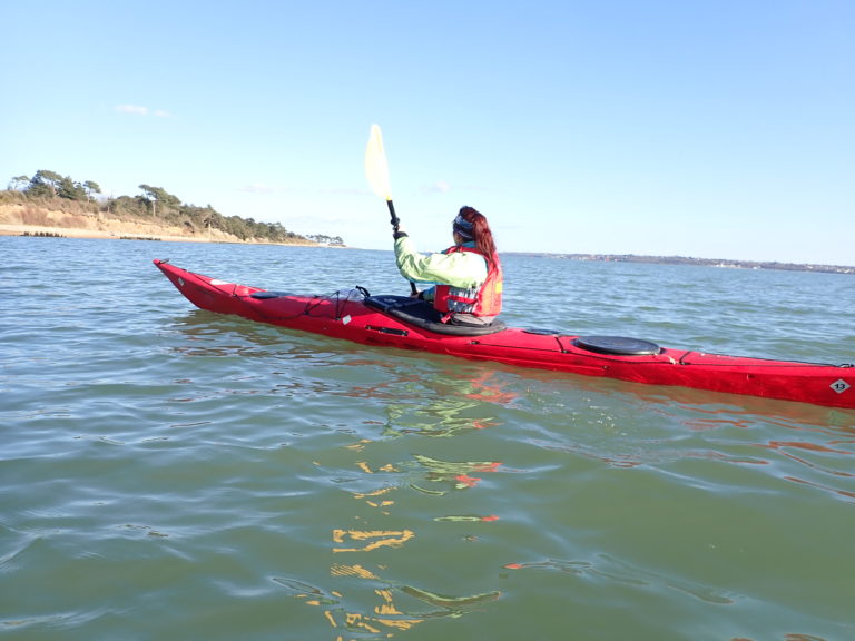
For our annual camping and kayaking weekend on the Jurassic Coast, a dozen of us made our way down to Dorset on Friday afternoon and evening. The weather forecast did not look good at all and it was somewhat doubtful if we would get on the water. After deliberating while at the pub, it was decided that a circuit of Poole Harbour would be the Saturday trip as it was mostly sheltered from the strong winds.
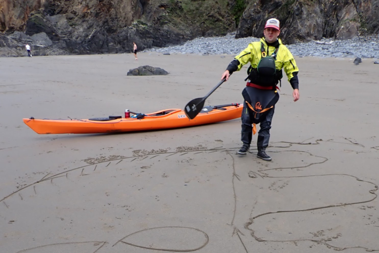
Enthusiastic paddlers ready to launch!
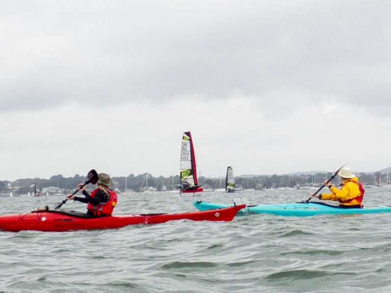
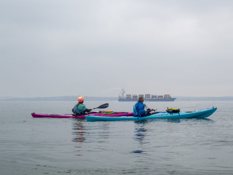
After a safety briefing, Mike taught us a new game to help warm us up (now known as the ‘peg game’). Then we were off to Brownsea Island. As we crossed the Western part of Pool Harbour a large number of racing yachts with hydrofoils (called ‘International Moths’) whizzed passed us at speed.
Hydro-foiling yachts
After a stop on the Arne peninsular, a bird reserve known for a very large numbers of Avocets. Ironically one of our kayaks was also an Avocet, but from Anglesey.
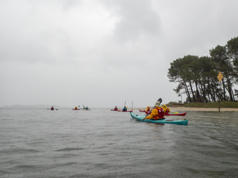
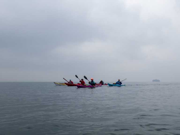
In Ower Bay we stopped for a few minutes to practice some self and assisted rescues, and the occasional roll, before a quick lunch break. As we started after lunch the skies closed in and the wind picked up. Rounding Goathorn Point we got a full blast of the wind from our side at the same time as the rain started. There was nothing to do except put our heads down and paddle back towards our start point without being blown off course.
After lunch the skies closed in
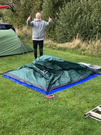
Once back at our lunch point the weather cleared allowing us to get the boats and kit loaded and return to the campsite before getting showered and changed for the evening’s pub trip. However, returning to the campsite we saw that a lot of our tents had been not been spared from the wind. Phil’s tent in particular was completely flat!
After a windy day!
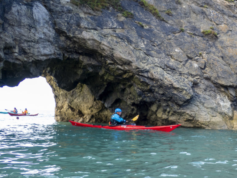
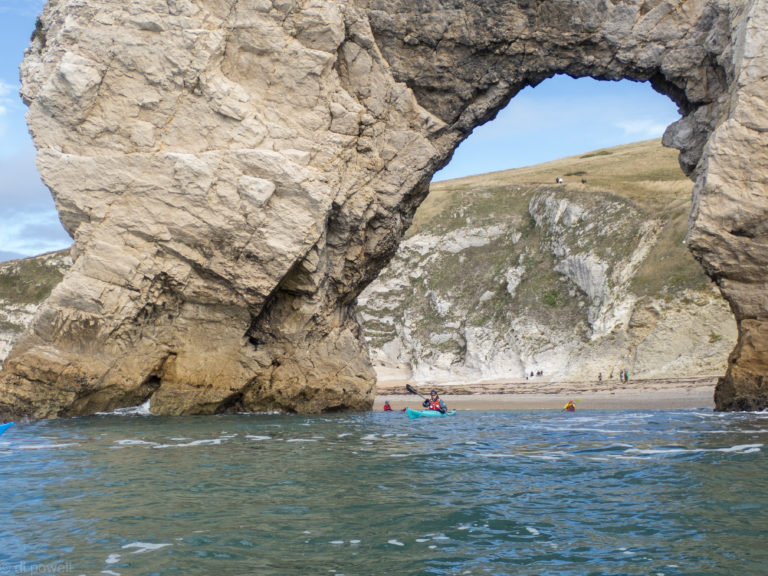
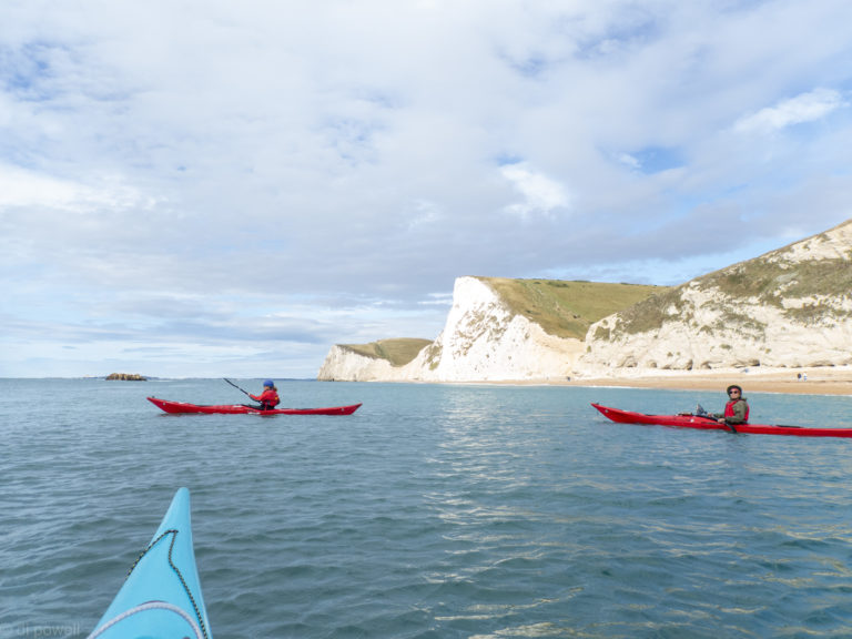
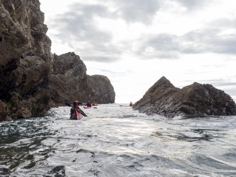
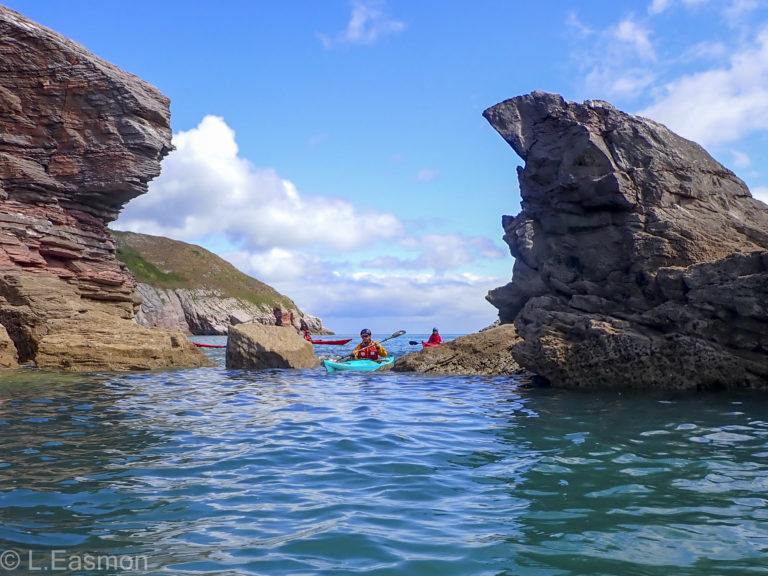
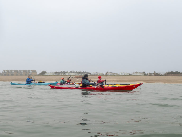
The next day the weather had cleared considerably and we were able to plan to get on the water at Lulworth Cove. That involved consolidating the boats onto a small number of cars to avoid the significant parking fees, and driving down to the shoreline before 10am, two at a time so as have enough room to unload and turn around. Then we were on the water, paddling through some spectacular rock formations and coastline.
Swyre Head
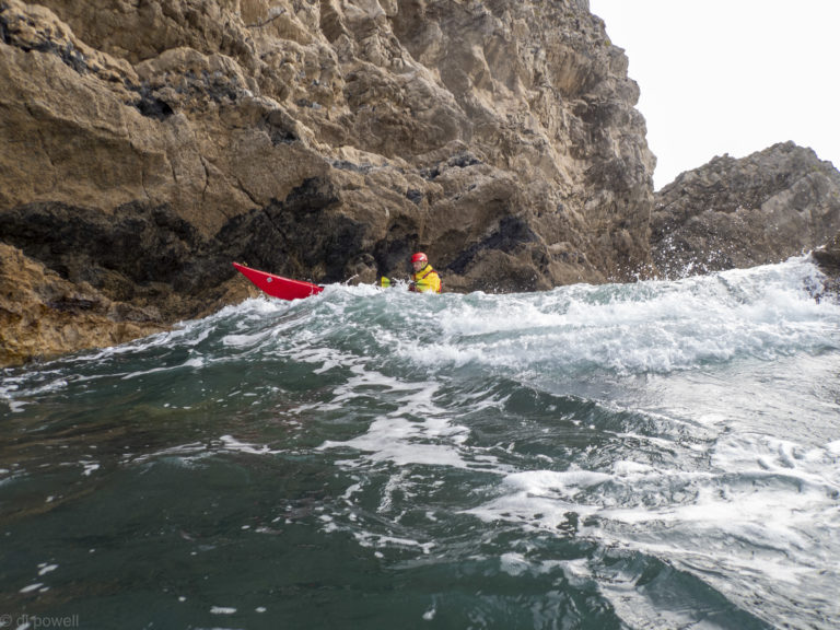
Although the weather had improved we still had to cope with the sea state from the previous day’s storm and that was occasionally challenging.
A break for lunch at Mupe Rocks (quite rocky and not recommended for future trips) made for a short but exciting paddle with lots to see and do.
Nestled on the rugged North Devon coast, Ilfracombe is a charming seaside town known for its Victorian architecture, working harbour, and dramatic cliffs. While many visitors come for fish and chips on the quay or to admire Damien Hirst’s Verity statue, seeing this stretch of coastline from the sea is a must.
Sea kayaking around Ilfracombe offers a unique perspective on the area’s natural beauty. Paddling just beyond the harbour walls, you’re quickly immersed in a landscape of hidden coves, sea caves, towering headlands, and abundant wildlife.
Ilfracombe’s harbour provides a sheltered launch point, making it slightly easier to get on the water even when conditions are a little lively outside the bay. Sunday’s launch certainly challenged all paddlers, but everyone managed to successfully get out and hold position in a sizeable swell. Outside of the harbour you soon enjoy the dramatic cliffs and a chance to spot seabirds nesting on the rock ledges. Hele Bay itself is a peaceful shingle cove, perfect for a rest stop. During higher tides there is also the opportunity to explore narrow inlets, and sea caves.
One of the joys of kayaking here is the wildlife, seals are seen bobbing curiously near your kayak, porpoises playing the surf and guillemots, razorbills, and fulmars are common.
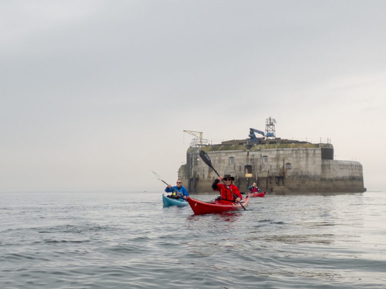
Leaving the beach near Gosport RNLI, the VHF radio is full of chat about swimmers crossing the Solent. That seems like a mad idea and much better to be in kayaks. Especially as we have an exciting route that takes us pass three of the four Solent Palmerston Forts, as well as the buoy marking the spot where the Mary Rose sank, and across the shipping channel to the Isle of Wight.
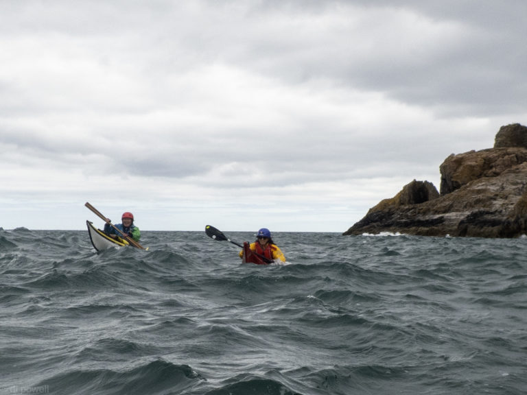
Conditions were expected to be challenging and this trip had been advertised only for experienced club members. As well as some waves and strong winds, the trip route meant that the wind would be in every direction at some point in the trip: from the left, from the right, behind and straight ahead – and everything in between! With wind of F4 (12-18mph) and gusts a lot higher, we were in for an exciting paddle.
En-route to Horse Sands Fort with the Isle of Wight in the background
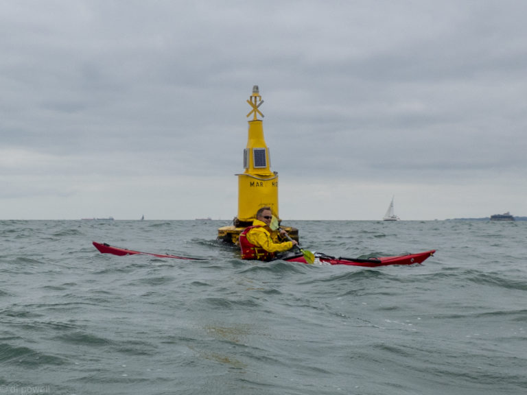
About an hour after we start heading East, we’re at Spitbank Fort and then we change direction to head South West to the Mary Rose Buoy.
The Mary Rose Buoy
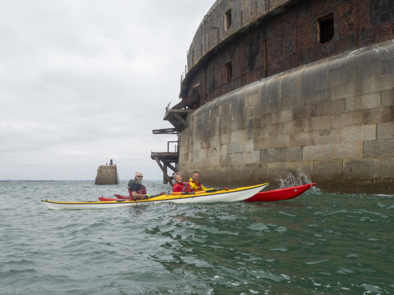
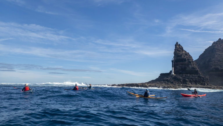
Then we have the 3km paddle into the wind to Horse Sands Fort, where we’re able to a have a short rest.
Horse Sands Fort
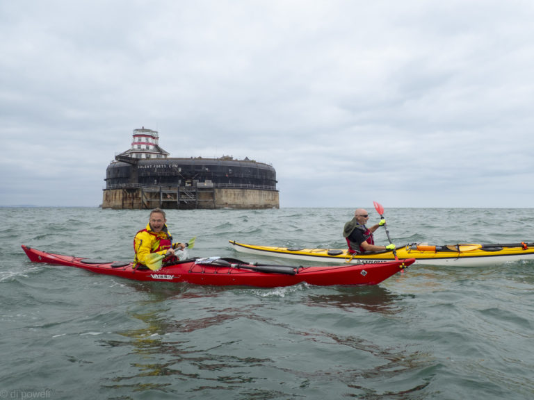
Then we are off to No Man’s Fort across the shipping channel. The wind is behind us for this leg and we do it about 20 minutes faster than planned. The strong wind along with the changing tidal flows have made planning the timings for the trip challenging.
Crossing the shipping channel
Approaching Seaview
We land at Seaview about 20 minutes early, so we have a long lunch break and have time for a pot of tea at the Old Fort café. While we’re there the Red Arrows fly over, as part of the VJ Day commemorations.
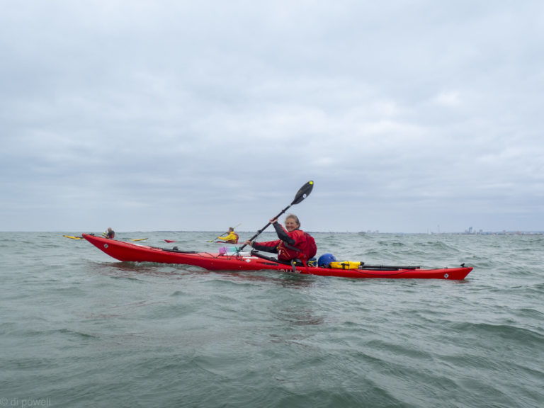
After lunch we all do a seal launches to get on the water to avoid getting pushed into the rocks by the waves. The route back is a direct straight line without any forts. However, once in the Solent we get affected by the wind quite a lot as well as the flow, which are pushing us much further East than we want to be. After adjusting our course, dodging hovercraft and ferries, we get to the middle of the Solent.
Solent crossing!
As we arrive, an enormous P&O cruises ship goes past. When it is well passed we adjust our course to land at the beach at our launch point. Before getting off the water, Fiona does a self rescue in the bay, and Mike does a roll. Which is pretty impressive after the length of the trip (26km) and the conditions. Well done to everyone for completing this trip successfully!
After travelling down to South Devon on Friday night to our usual campsite, on Saturday morning we’re going in a convoy down to Warfleet near Dartmouth Castle. The wind is very strong according to the weather apps, 20 miles an hour, gusting 30 miles an hour from the West. The idea is that we get some shelter from the cliffs around the castle and when the wind gets too strong head back up the River Dart to Dittisham.
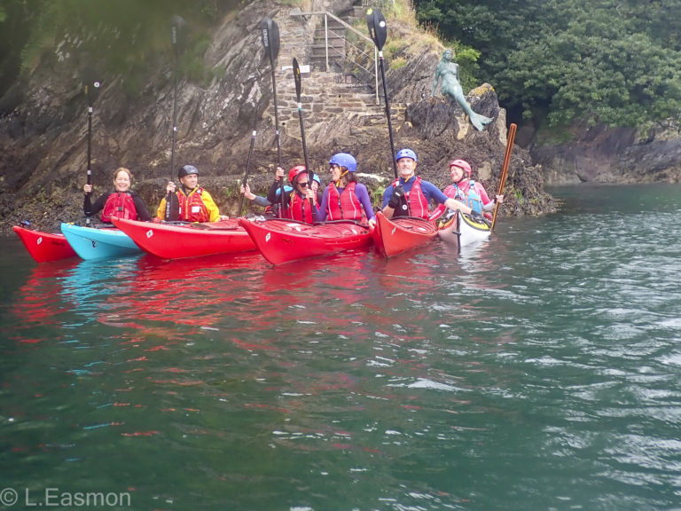
Spot the mermaid!
There is almost no wind on this side of the river as we head out to sea. We find a huge gully to go down as well as some small channels and suitable rock hopping rocks. At Blackstone Point Liza takes a small group over to the Western Blackstone, two rocks offshore and exposed to the wind. As expected it is much more windy and has more waves around it. The rest of us stay in the lee of the cliffs and practice turning in the wind around two buoys.
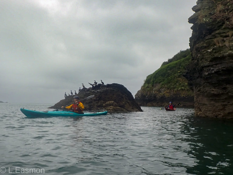
Rock Hopping under the watchful eyes of the local cormorants
Then we’re off up the River Dart. We have to negotiate all the ferries and other traffic on the river as well as the wind and the gusts, but everyone copes well and no issues. We arrive at Dittisham outside the pink pub and stop for lunch. Some of us have a beer and a bag of crisps as well. Then a paddle back to the launch point with a detour along Old Mill Creek to the stone bridge.
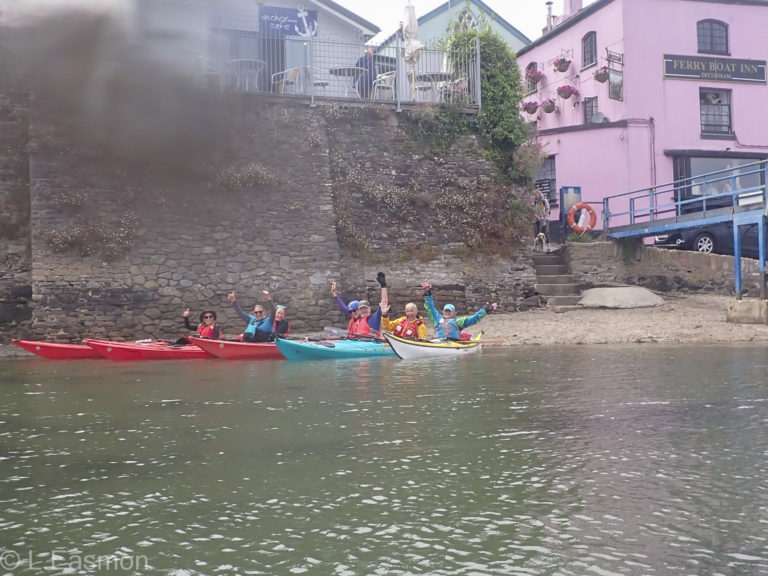
Dittisham lunch stop
Sunday
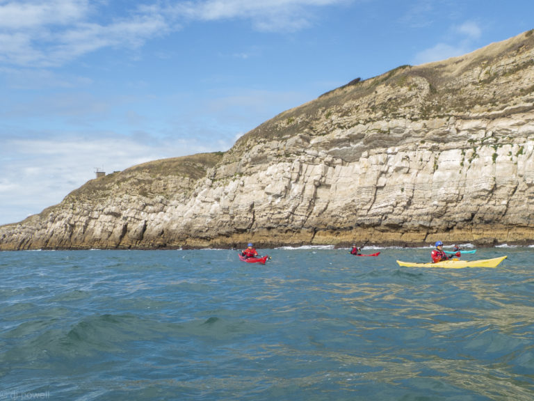
We arrive at Brixham breakwater car park early and have breakfast at the Breakwater Bistro, which is very civilised for a camping trip. The wind is much stronger today, but from the North West, so the plan is to go around Berry Head and be sheltered for most of the day.
With the wind behind us, we are relatively quickly at Berry Head. We have to go out to Mew Stone to avoid the nesting birds and then do some rock hopping to Saint Mary’s Bay.
Rock hopping in Saint Mary’s Bay
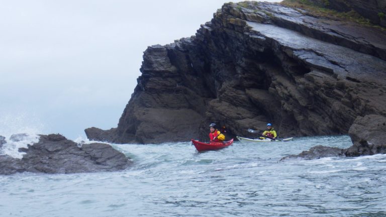
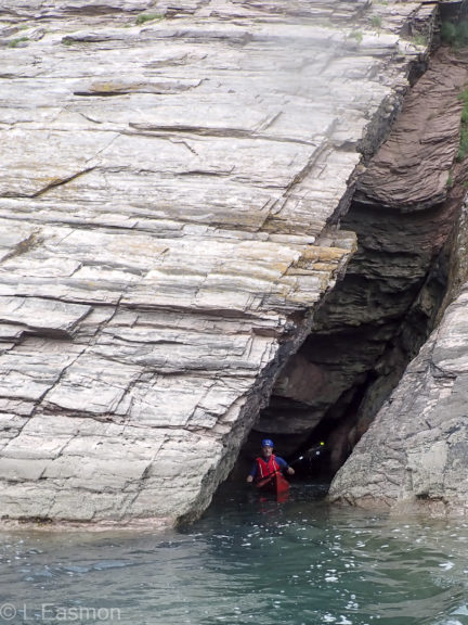
There are a few caves. In one Liza scares some seals and all hell breaks loose as they start jumping around in the water inside the cave in the dark. All the rest of us hear is Liza squealing! Everything is good in the end, but we decide not to go in the other caves in case there are more seals in them. After lunch at Man Sands we head back along the same route, looking in the smaller caves and rock hopping.
No seals in this one!
A bit more rock hopping, with virtually no wind
As we round the Berry Head we have the the wind against the tide and some challenging but fun conditions.
Wind against tide gave us some exciting conditions for the last part of the trip
After landing through some small surf, we get the boats and kit loaded before having a cup of tea and some chips at the bistro. While we’re there, a mother gull is defending her youngster from a much bigger gull by swooping repeatedly at the bigger gull while it stands on the beach. Eventually the bigger gull flies away after the smaller gull’s partner arrives. This seems to conclude our weekend kayaking and some of us then head back to London, while others reward themselves with fish and chips.
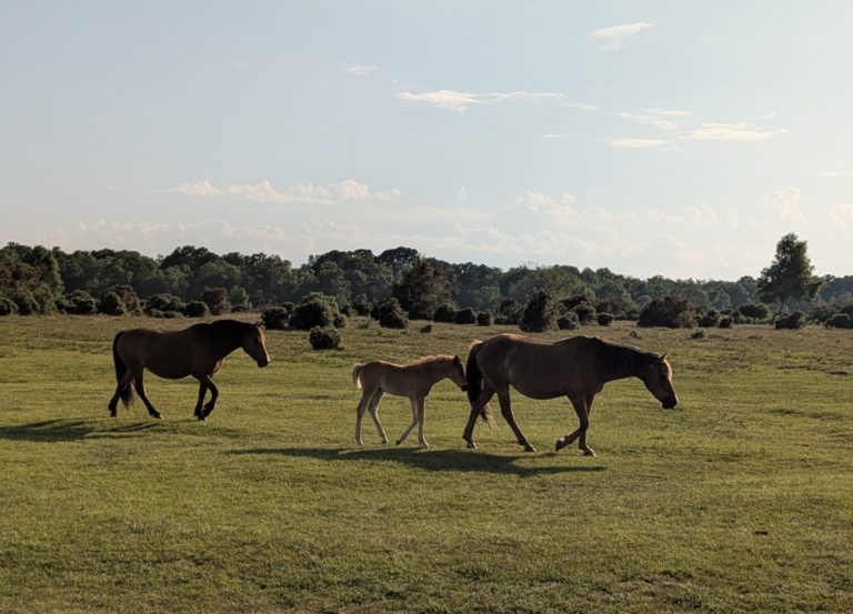
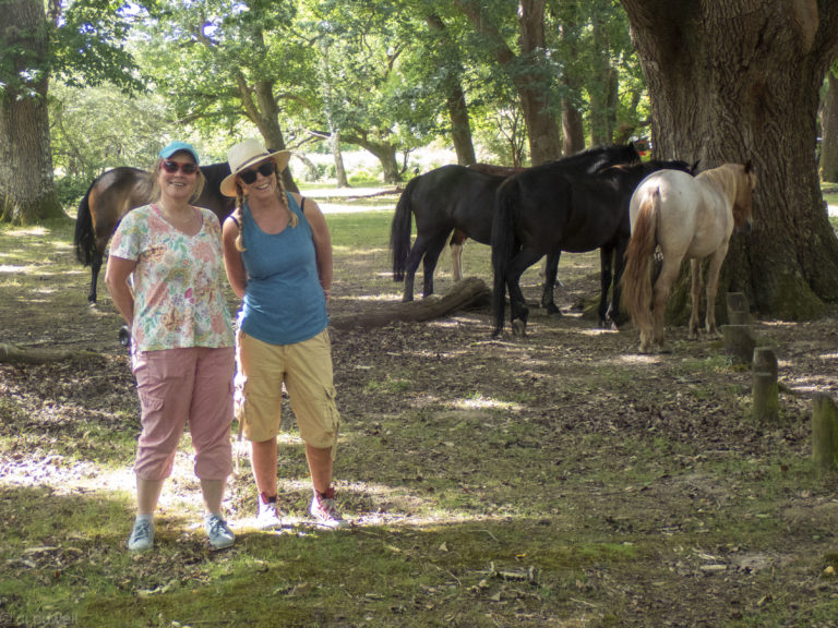
On a warm Friday afternoon, 7 CKC club members travelled down to the New Forest for a weekend of kayaking around, across and along the Solent. Those arriving early got to walk through the New Forest for a pub meal, seeing wild horses along the way.
Wild Horses
The later arrivals, after overcoming the usual Friday evening traffic jams and road closures, were treated to white port with tonic and kiwi cordial (from Mary), after the tents had been setup. The campsite was a huge flat field with very rule-bound staff and we got an earful when they found out Ingo was not going to arrive until 10:15pm. The campsite completely shuts down at 8pm and the gates are locked. It looked like Ingo was going to be sleeping in his car! Luckily he was able to get to the site before 10pm and was allowed in, although his car wasn’t and he had to carry his tent and kit across the campsite. Throughout the weekend the locking of the gates at 8pm meant that we had to devise our plans to be back before then, which was quite restrictive. For future trips we all agreed that we would try a different campsite.
Once everyone had arrived, we had our normal planning meeting to discuss plans for the next day. The wind looked to be quite strong, but not all weather apps were in agreement. We agreed on having two groups: one to Lepe and one to the Needles.
Saturday
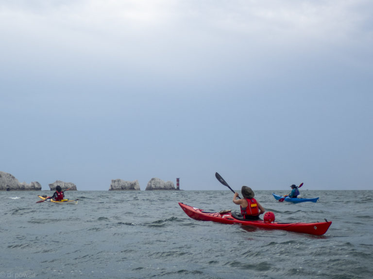
Everyone was up early and we are quickly on our way to the respective launch sites. After the usual safety briefing on the beach we are off to the Needles, with no sign of the strong winds. We’re soon crossing the Lymington channel with a nice tidal push towards Hurst Castle.
Crossing to Fort Victoria, several yachts and motorboats and even one ship had to be navigated around to get safely to the other Isle of Wight. Once we were through the gap between Fort Albert and Hurst Castle the wind started to pick and everyone coped with these conditions. The Needles were in sight and that kept us focused.
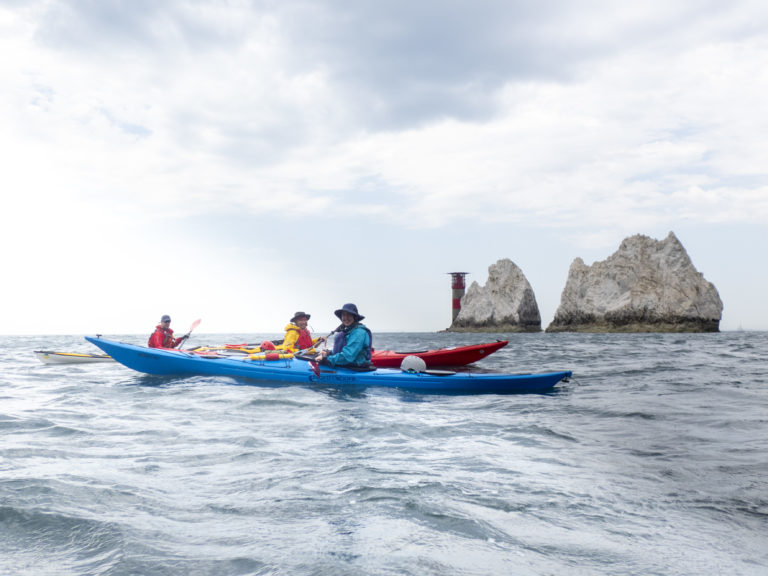
The Needles
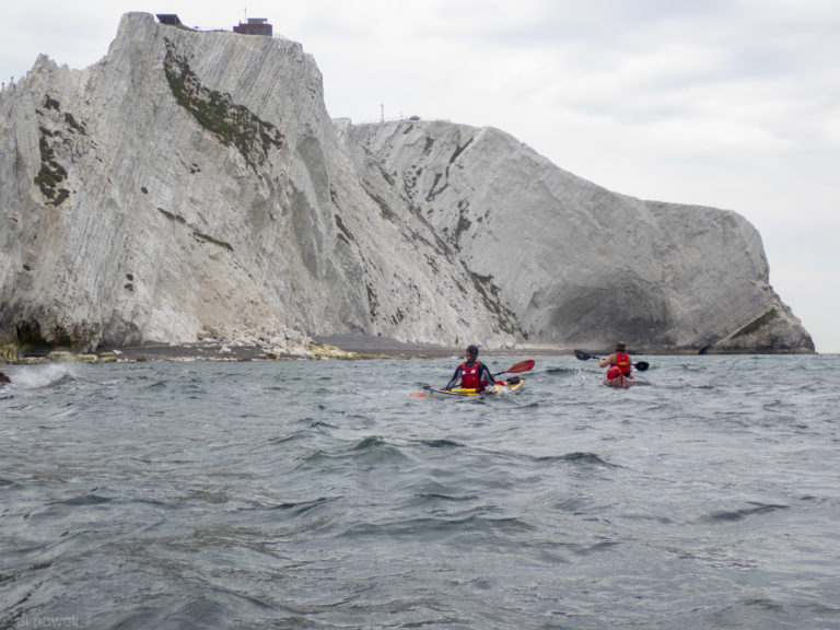
We headed to the cliffs near Alum to get some shelter, then in no time we are through the gap in the Needles. On the other side the huge cliffs of Scratchells Bay are an impressive sight.
Scratchells Bay
We headed for the shingle beach. As it was approaching low water, it’s not too difficult to land although with a bit of wind coming over the cliff then down onto us. To our surprise it started to rain, so we cut short our lunch and got back on the water.
Getting ready to head back to the Solent
Once again we passed through the Needles and then back to the colourful cliffs of Alum Bay before following the coast closely back to Fort Albert.
Alum Bay
The wind dropped a lot and we got a nice tidal assist all the way back to Fort Albert with occasional bumpy water when coming through the gap to the Solent.
Racing motor boats into the Solent
Before we know it we were back at the launch point, excited to have completed a Solent crossing – a first for three of the group.
Success! First trip over to the Isle of Wight completed
Sunday
The day started to get very warm early in the day, meaning that we were all up early. As we poked our noses out of tents, it was a surprise to see a lot of deer at the end of the campsite. Liza said that she woke up at 3 am and they were all around the campsite in between the tents.
The wind forecast had increased overnight so we decided not to paddle on the second day. Instead we drove to Brockenhurst and did a walk across a common and in the woodland, bordered by a campsite called Hollands, which looks significantly better than our one. We saw some horses and cows (but unfortunately not on beaches).
Kayakers in Disguise
There was a lovely vignette where a foal was lying asleep on the ground then woke up and realised that it’s mother had walked off. The matriarch of the group can hear the foal neighing and went into the woods and found its mother, then chased her back to her foal, who was very happy.
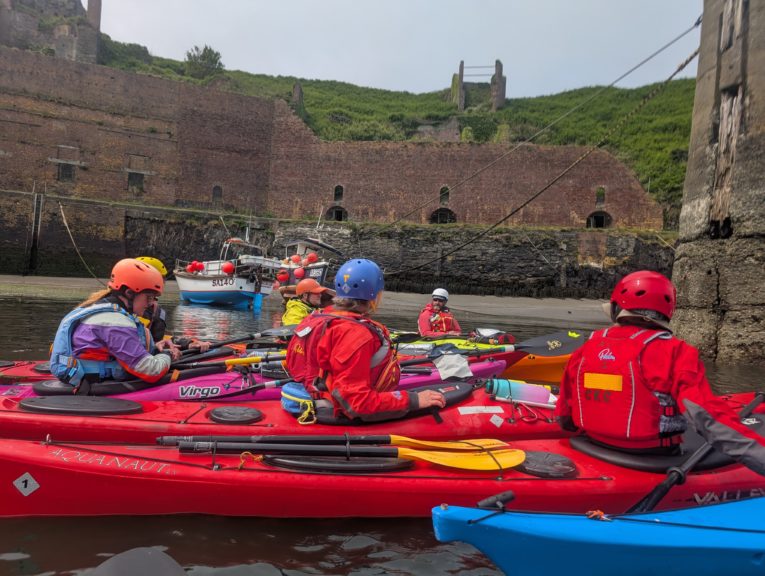
Claire and Fiona organised a fantastic coached club trip to Pembrokeshire in June, guided by Sea Kayak Guides.
A group of us met at the arches at 9:30 on Friday morning to load up boats and gear before setting off to Wales — immediately or later in the day. We’d made different arrangements for accommodation, with five staying in cottages nearby and seven staying at the Llanungar campsite where the guides were based. Some of us who were early enough walked in to Solva for dinner or a drink at “Hats and Barrels”. There was loud overnight rain on our tents, but the weather cleared by the morning.
On Saturday morning we met the guides — Martin, Ben and Pablo, whom we’d met the previous year — at the campsite and planned trips for the day. We all said what we were hoping to get from the weekend and then the guides went over the essentials of planning: looking at weather, swell, tides and current and anticipating what conditions would be like in different places. We’d all been watching the weather forecast and were glad to see that the forecast high winds were now not expected until Sunday, but there were still strong westerly winds and a significant swell from the west.
Briefing on the water in Porthgain harbour
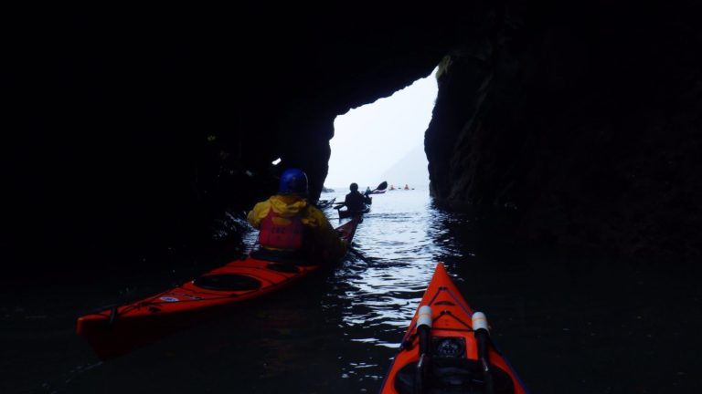
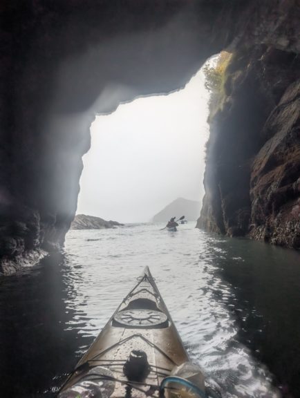
In the end we split into two groups — seven looking for more challenging conditions deciding to go to Porthgain with Ben and Pablo, and five going on to Abercastle with Martin where conditions should be calmer. We sorted boats out and drove off to our respective launch points before preparing to get on the water. In Porthgain, there was plenty of parking and we launched to the side of a boat ramp that was slippery because of the low tide. On the water Ben encouraged us to observe the water texture and read what the conditions were further out –- were they what we’d anticipated when planning?
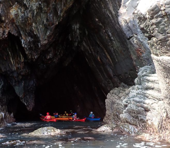
Exploring a cave.
We paddled out of the harbour feeling the conditions build and went through some channels, discussing where the safe places were. Arriving at a beach by lunchtime, we made surf landings, with several of us capsizing on the way in. Ben went over our journey, describing the back-eddies that we’d observed in the journey. When we returned to Porthgain, we did some rescues and Ben demonstrated a scoop rescue.
Ben explaining the eddies along our route.
In the evening all twelve of us had dinner in the Cambrian Arms before dispersing to our accommodation.
On Sunday we again convened at Llanungar at 9am and discussed options for the stronger winds. We decided to stay in two groups, but all head to the North coast in the shelter of Dinas head, launching from Cwm yr Eglwys. Two fishing yaks launched before us, and as we launched we saw that one had capsized. Ben went over to assist and was able to get the swimmer back on his kayak using a stirrup supported on a paddle.
We observed the conditions in the bay and further out, and saw how the sea state increased as we headed out. We proceeded North along the coast finding the eddies and watching dolphins leaping out of the waves. Coming to a headland where the waves were getting stronger, the group sheltered in an eddy and three of us sallied out around the headland to see what the conditions were like. Finding another safe point around the corner, we returned to the group and brought them round, then practiced going out to the stronger conditions and returning to the eddy, after Ben had gone over how to turn up and downwind.
Kayakers being hidden behind the swell.
Some of us did rocky landings for a toilet break and we then ate lunch in our boats before running downwind to rejoin the other group at a beach beyond Cwm yr Eglwys. Martin, Ben and Pablo demonstrated towing techniques and stirrup rescues before we all went on the water to practice towing, stirrup and scoop rescues.
Practicing emptying a flooded compartment on the water.
Some of us headed straight back to London that night, while others stayed and had dinner in the Cambrian Arms before staying overnight to come back on Monday. We had a great weekend, with lovely sunny weather despite the strong winds. We saw many birds (among them oystercatchers, razorbills and one puffin); several seals and had got to watch the dolphins for several minutes. We all learned or practiced essential skills and enjoyed facing the challenge of more moderate water than we usually get to see.
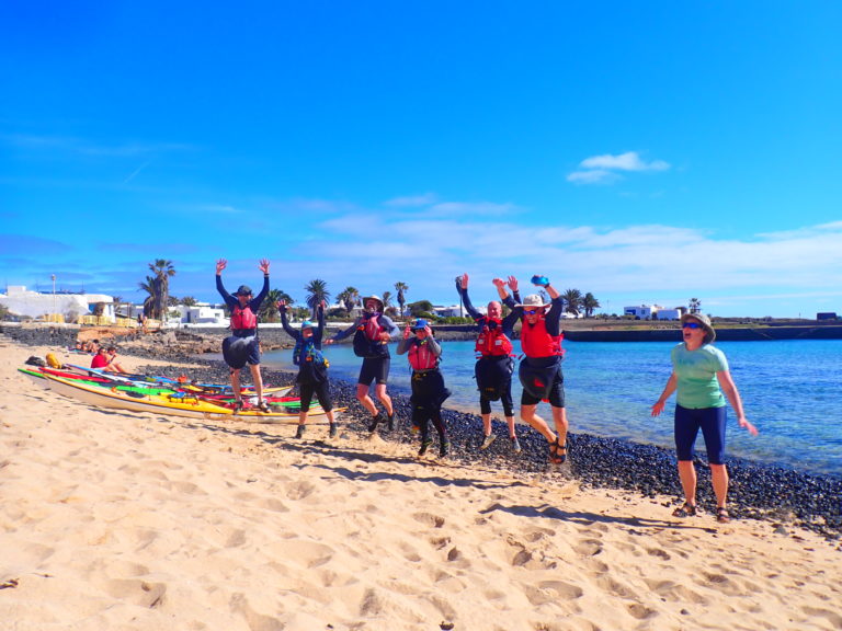
This was to be our first Isle of Wight (IOW) Solent crossing this year and the first time ever for four of our group. We all arrived in good time on Sunday morning and were able to get changed, unload the boats and kit ready for a safety briefing on the beach.
Getting ready to launch on the mainland
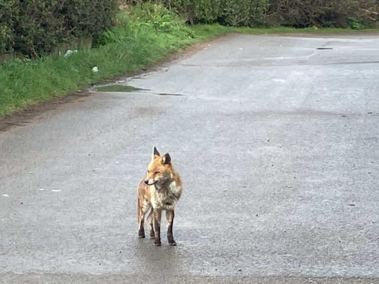
While getting changed a very relaxed fox observed our comings and goings. On previous trips we’d seen a fox walking along the beach, so maybe it was the same one. No cows on the beach though.
Preparations overseen by the local wildlife
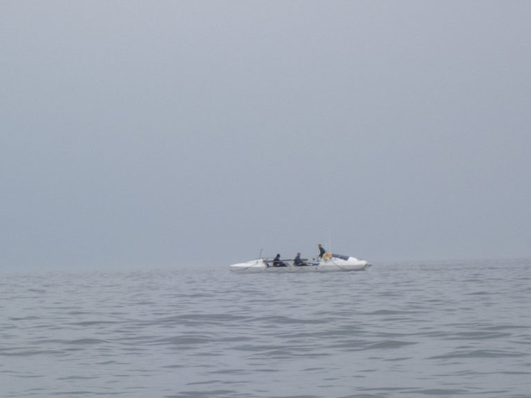
After the safety briefing, we were on the water at 10 am. There were very light winds (F1), very light flows and no waves or swell. It was quite misty, so visibility was not that great. Our first destination was to paddle out to Horse Sand Fort. On the way we saw in the distance an unmarked ocean rowing boat going towards Bracklesham with three people on board. It looked like they were practicing, or at least two of them were.
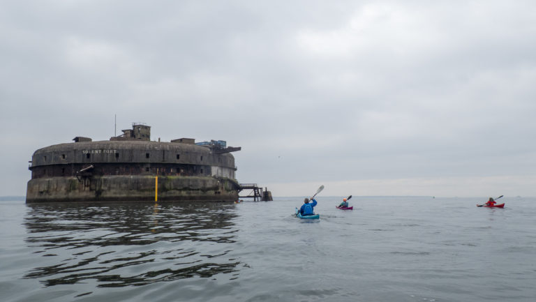
After about an hour we reached Horse Sand Fort. This is one of four Palmerston forts built in the Solent to protect against an invasion by Napoleon. By the time the construction of these was completed, the threat had passed. Nevertheless Horse Sand Fort is impressive up close, being more than 64m in diameter and three storeys high. It boggles the mind as to how they have been built. Apparently during World War II the fort was manned entirely by people who could not swim. We did not see anyone on our visit and although it was sold in 2021 (for £715,000) it looked unrenovated.
Approaching Horse Sand Fort
Flat water around the first of our forts
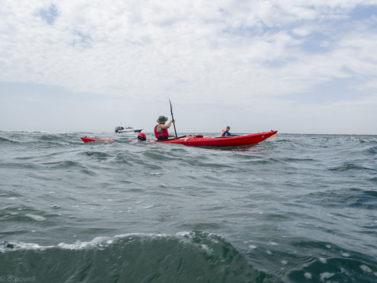
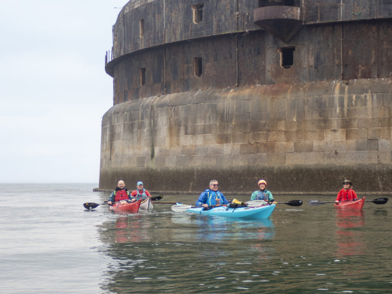
At Horse Sand Fort we waited to cross the shipping channel until two ships had gone passed, one each way. Then it was a sprint across the shipping lane to get out of the way of any more ships that might appear.
Waiting for the shipping channel to clear
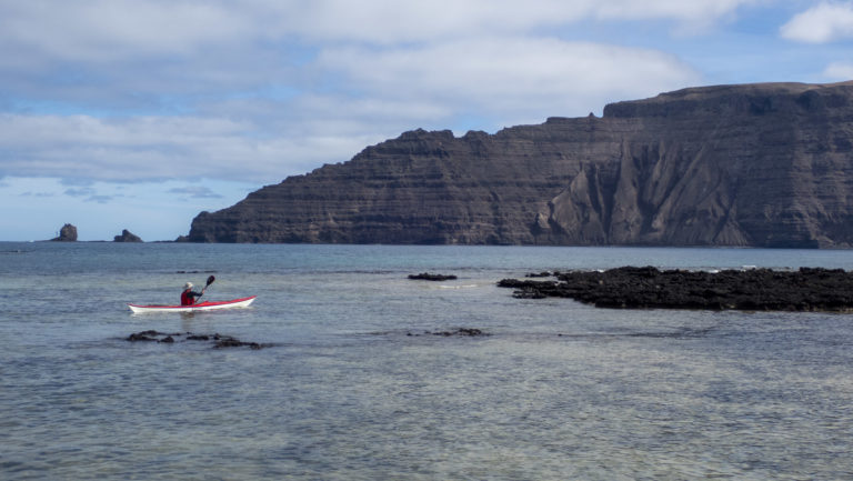
Once across the shipping channel we headed towards St Helens Fort, although initially the sea mist made it difficult to see. St Helens is a smaller fort and much closer to the coast of the Isle of Wight. At the lowest tides of the year, it is possible to walk from Bembridge along the original causeway that was used in its construction.
As we approached the fort we spotted a seal who also seemed to be enjoying itself.
Lunch at Bembridge
After about 2.5 hours in the boat it was time for a stretch and some lunch, so we landed opposite Bembridge on a sand and shingle beach. As forecasted, halfway through lunch, it started to lightly rain and we all put on our cags or storm cags. After an hour the rain stopped and we got back on the water and paddled up the East coast of the Isle of Wight to Seaview. What little wind there had been dropped completely and the sea was almost like a mirror. With the sea mist deadening any sound it was surprisingly peaceful.
From Seaview we paddled over to No Man’s Land Fort (also known as No Man’s Fort) – our third fort for the day – which has been refurbished as a hotel. Then we paddled purposefully across the shipping channel once more. With visibility very poor we had to listen carefully for oncoming ships before committing to our route. The Isle of Wight hovercraft could be heard no matter what though. Luckily there were very few boats on the water for the route back, probably because of the sea mist.
Heading back to the start point
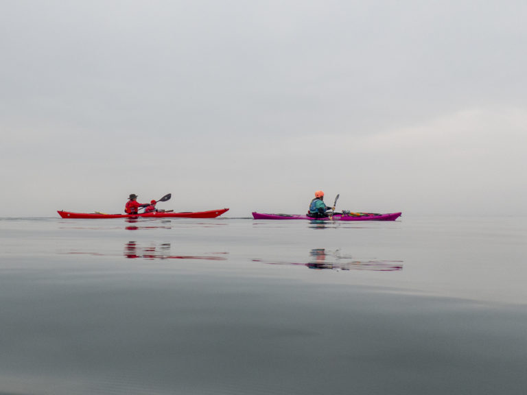
After 26km we arrived back where we started, having experienced some unusually calm paddling conditions for the Solent, with added sea mist for atmosphere.
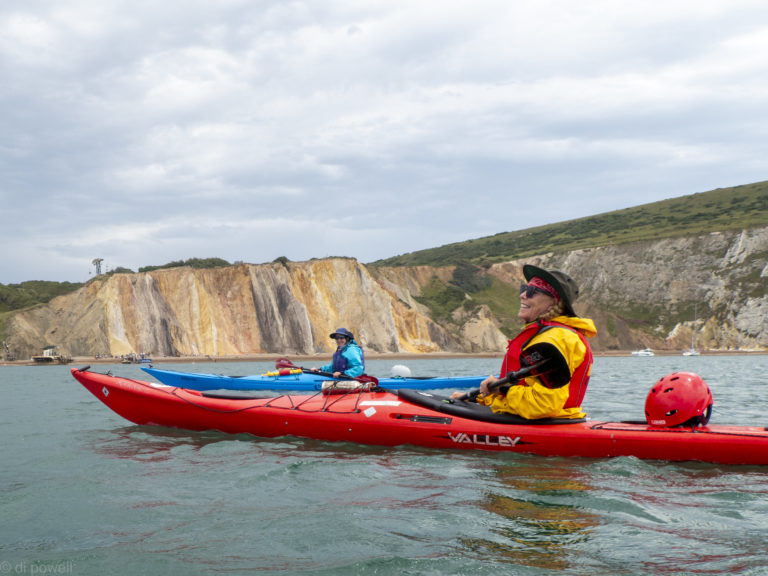
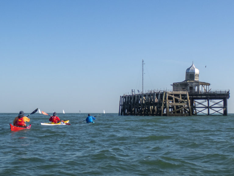
It is early March and it’s time to repeat one of our paddling favourites along the North Kent coast – a trip passed Herne Bay to the Reculver Towers. It is the first proper sea trip for two of our group and the conditions are ideal as we prepare on the shingle beach, with sunshine and small, frequent waves. It is also the first sea trip for Phil’s new boat. So an auspicious paddle for everyone.
Herne Bay Pier Landing Stage
The first stop is the Herne Bay Pier Landing Stage. This is the last remaining part of the pier that was originally used by paddle steamers to bring people to Herne Bay. It’s a long way off shore and understandable why it was the second longest in the country.
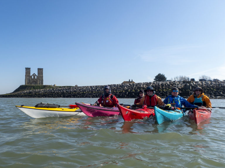
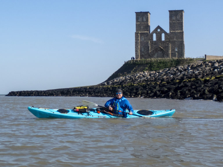
Rafting up before landing at Reculver
From the Landing Stage we headed to the two towers at Reculver, which could be seen in the distance. With the tide pushing us Eastwards and the wind coming from the South-East, we got some fun waves as the wind against the tide created small waves. A perfect introduction to sea paddling and a good way to christen a new boat.
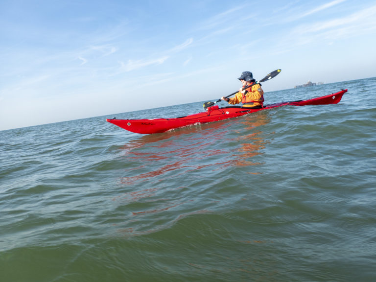
After lunch under the two towers the tide had changed direction, so we were now getting assistance from the wind behind us as well as the tidal stream. That gave us quite a few small surfable waves, so we zig zagged our way back to the launch point, surfing towards land then paddling back out. Even those with no prior surfing experience got the hang of it quickly.
First time kayak surfing
Eventually we arrived back where we had started. After landing and a celebratory photo, it was to the beer garden of the local pub to get some later afternoon sun and re-hydrate. Another excellent day on the water!
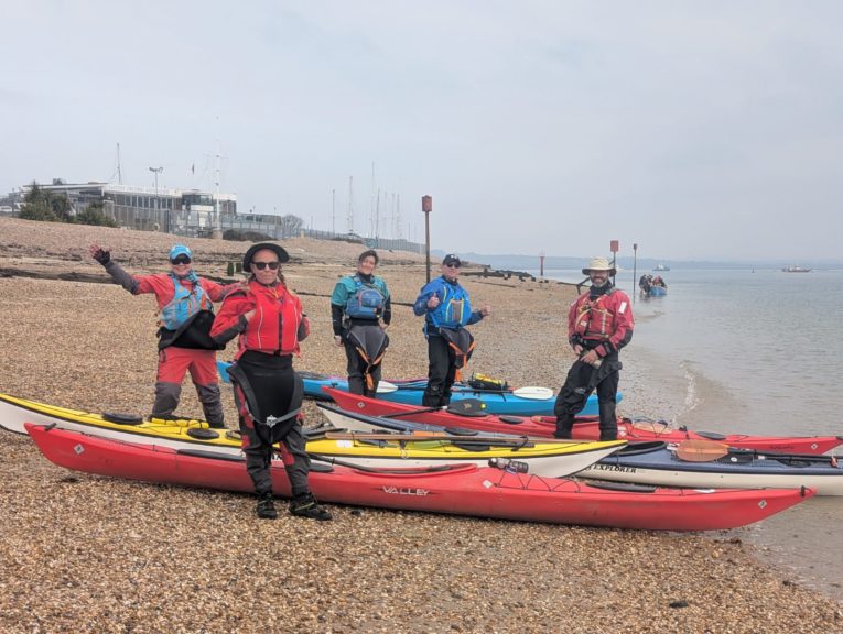
Sunny day and calm conditions for the St David’s Day Bealieu River trip
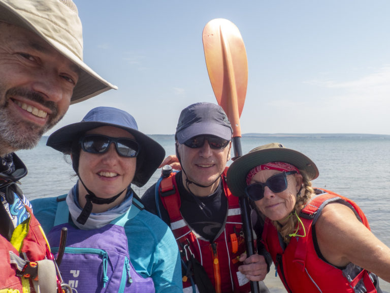
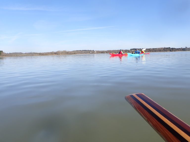
Our Saint David’s Day started early leaving from London and surrounds to arrive by 9 am at the Beach Car Park in Lepe Country Park by the Solent for what turned out to be a fun trip up the Beaulieu River. Marie Laure, Glen and myself (Mike C) were abled marshalled by trip leader Liza and were on the sea before 10 am.
Mostly quiet on the river
Passing some fancy sea craft
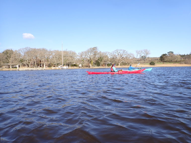
From a calm Solent, we ventured up a mostly quiet Beaulieu enjoying the pastoral sights of the riverside including traditional country homes, some fairly fancy sea craft and plenty of bird life. After completing our journey upstream, we turned around and landed just after midday to enjoy our packed lunches.
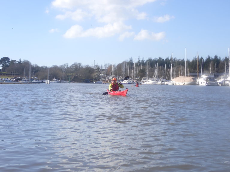
Returning after a good days’ paddle
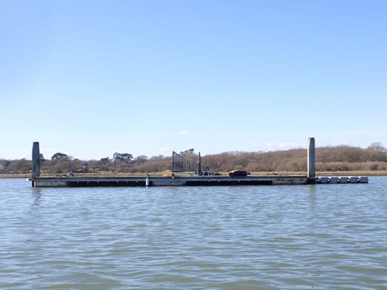
On the return trip we were to encounter the highlight of our day with two well grown seal pups on a pontoon patiently waiting for their mother to return with their lunch!
Seals lolling about on the pontoon
After crossing back into the Solent, we landed just after 3 pm. A big thank to Liza for a very enjoyable trip!
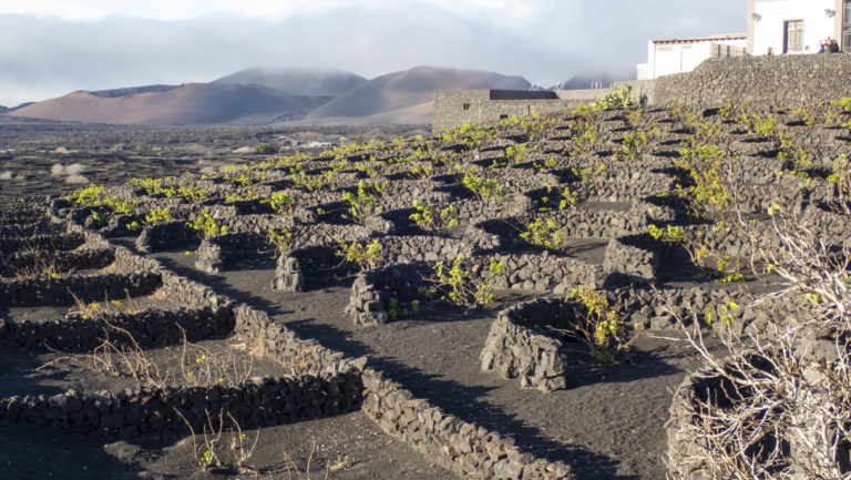
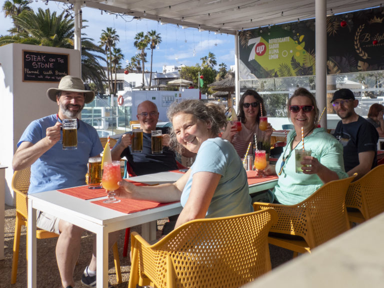
We’re sitting in the courtyard of a vineyard enjoying a glass of local wine. This is not the green and rolling hills that we came across on our summer Essex trip; it is the volcanic island of Lanzarote. Here the vines are planted in the black sand of volcanic ash and each vine is protected by an individual wall around it. It looks like no other vineyard I’ve seen.
Lanzarote Vineyard
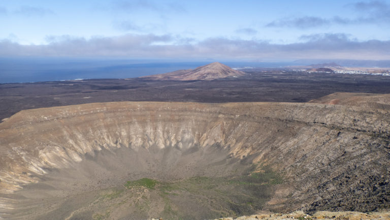
Caldera Blanca – one of many volcanoes on the island
There are seven of us and we’ve just come back from walking up to and along the crater rim of an extinct volcano. We’re having a late lunch of tapas, beer, wine and juice before some of us head back to the UK and others go in search of the lava tubes. The grey skies, damp and cold of the UK are a distant memory and thoughts turn to the previous four days sea kayaking with Sea Kayaking Lanzarote (also known as Juan) in 23C temperatures.
We’ve had four days of journeys along the East Coast of the island mixed with skills training in the warm waters of Lanzarote. The East coast is protected from the prevailing wind and generally is always between F3-F5, meaning there is almost always somewhere to paddle.
Rich had initially gone to the wrong airport so was quite lucky to be on the trip!
Paella to start the trip
Day 1 – Thursday
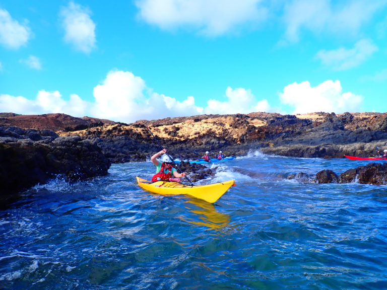
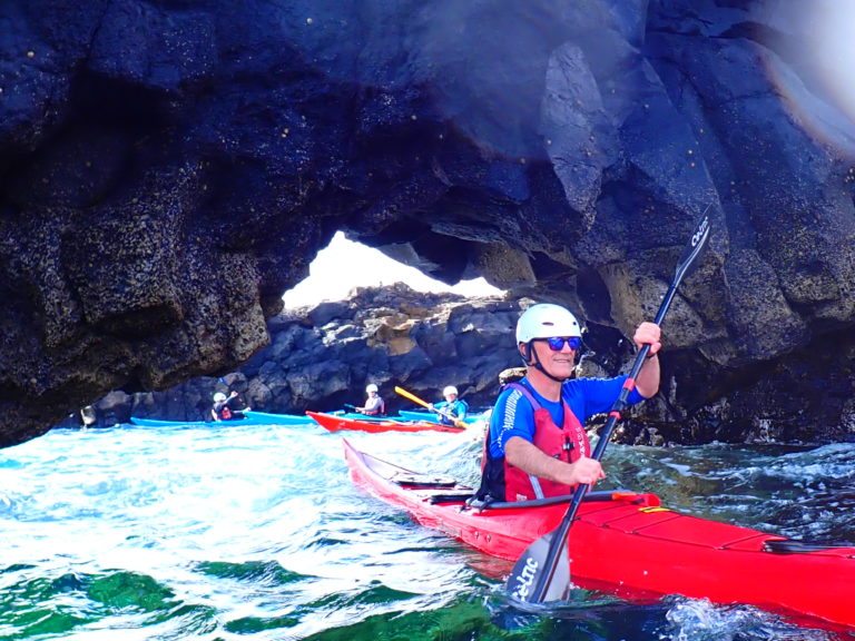
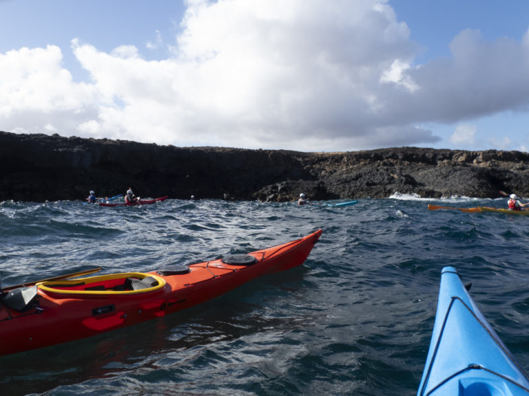
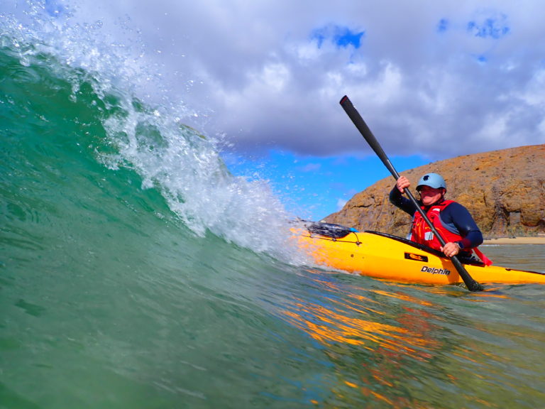
We start our first day by rock hopping along the coast for 6km. There are caves, arches and gaps between rocks that are perfect for kayaks. Also there are lots of crabs running along the rocks as we get close, some small and bigger red ones, indicating adults. Some jump in the water or surprisingly jump gaps between rocks.
Arch near Los Cocoteros
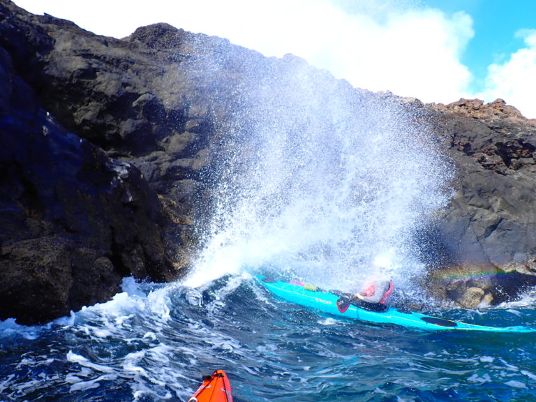
While playing at a blowhole, Liza loses her camera into the sea but as it is lunchtime and there is no time to search for it.
Blowhole!
After lunch we paddle back to where Liza lost her camera and put Liza into the water as a swimmer to search for it. The area now has significantly more clapotis, although the waves are only 0.4m. Unfortunately in getting ready to get in, Liza’s day hatch cover also fell in the sea and sank. With Liza diving down to look for the camera, Rich rolls to look for the hatch cover, spots it then dives down about 5m to recover the hatch cover! Meanwhile Liza has spotted her camera. Rich swims over and again dives down and is able to recover the camera too. Meanwhile Claire is practicing her edging in conditions and capsizes. With two people in the water, two of us on short tows with the empty boats, and Andrew doing an assisted rescue with Claire, it is an exciting 10 minutes. All is good as we put everyone back in their boats and continue on our way back. Some dolphins pass us going the other way.
Diving to find hatch covers and cameras
Day 2 – Friday
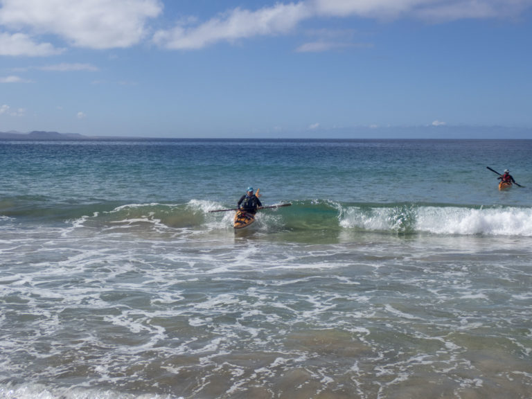
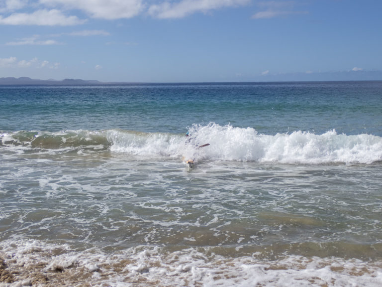
Today we’re at Papagayo practicing skills in the bay, including rescues, towing and surfing. At a sandy beach we practice some surfing: the waves are flat until just before the beach then quite strong. We practice landing and quickly getting out on the sea side to make sure boat does not break your legs if it gets caught by the next wave.
Small but strong waves form very close to the beach
At the next beach the waves are bigger (0.5m) and it is a nudist beach. Juan advises us to go in backwards so we can see the waves coming and make sure we go in on the back of the wave. It doesn’t always go to plan, but after a few waves we start to get the hang of it.
During the day Geoff has lost his flip flops in the surf so after we have finished for the day goes to a local supermarket to get new ones but gets thrown out for not having shoes on! Luckily he is able to get some at the shops in Playa Blanca that evening.
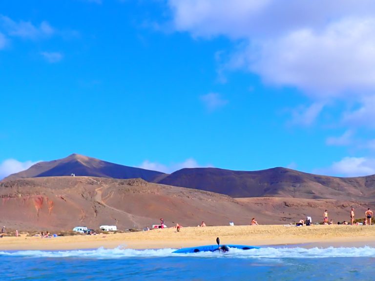
Day 3 – Saturday
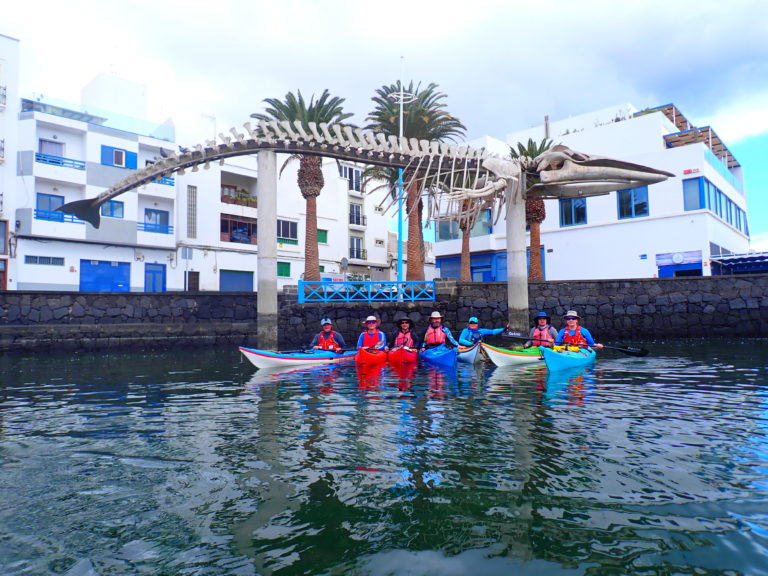
After all the excitement of the past two days, today’s paddle is a shorter distance to the Arrecife town centre through multiple lagoons. We have a lunch stop at a tapas restaurant on the terrace, while a busker murders all manner of popular music in the background. This is followed by ice cream and the newly discovered café con leche leche largo (condensed milk coffee).
Lunch stop at Arrecife harbour
After lunch we go further out to get some waves and practice rolling, rescues and balancing while sitting on the back deck in conditions.
Balancing while sitting on the back deck
Day 4 – Sunday
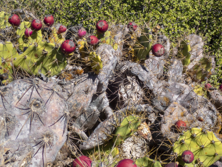
For our last paddling day we are paddling over to an island off the North West coast of Lanzarote, La Graciosa. Almost all of us are in composite NDK boats and make easy work of the clapotic conditions under the cliffs near Orthza, before crossing over to the island. After landing at a small harbour, Juan shows us how to eat a prickly pear by picking the red fruit, using a spine to remove the very fine needles, removing the top, then squeezing the red pulp and pips out. It is very difficult to eat as pips are most of it, plus there are very fine needles still in place. That means either you get needles in your fingers or tongue, or both.
Prickly pear – beware!
We experienced lower gravity on La Graciosa
After lunch we cross the 2nm back to the main island and spend some time watching the huge surf break at Punta Fariones on the very top of Lanzarote.
Crossing to Lanzarote
Punta Fariones
To celebrate our successful trip to Lanzarote we have a homecooked meal of haggis (especially imported from Scotland for the occasion), mash potatoes and squash, followed by papaya and lime, with marzipan slabs and liquorice sticks. A perfect ending to a perfect way to spend a few days of the British winter.