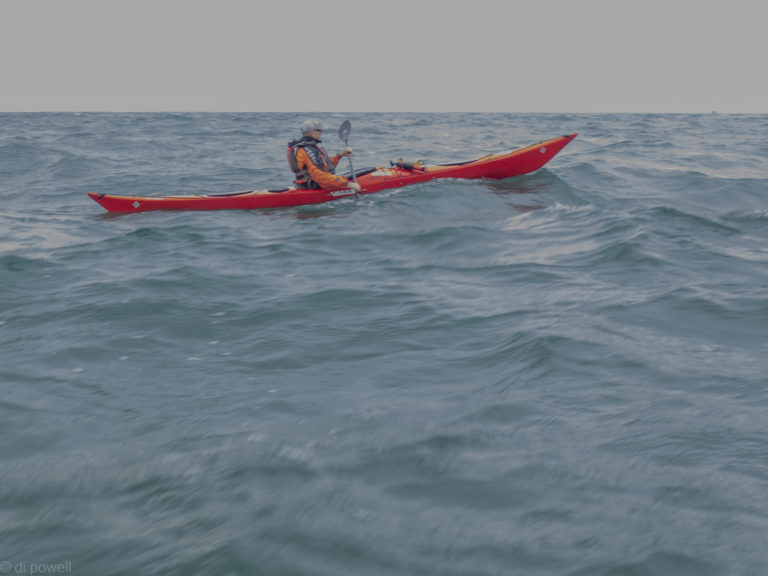
We haven’t been able to paddle to Beachy Head for the last 2 years as the weather and tides never worked for us. But this year we managed to get to see the lighthouse twice in 6 weeks!
Although the wind was a bit gusty while we were getting ready at Eastbourne, it was to get lighter throughout the day. Whereas on the previous trip we were dodging rain clouds, this time getting sunburnt was more of a concern.
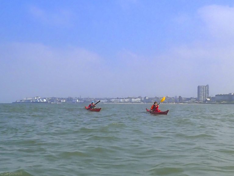
Blue skies around Beachy Head
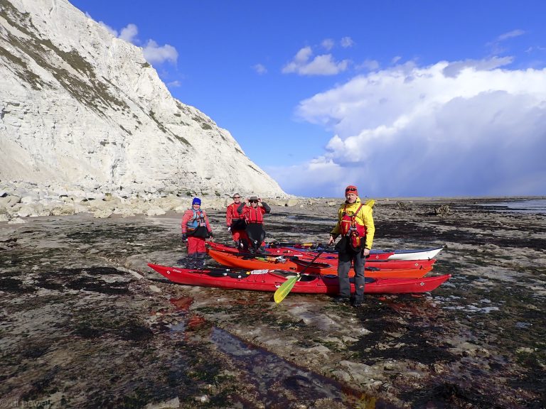
Paddling passed the lighthouse we were able to surf some small waves, pushing us on towards Birling Gap. Birling Gap had suffered a landslide of part of the cliff around the steps leading to the beach. We had hoped that we would have the beach to ourselves, but the steps had re-opened 2 days previously letting the general public back onto the beach. Still, it was quieter than usual. For lunch we kept well away from the cliff, just in case there was another rockfall.
Birling Gap
On the way we had seen one really big seal, but on the way back we saw a large group of 8. After paddling back to the launch point we continued onto have a look at the golden domes on the pier, before landing. An enjoyable day on the sea!
It’s 11:00am and I’m already part way through my first crab roll of the weekend for brunch. Today is a travel day as we’re on the Northumberland coast and it takes about 6 hours to drive up from Kew Bridge. There are 8 of us paddling plus a cake maker and support dog. Over the course of the day everyone arrives at the Airbnb, which overlooks the massive sandy Budle Bay, near Bamburgh, in the distance. Claire is not able to come because she’s hurt her back but has sent up a vegetable chilli for our Friday dinner!
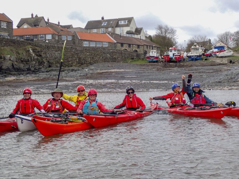
Craster Harbour
On Saturday we’re all excited to launch at Craster Harbour, where we have to pay £5 a boat to launch, although Liza haggles and is able to get us a group rate. Once we are out of the harbour we stay close to land in the wind shadow of the land, passed Dunstanburgh Castle under some ominous looking skies.
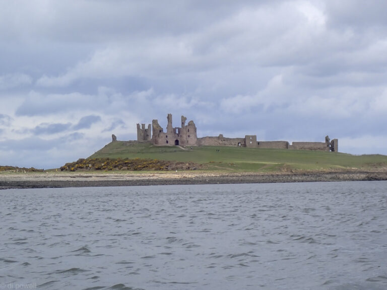
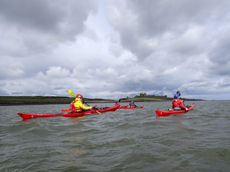
Dunstanburgh Castle
Under grey skies around Dunstanburgh Castle
Some of the points forced us to go further out away from the land and here the gusts got stronger. Crossing Beadnell Bay was initially a challenge, although it got easier as we got more shelter from the dunes. Luckily we had set up a shuttle so there was no need to paddle back in the strong gusts.
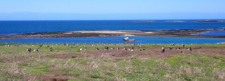
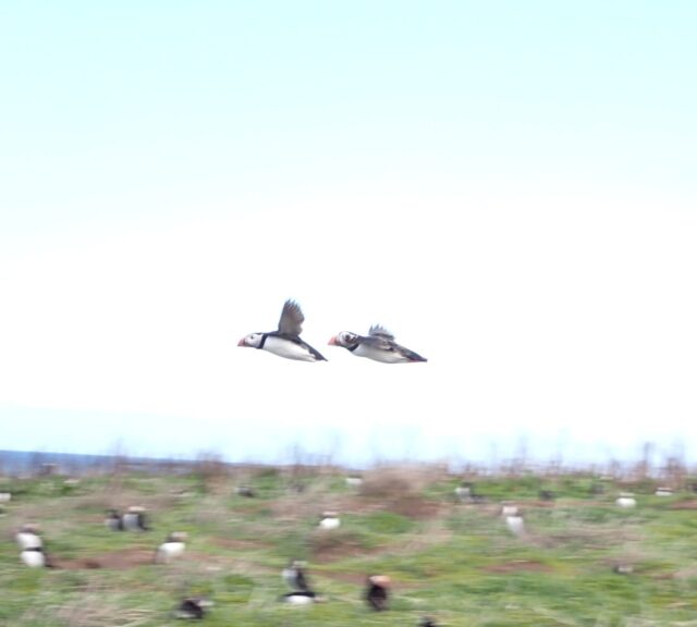
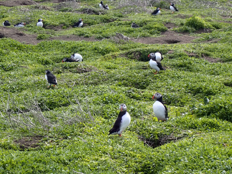
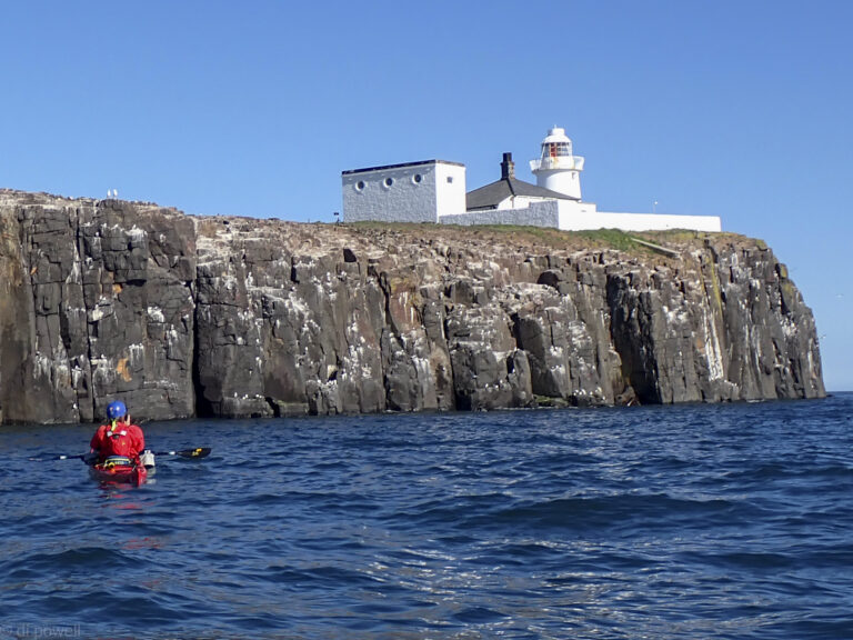
On Saturday we all assembled on the beach near Seahouses to launch for Inner Farne. Inner Farne is a National Trust island with a large puffin population, although we had been told on Friday that there were only 2 puffins on the island. Paddling over to Inner Farne we saw both of them! And then a lot more on the water and on top of the island.
Puffins on Inner Farne
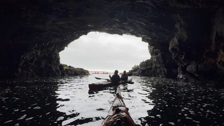
As we had a tidal gate, we only stayed about an hour before paddling to Outer Farne, via Knoxes Reef which provided plenty of waves.
Knoxes Reef
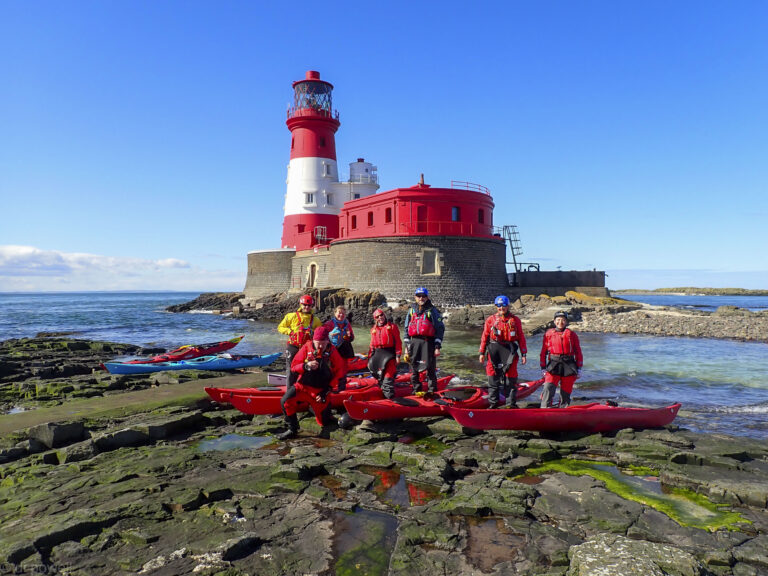
Arriving at Craford’s Gut we had a tough 50m paddle against the flow to get to the Longstone lighthouse, but everyone made it.
Longstone Lighthouse
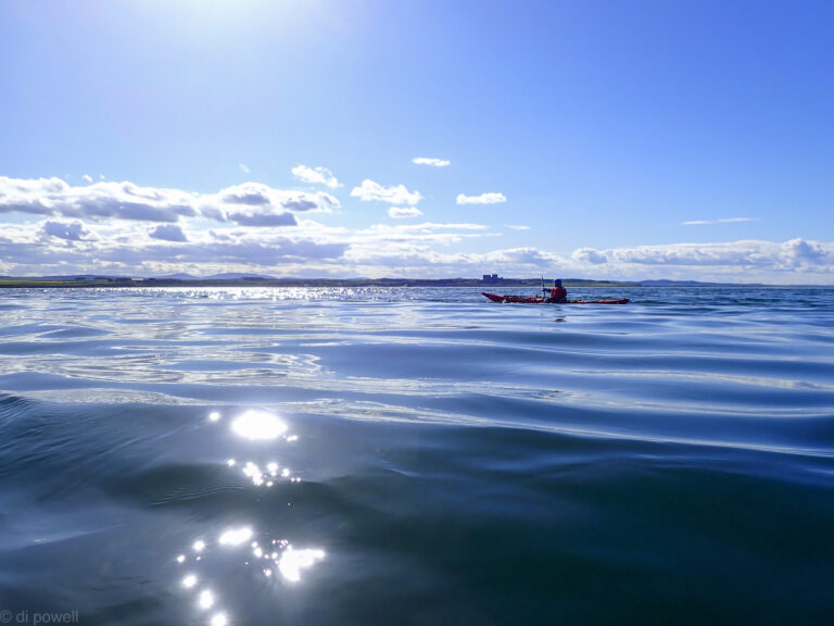
Then it was back across glassy seas to our launchpoint, via the cliffs of Inner Farne.
A very enjoyable weekend paddling with good company, good cake, interesting paddling and lots of birdlife. We only wish it wasn’t so far away from us!
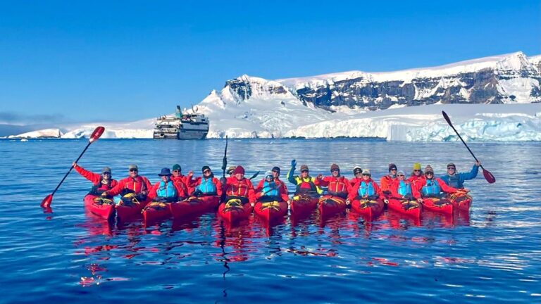
When I signed up to join an expedition cruise to Antarctica I ticked the box labelled ‘kayaking’. I had previously done what I thought was kayaking on the Loire in France and a single trip to look at Sea Otters in Monterey Bay. It turned out that this wasn’t nearly enough experience to qualify. I had about 9 months to pick up the skills. This was a little daunting for an older man based in central London – somewhat out of my comfort zone.
I started my education in the unlikely setting of a swimming pool – under the auspices of the Battersea Canoe Club in Clapham Leisure Centre. A good choice. The instructors were patient and calm and after six sessions I felt confident getting in and out of the boats and what to do if I turned over. But I realised there was quite a difference between the small water polo kayaks and full size sea kayaks – so I joined the Chelsea Kayak Club. My previous experience allowed me to gain my Discover award reasonably quickly (thank you David P.) and then consolidate by taking part in a few evening paddles up and down the river.
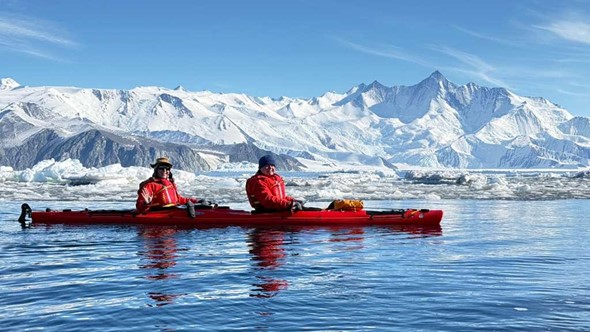
Kayaking in Antarctica is a step up again. The boats were double kayaks with a rudder operated by the rear paddler. They felt a little more stable than the single kayaks and it was good to have a ‘buddy’ in the boat with you. The kit was another matter. To stay warm you needed two thermal layers and a down jacket. You then had to worm your way into a dry suit (tight rubber gaskets around arms and neck), and fit a life jacket over the top. One felt like a Michelin Man. A neck gaiter and beanie hat would keep you protected from winds. Gloves I found were less necessary, the pogies being surprisingly effective at keeping your hands warm.
We were put through our paces at a sub – Antarctic island called Enderby Island. A gentle paddle around cliffs of basalt pillars with the odd cave. No ice, just a few fur seals for company.
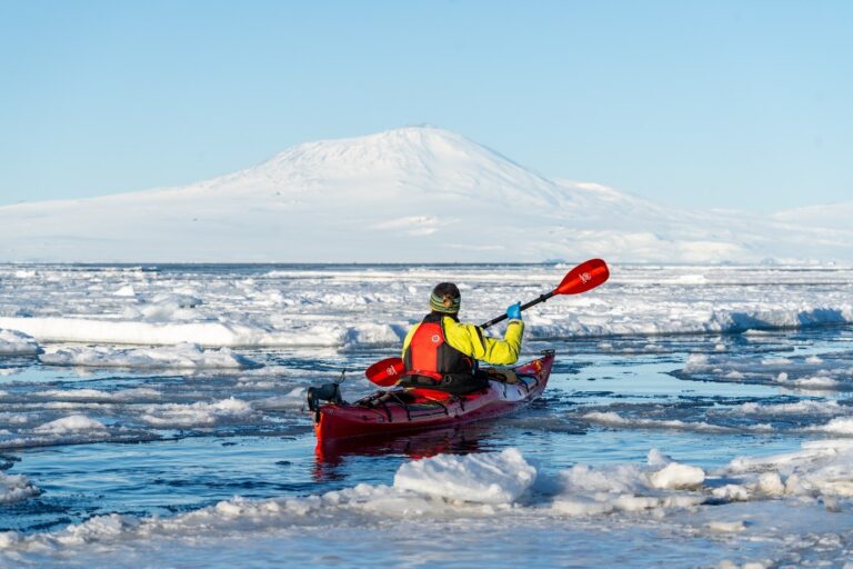
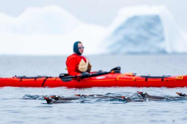
We proceeded down to Antarctica proper with paddles at Cape Hallet and McMurdo Sound. Here we encountered ice in its many forms. Grease ice makes the sea soupy – like paddling through treacle. Brash ice – small, floating ice fragments that need careful navigation; bumping into a small block of ice can stop your kayak in its tracks. Nilas ice, where the ice has formed into thin sheets on the surface. Your kayak will just force them to slide over one another. And then Pancake ice, circular dishes of ice that you can hopefully force apart and find a way through.
The paddle at Cape Hallet was extraordinary. Bright sunshine and the grease ice damped down any choppiness, just leaving a long wavelength swell where you would drop into an icy world in the troughs. The brash ice was all sparkly and the snow covered mountain scenery breathtaking.
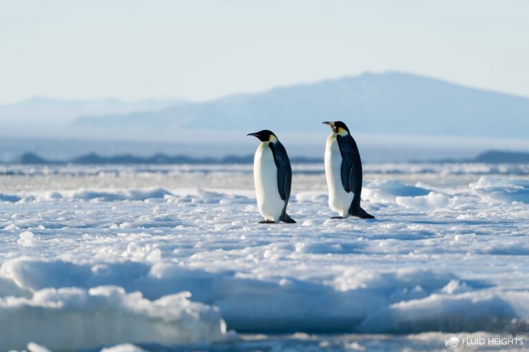
In the more southerly McMurdo the temperature was lower and the ice was much more intimidating. Large flat ice floes with narrow leads in between, all underneath the smoking volcano Mount Erebus. We did have a close encounter with some stately Emperor Penguins on the flat floes.
Our route then took us along the Ross Ice Shelf and beyond, to a part of the continent known as the peninsula. This is an offshoot of the main land mass and largely above the Antarctic Circle.
On a foggy morning we paddled around a Ukrainian base on the Argentine Islands. Visits to bases are no longer allowed (post covid) and so we had to forego the home distilled vodka that the Ukrainians normally serve to visitors. Rather oddly our only interaction with the scientists was one of them appearing from a sauna and promptly mooning at our flotilla! At one point we were asked to raft up as an inquisitive, three metre Leopard Seal buzzed around our kayaks. Just after being picked up in our Zodiac we witnessed its true nature in full tooth and claw – the seal caught a young Gentoo Penguin and hurled it back and forth in order to detach the feathers and skin from the body. Bloody and chilling, but fascinating.
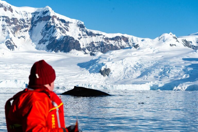
Our final paddle was in the beautiful surroundings of Founier Bay on Anvers Island. The weather was perfect and the bay turned out to be full of Humpback Whales. They were actively feeding, so constantly sounding and returning to the surface with noisy blows – right in front of our kayaks. An afternoon that none of us wanted to stop.
There are many wonderful things to experience in Antarctica – the scenery, the wildlife, the history (we visited both Shackleton’s Nimrod hut and Scott’s Terra Nova hut, still with their very British stores of Huntley and Palmer’s biscuits and Colman’s mustard!) – but the kayaking gave you a whole other perspective, sneaking up on sleeping seals, being visited by interested penguins and experiencing the full majesty of Cetaceans.
A wonderful and memorable trip for which I owe many thanks to the Chelsea Kayak Club. I would wholeheartedly encourage anybody thinking of going to Antarctica to tick that kayaking box!
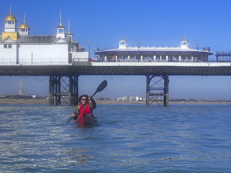
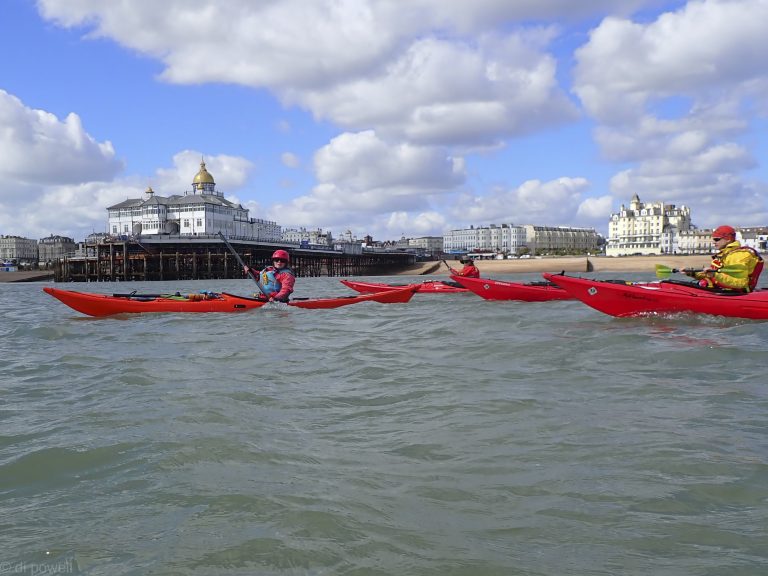
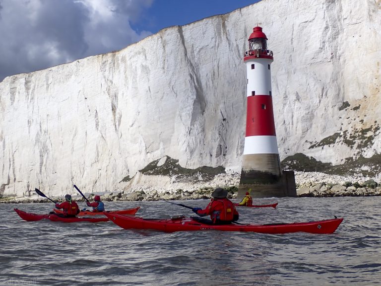
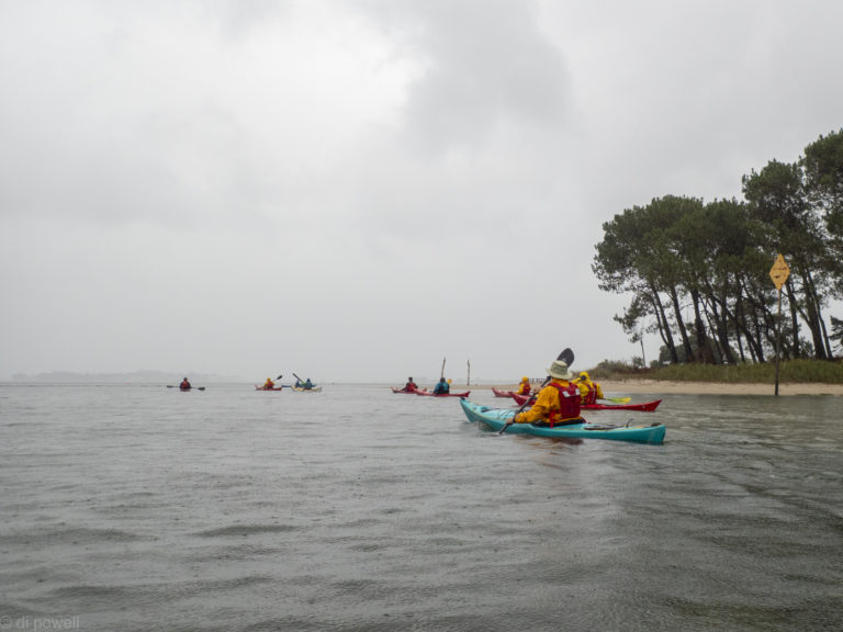
An early start meant that we were on the beach at Eastbourne at 10:30am, having coffee and croissants and sausage baps outside the local café next to our launch point. After a short safety briefing on the beach, we launched from the shingle beach into absolutely no waves.
Fantastic conditions to launch and not what was expected
That was a surprise as the weather forecast had been very bad, even up to the time we arrived. Wind was forecast to be NW F4 with F5 gusts and 0.7m waves every 5s. It really was about F2 with F3 gusts, with very small waves. However, we knew from previous experience that a NW wind meant that the Eastbourne side of Beachy Head was sheltered and we would experience stronger winds around the headland.
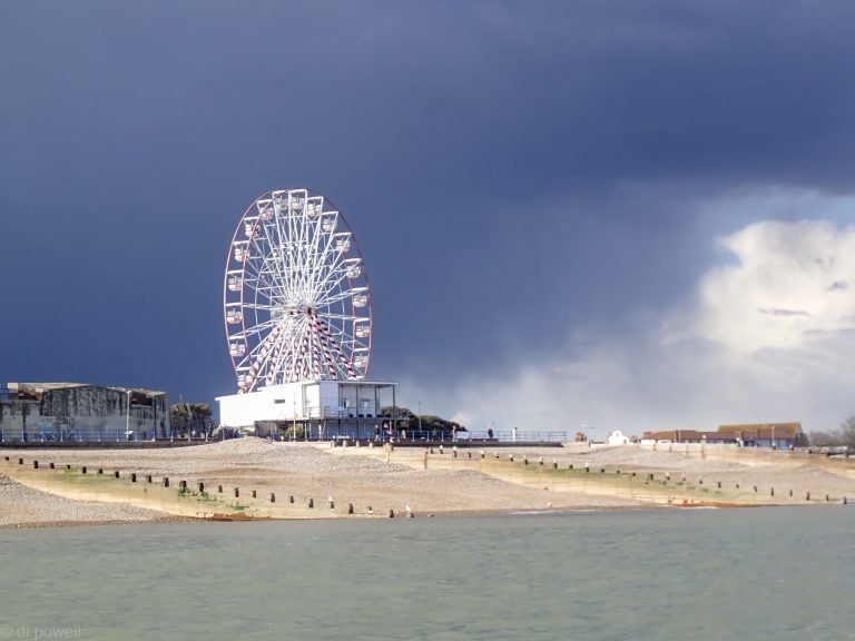
We had both the sun and the flow with us, so we zipped passed the Eastbourne Pier with its golden domes.
Eastbourne Pier
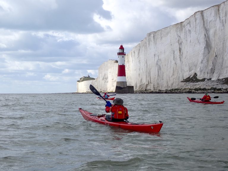
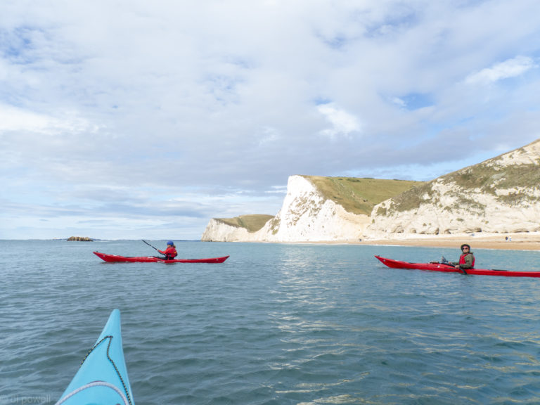
A short stop on one of the beaches exposed at low water to correct some footpegs and we were off around the reef at the headland. Passing the reef, two seals accompanied us with one following us to the lighthouse.
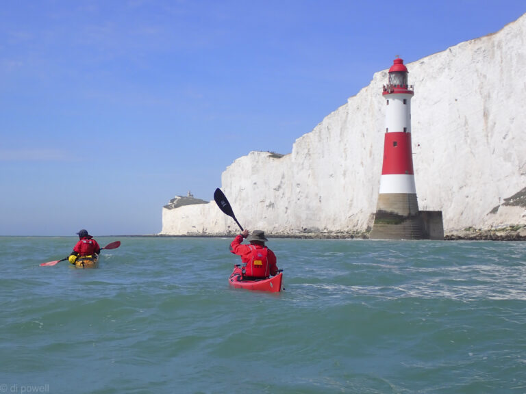
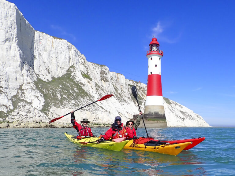
The lighthouse itself is on the sea with huge white cliffs as backing. At Beachy Head the fast moving clouds gave a searchlight effect to the cliff face, as the sun alternate shone through and was blocked by the next cloud.
Beachy Head Lighthouse
The wind also had picked up as anticipated and although we paddled about 3km into the wind, our pace started to drop so that by the time we reached Belle Tout (the second lighthouse) we really weren’t making much progress.
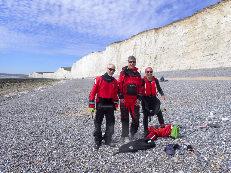
Liza, our leader, decided to cut our losses and we headed for lunch at one of small beaches under the cliffs out of the wind, that were exposed at low water.
Sun and clouds at Falling Sands
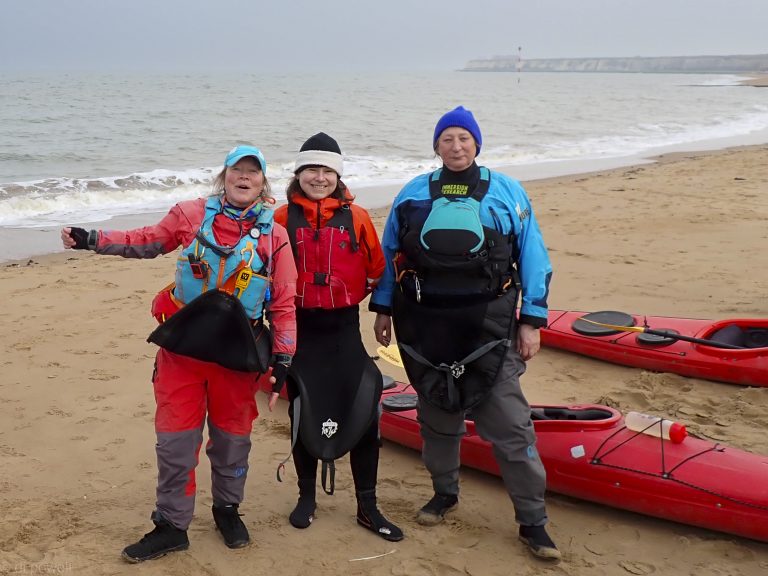
After lunch we headed back to the launch point with the increasing flow. The clouds also thickened and we saw in some places that it looked like the clouds came down to the sea.
As we passed Eastbourne pier the clouds in the distance turned very black. As we started to load the boats on the cars, it started to snow!
A lovely day on the sea at Margate. We parked up at Hodges Gap promenade car park at Palm Beach Bay. It’s not the closest to the beach – that one is adjacent but closed by a barrier to vehicles and access is only for jet-skiers with a code. So it adds a little to the walk, but is manageable. There are no toilets here – the nearest we found were at the smart Bowling Club a short walk away – visitors welcome.
Palm Bay Launch
The launch at about 1215 from the beach was straightforward, with just a slight swell to contend with, and keeping clear of the reef to the left. We headed out to catch the flow, keeping a careful eye on a pack of noisy jet-skiers who fortunately moved off pretty quickly and left us in peace.
We headed west with the flow in good conditions, with a light north-easterly breeze and a sunny sky. We paddled past Walpole Bay, Margate Cove, past the Turner Contemporary, searching as we did for the Antony Gormley statue, but he was submerged (the solitary figure becomes visible three hours before low tide). Then past Margate Main Sands, Westbrook Bay, St Mildred’s Bay, Westgate Bay, towards the impressive Reculver Tower and Roman Fort. A deliberate and – may I say – a well-executed roll by David along the way added to the fun.
Hazy afternoon start
We stopped for a packed lunch at Epple Bay, the turning tide revealing an area of sand to land on, which was much preferable to a slipway a bit further along. No facilities in the area though.
Small beach at Epple Bay
Then back the way we came, a lovely smooth run in the sun and the sparkling sea, keeping out from land to catch the flow which picked up as we headed east. It felt we covered the ground faster than on the way out – and we took the time to do some skills practice with Mary coming to the aid of a suddenly poorly David, who was towed by Liza for a few metres before happily recovering Liza demonstrated an impressive self-rescue.
Cliffs near Westgate on Sea
We arrived back at Palm Bay Beach at about 1630 with the tide coming in, shortening a little the walk back to the cars. It was a great day out, and it felt good to brush off the winter cobwebs. Many thanks to Liza for organising it so well.
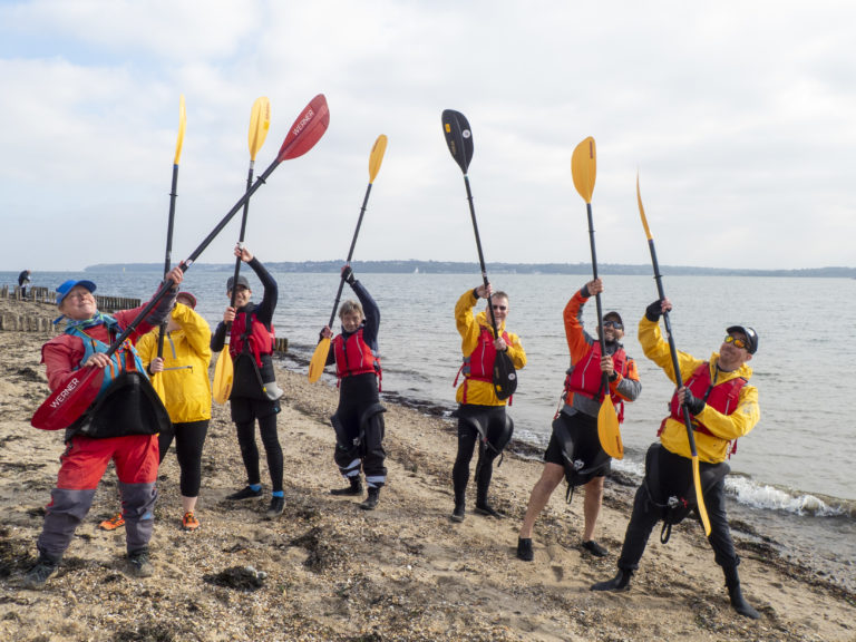
Perfect weather for a first time sea paddle for five members on the Solent trip in October. Liza had us all doing warm up exercises under the watchful eyes of some donkeys in the nearby field, before getting on the water, then it was simply a matter of following the coastline.
First sea trip!
We had perfect conditions: a little cloud, slight winds and small waves, with the tide with us both ways. Once we also thought we saw some cows on the beach, but on getting closer we saw they were New Forest ponies.
After 45 minutes of paddling in a straight line, it was time for the ‘peg game’, seeing how many pegs you could get from each others kayaks. After 10 minutes, Struan was announced as the winner of the prized Double Decker chocolate bar.
Then onto Lepe Country Park for lunch after crossing the Beaulieu River entrance, which became very busy as we approached it. After a break for lunch and tea, there was some messing about with paddles to warm up again. Later one broke in half and had to be replaced but it wasn’t because of this (honest, Rich!).
Then we retraced our route back to the launch point. With the cloudy dissipating and the sun beating down on us, it made for a hot return. Before landing there was the opportunity to practice some cooling off rolls and an anchored tow rescue (so the rescuer and rescuee would not be taken onto the sandbank near to the landing point).
After an efficient boat and kit loading it was time for a chocolate biscuit and photo on the foreshore, before heading back to the Arches through the New Forest, where we saw a family of Gloucester Old Spot pigs and piglets crossing the road!
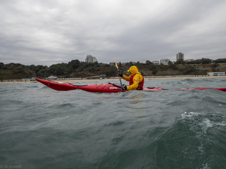
We had one of the shortest paddles in our recent history, but what a trip! Originally we had planned to paddle from Bournemouth Beach around Hengistbury Head. the weather did not look promising on the weather apps and as soon as we were on the beach it was clear that the trip was not going to be feasible. Instead we set our goal to be somewhat less that half the planned distance, staying in Bournemouth Bay.
Launching through surf, we were soon out in the wind and waves. While the waves were moderately large, they were mostly not breaking, meaning that we could enjoy riding up and down them as we followed the bay along.
After about 2km it became clear that the wind was having too much of an effect on the group and we decided to land near to Bournemouth Pier – landing through surf. Breaking out the group shelter to keep the wind from getting us too cold, we decided that the best plan would be to return back to the start point.
Once more we launched through surf, back into the wind and waves, paddling with our head down until we reach our start point. Then another surf landing, making 4 surfing launches and landing all within 4 km!
Although it was a very short trip, it had everything: wind, waves, surf and some lessons for future trips. Amazingly everyone loved the trip, as it had everything condensed into a short distance, making it a very intense trip!
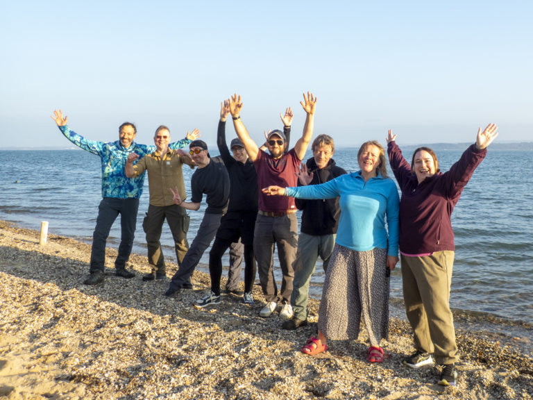
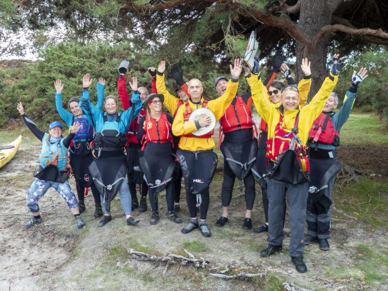
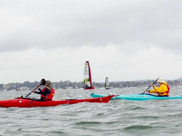
For our annual camping and kayaking weekend on the Jurassic Coast, a dozen of us made our way down to Dorset on Friday afternoon and evening. The weather forecast did not look good at all and it was somewhat doubtful if we would get on the water. After deliberating while at the pub, it was decided that a circuit of Poole Harbour would be the Saturday trip as it was mostly sheltered from the strong winds.
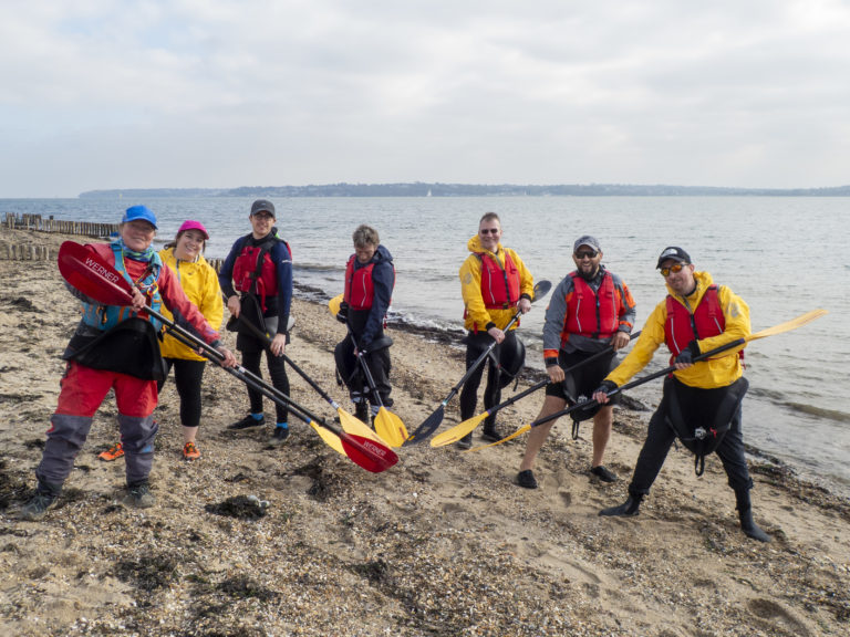
Enthusiastic paddlers ready to launch!
After a safety briefing, Mike taught us a new game to help warm us up (now known as the ‘peg game’). Then we were off to Brownsea Island. As we crossed the Western part of Pool Harbour a large number of racing yachts with hydrofoils (called ‘International Moths’) whizzed passed us at speed.
Hydro-foiling yachts
After a stop on the Arne peninsular, a bird reserve known for a very large numbers of Avocets. Ironically one of our kayaks was also an Avocet, but from Anglesey.
In Ower Bay we stopped for a few minutes to practice some self and assisted rescues, and the occasional roll, before a quick lunch break. As we started after lunch the skies closed in and the wind picked up. Rounding Goathorn Point we got a full blast of the wind from our side at the same time as the rain started. There was nothing to do except put our heads down and paddle back towards our start point without being blown off course.
After lunch the skies closed in
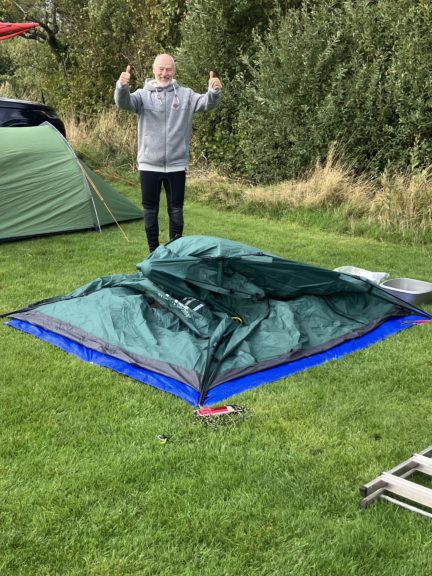
Once back at our lunch point the weather cleared allowing us to get the boats and kit loaded and return to the campsite before getting showered and changed for the evening’s pub trip. However, returning to the campsite we saw that a lot of our tents had been not been spared from the wind. Phil’s tent in particular was completely flat!
After a windy day!
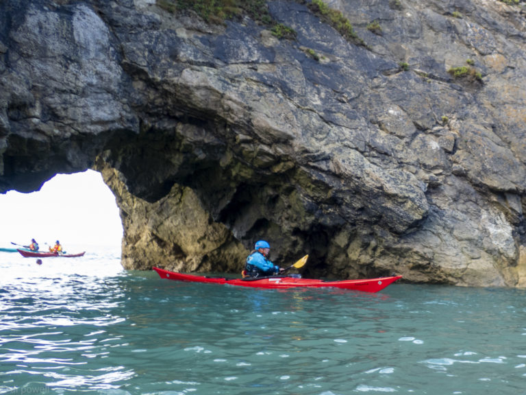
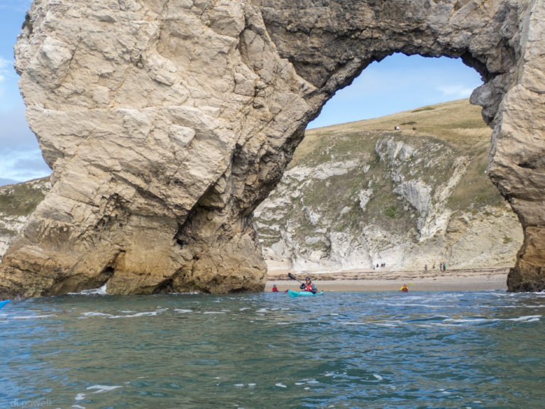
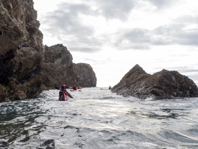
The next day the weather had cleared considerably and we were able to plan to get on the water at Lulworth Cove. That involved consolidating the boats onto a small number of cars to avoid the significant parking fees, and driving down to the shoreline before 10am, two at a time so as have enough room to unload and turn around. Then we were on the water, paddling through some spectacular rock formations and coastline.
Swyre Head
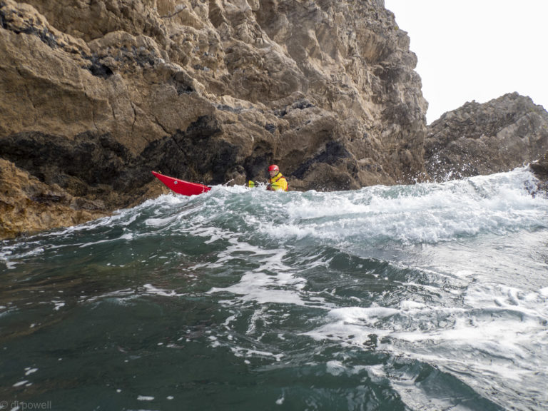
Although the weather had improved we still had to cope with the sea state from the previous day’s storm and that was occasionally challenging.
A break for lunch at Mupe Rocks (quite rocky and not recommended for future trips) made for a short but exciting paddle with lots to see and do.
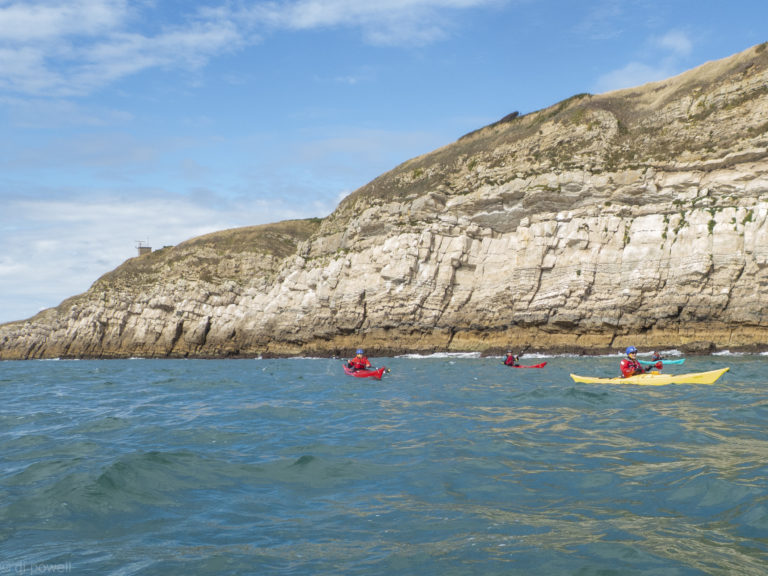
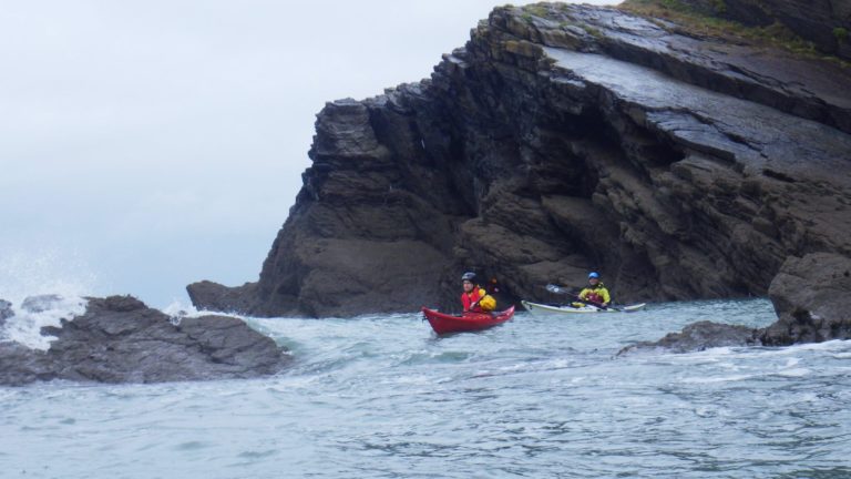
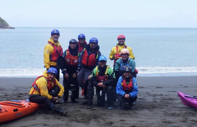
Nestled on the rugged North Devon coast, Ilfracombe is a charming seaside town known for its Victorian architecture, working harbour, and dramatic cliffs. While many visitors come for fish and chips on the quay or to admire Damien Hirst’s Verity statue, seeing this stretch of coastline from the sea is a must.
Sea kayaking around Ilfracombe offers a unique perspective on the area’s natural beauty. Paddling just beyond the harbour walls, you’re quickly immersed in a landscape of hidden coves, sea caves, towering headlands, and abundant wildlife.
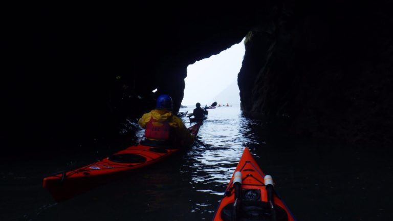
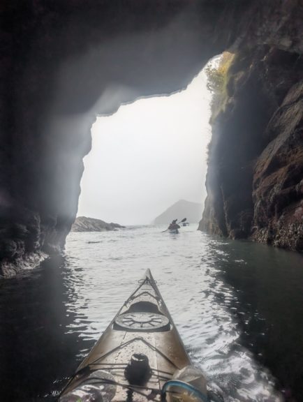
Ilfracombe’s harbour provides a sheltered launch point, making it slightly easier to get on the water even when conditions are a little lively outside the bay. Sunday’s launch certainly challenged all paddlers, but everyone managed to successfully get out and hold position in a sizeable swell. Outside of the harbour you soon enjoy the dramatic cliffs and a chance to spot seabirds nesting on the rock ledges. Hele Bay itself is a peaceful shingle cove, perfect for a rest stop. During higher tides there is also the opportunity to explore narrow inlets, and sea caves.
One of the joys of kayaking here is the wildlife, seals are seen bobbing curiously near your kayak, porpoises playing the surf and guillemots, razorbills, and fulmars are common.
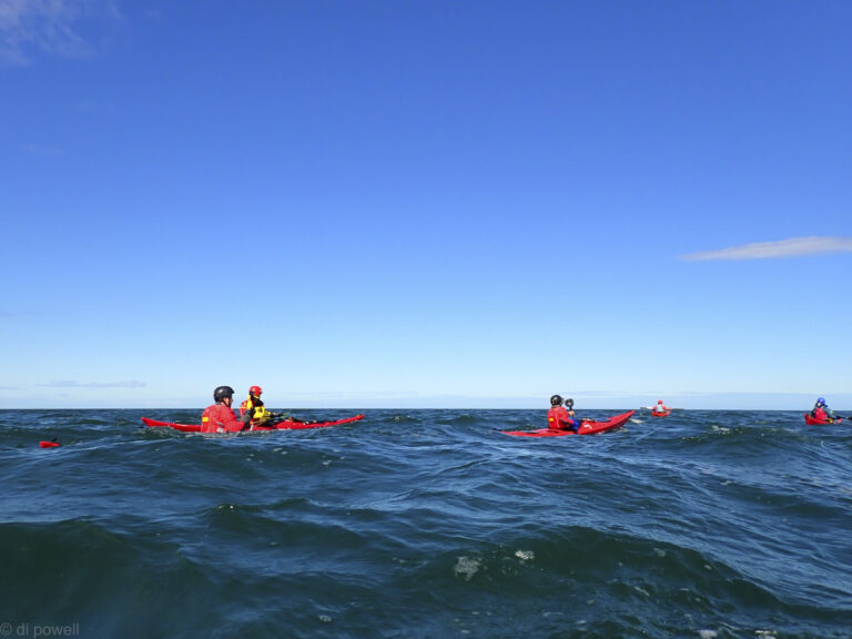
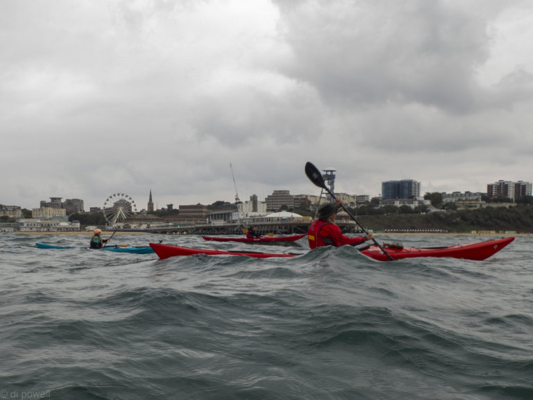
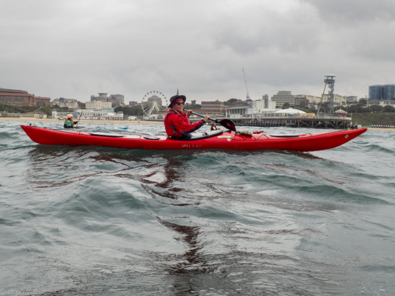
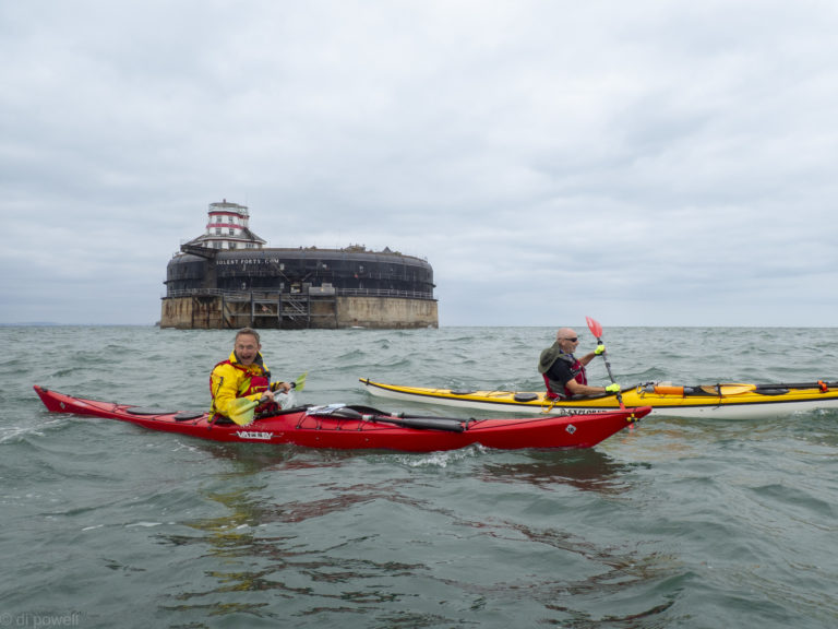
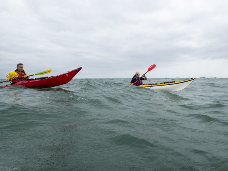
Leaving the beach near Gosport RNLI, the VHF radio is full of chat about swimmers crossing the Solent. That seems like a mad idea and much better to be in kayaks. Especially as we have an exciting route that takes us pass three of the four Solent Palmerston Forts, as well as the buoy marking the spot where the Mary Rose sank, and across the shipping channel to the Isle of Wight.
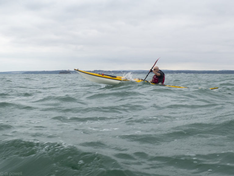
Conditions were expected to be challenging and this trip had been advertised only for experienced club members. As well as some waves and strong winds, the trip route meant that the wind would be in every direction at some point in the trip: from the left, from the right, behind and straight ahead – and everything in between! With wind of F4 (12-18mph) and gusts a lot higher, we were in for an exciting paddle.
En-route to Horse Sands Fort with the Isle of Wight in the background
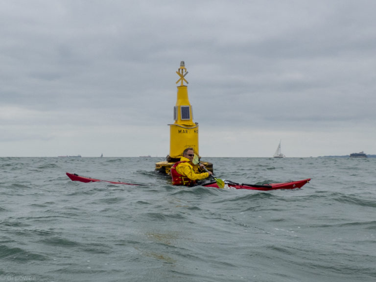
About an hour after we start heading East, we’re at Spitbank Fort and then we change direction to head South West to the Mary Rose Buoy.
The Mary Rose Buoy
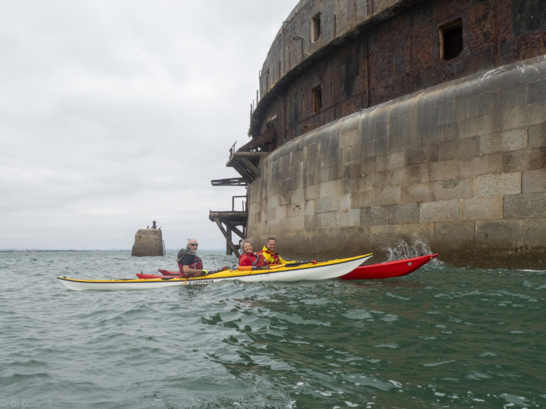
Then we have the 3km paddle into the wind to Horse Sands Fort, where we’re able to a have a short rest.
Horse Sands Fort
Then we are off to No Man’s Fort across the shipping channel. The wind is behind us for this leg and we do it about 20 minutes faster than planned. The strong wind along with the changing tidal flows have made planning the timings for the trip challenging.
Crossing the shipping channel
Approaching Seaview
We land at Seaview about 20 minutes early, so we have a long lunch break and have time for a pot of tea at the Old Fort café. While we’re there the Red Arrows fly over, as part of the VJ Day commemorations.
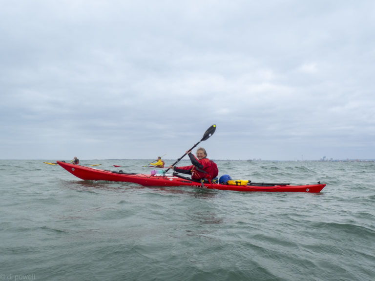
After lunch we all do a seal launches to get on the water to avoid getting pushed into the rocks by the waves. The route back is a direct straight line without any forts. However, once in the Solent we get affected by the wind quite a lot as well as the flow, which are pushing us much further East than we want to be. After adjusting our course, dodging hovercraft and ferries, we get to the middle of the Solent.
Solent crossing!
As we arrive, an enormous P&O cruises ship goes past. When it is well passed we adjust our course to land at the beach at our launch point. Before getting off the water, Fiona does a self rescue in the bay, and Mike does a roll. Which is pretty impressive after the length of the trip (26km) and the conditions. Well done to everyone for completing this trip successfully!